- Population
- 41
- 41
- Elevation
- 4 m
- above sea level
- Local time
- UTC+01:00
- Europe/Rome · UTC+01:00
- Airports
- FCO Rome–Fiumicino Leonardo da Vinci International Airport62 km
- CIA Ciampino–G. B. Pastine International Airport85 km
About Saline
Saline is a village. Location: Tarquinia, Province of Viterbo. Population: 41. Elevation: 4 m. The best months to visit are May–June, September–October. The nearest airport is Rome–Fiumicino Leonardo da Vinci International Airport (62 km). Nearby sights include Boca Do Mar and Michelangelo Fortress.
Climate of Saline
Best months for sightseeingBest months for sightseeing: May–June, September–October.
This month · November
Outside the best season
Day 16° · Night 8° · Rain 66 mm
- Hottest month
- July (day 30°)
- Coldest month
- January (night 4°)
- Wettest month
- November (66 mm)
- Driest month
- July (8 mm)
Bars: average monthly low and high temperature. Below: precipitation. Monthly averages for 1970–2000 at about 18 km resolution, adjusted for elevation. Highlighted months are mild and relatively dry. Source: WorldClim 2.1 (CC BY 4.0).
Show values as a table
| Month | Jan | Feb | Mar | Apr | May | Jun | Jul | Aug | Sep | Oct | Nov | Dec |
|---|---|---|---|---|---|---|---|---|---|---|---|---|
| Average high (°C) | 12° | 13° | 15° | 18° | 23° | 27° | 30° | 30° | 26° | 21° | 16° | 13° |
| Average low (°C) | 4° | 5° | 6° | 8° | 12° | 16° | 19° | 19° | 17° | 13° | 8° | 6° |
| Precipitation (mm) | 63 | 49 | 39 | 41 | 34 | 17 | 8 | 22 | 45 | 62 | 66 | 53 |
Other places to visit in this season: May June September October
How to get to Saline
The nearest airport is Rome–Fiumicino Leonardo da Vinci International Airport (FCO), 62 km to the southeast as the crow flies. The nearest large city is Nice, 400 km to the northwest.
Airports
- Rome–Fiumicino Leonardo da Vinci International Airport (FCO) Rome 62 kmsoutheast
- Ciampino–G. B. Pastine International Airport (CIA) Rome 85 kmsoutheast
- Perugia San Francesco d'Assisi – Umbria International Airport (PEG) Perugia (PG) 119 kmnortheast
Nearby large cities
- Nice Population: 342.7K 400 kmnorthwest
Straight-line distances; road distances are longer. Airport data: OurAirports.
Day trips from Saline
Within 100 km: 157 historic and cultural sites, 114 natural sites, 34 lakes, rivers and coasts.
0–25 km9 places
- Boca Do Mar Beach 4 kmSE
- Spiaggia di Civitavecchia Beach 14 kmSE
- Spiaggia di Santa Marinella Beach 22 kmSE
- Monte Turco Mountain 12 kmSE
25–60 km51 places
- Ultima Spiaggia Beach 30 kmNW
- Siaggia delle graticciare Beach 29 kmNW
- Riva del Marchese Beach 47 kmNW
- La capannuccia Beach 44 kmNW
60–100 km245 places
- Poggio Mosconcino Mountain 84 kmNW
- Valle Cerrese Natural site 81 kmE
- Parco della Rimembranza Natural site 80 kmNW
- Parco di Villa Pizzetti Natural site 80 kmNW
Straight-line distances.
Nearby attractions & nature
Everything nearby-
Boca Do Mar Beach, Tarquinia3.9 km SE
-
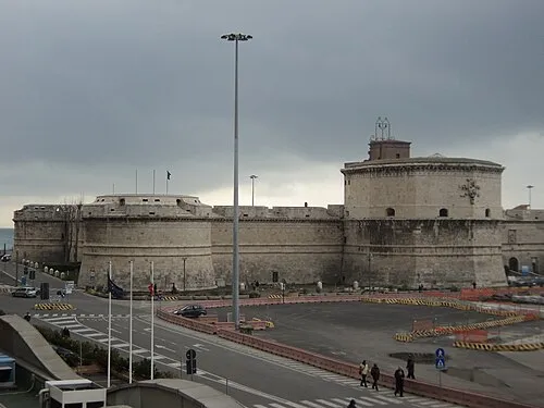 Michelangelo Fortress Historic site, Civitavecchia14 km SE
-
Monte Turco Mountain, Allumiere12 km SE
-
Monte Farnesiana Mountain, Allumiere12 km SE
-
Monte Ferrara Mountain, Civitavecchia13 km SE
-
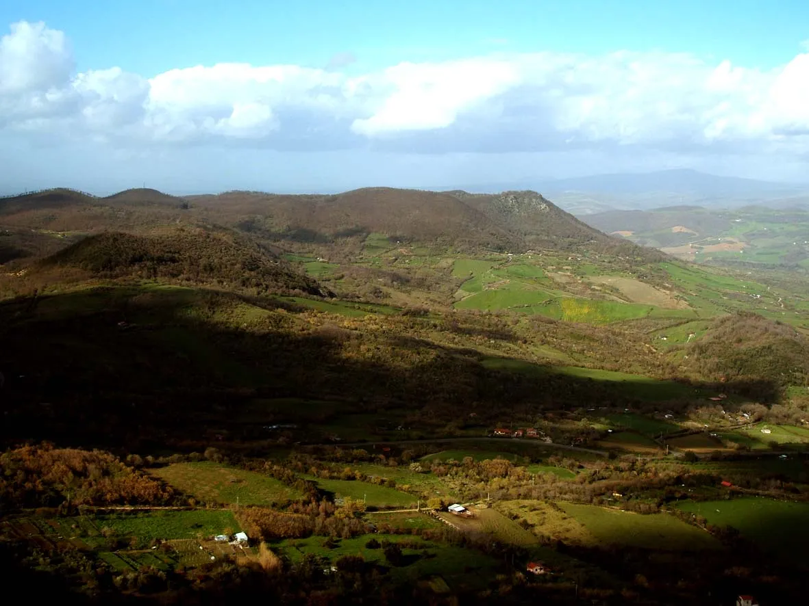 Monti della Tolfa Mountain, Lazio17 km SE
Sources & licences
Data last updated: · 2 independent sources