- Population
- 40
- 40
- Elevation
- 667 m
- above sea level
- Local time
- UTC+01:00
- Europe/Rome · UTC+01:00
- Airports
- BGY Il Caravaggio International Airport19 km
- VBS Brescia Gabriele d'Annunzio Airport54 km
About Montebeio
Montebeio is a village. Location: Leffe, Province of Bergamo. Population: 40. Elevation: 667 m. The best months to visit are June–September. The nearest airport is Il Caravaggio International Airport (19 km). Nearby sights include Valle Cavalline and Monte Torrezzo.
Climate of Montebeio
Best months for sightseeingBest months for sightseeing: June–September.
This month · November
A cold month
Day 9° · Night 1° · Rain 69 mm
- Hottest month
- July (day 25°)
- Coldest month
- January (night -3°)
- Wettest month
- October (103 mm)
- Driest month
- February (37 mm)
Bars: average monthly low and high temperature. Below: precipitation. Monthly averages for 1970–2000 at about 18 km resolution, adjusted for elevation. Highlighted months are mild and relatively dry. Source: WorldClim 2.1 (CC BY 4.0).
Show values as a table
| Month | Jan | Feb | Mar | Apr | May | Jun | Jul | Aug | Sep | Oct | Nov | Dec |
|---|---|---|---|---|---|---|---|---|---|---|---|---|
| Average high (°C) | 5° | 7° | 11° | 14° | 18° | 22° | 25° | 25° | 20° | 15° | 9° | 5° |
| Average low (°C) | -3° | -2° | 1° | 4° | 9° | 12° | 15° | 15° | 11° | 7° | 1° | -2° |
| Precipitation (mm) | 55 | 37 | 58 | 73 | 100 | 99 | 85 | 92 | 102 | 103 | 69 | 49 |
Other places to visit in this season: June July August September
How to get to Montebeio
The nearest airport is Il Caravaggio International Airport (BGY), 19 km to the southwest as the crow flies. The nearest large city is Innsbruck, 201 km to the northeast.
Airports
- Il Caravaggio International Airport (BGY) Orio al Serio (BG) 19 kmsouthwest
- Brescia Gabriele d'Annunzio Airport (VBS) Montichiari (BS) 54 kmsoutheast
- Milano Linate Airport (LIN) Segrate (MI) 60 kmsouthwest
Nearby large cities
- Innsbruck Population: 132.5K 201 kmnortheast
- Zurich Population: 415.4K 202 kmnorthwest
- Winterthur Population: 111.8K 210 kmnorthwest
- Bern Population: 121.6K 226 kmnorthwest
- Lausanne Population: 139.1K 263 kmwest
Straight-line distances; road distances are longer. Airport data: OurAirports.
Day trips from Montebeio
Within 100 km: 97 historic and cultural sites, 2,096 natural sites, 227 lakes, rivers and coasts.
0–25 km16 places
- Monte Bronzone Mountain 13 kmSE
- Monte Guglielmo Mountain 23 kmE
- Monte Torrezzo Mountain 8 kmSE
- Monte Sornadello Mountain 21 kmW
25–60 km304 places
- Lago di Poschiavo Lake 57 kmN
- Laghet d'Ur Lake 58 kmN
- Lagh dal Mat Lake 51 kmN
- Lagh da la Regina Lake 50 kmN
60–100 km2,100 places
- Spadalone Mountain 76 kmNE
- Dosso Rotondo Mountain 86 kmE
- Isole di Brissago Island 96 kmNW
- Sant' Apollinare Island 96 kmNW
Straight-line distances.
Nearby attractions & nature
Everything nearby-
Valle Cavalline Natural site, Lombardy5.9 km SE
-
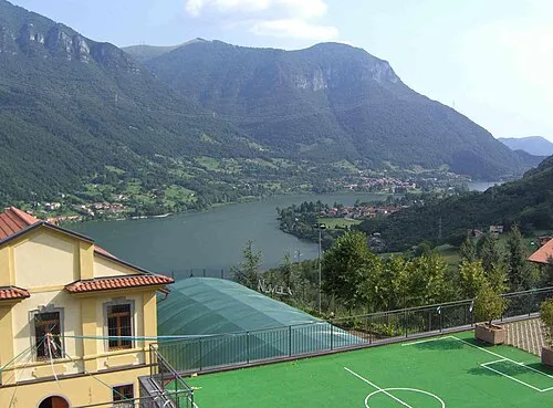 Monte Torrezzo Mountain, Endine Gaiano8.2 km SE
-
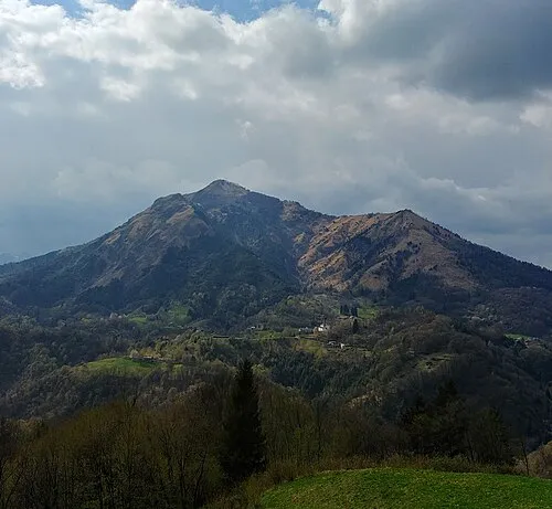 Monte Gioco Mountain, Serina15 km NW
-
Corna Maria Mountain, Algua14 km W
-
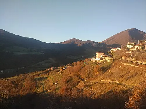 Monte Bronzone Mountain, Vigolo13 km SE
-
Pizzo di Spino Mountain, Zogno14 km W
Sources & licences
Data last updated: · 2 independent sources