- Population
- 10
- 10
- Elevation
- 397 m
- above sea level
- Local time
- UTC+01:00
- Europe/Rome · UTC+01:00
- Airports
- LIN Milano Linate Airport57 km
- GOA Genoa Cristoforo Colombo Airport63 km
About Biancanigi
Biancanigi is a village. Location: Borgo Priolo, Province of Pavia. Population: 10. Elevation: 397 m. The best months to visit are May–September. The nearest airport is Milano Linate Airport (57 km). Nearby sights include Cima Colletta and Monte Penice.
Climate of Biancanigi
Best months for sightseeingBest months for sightseeing: May–September.
This month · November
A cold month
Day 9° · Night 2° · Rain 82 mm
- Hottest month
- July (day 28°)
- Coldest month
- January (night -3°)
- Wettest month
- October (122 mm)
- Driest month
- July (39 mm)
Bars: average monthly low and high temperature. Below: precipitation. Monthly averages for 1970–2000 at about 18 km resolution, adjusted for elevation. Highlighted months are mild and relatively dry. Source: WorldClim 2.1 (CC BY 4.0).
Show values as a table
| Month | Jan | Feb | Mar | Apr | May | Jun | Jul | Aug | Sep | Oct | Nov | Dec |
|---|---|---|---|---|---|---|---|---|---|---|---|---|
| Average high (°C) | 4° | 7° | 12° | 15° | 20° | 24° | 28° | 27° | 23° | 16° | 9° | 5° |
| Average low (°C) | -3° | -2° | 2° | 5° | 10° | 13° | 16° | 16° | 12° | 8° | 2° | -2° |
| Precipitation (mm) | 70 | 44 | 62 | 73 | 68 | 59 | 39 | 67 | 77 | 122 | 82 | 61 |
Other places to visit in this season: May June July August September
How to get to Biancanigi
The nearest airport is Milano Linate Airport (LIN), 57 km to the north as the crow flies. The nearest large city is Nice, 204 km to the southwest.
Airports
- Milano Linate Airport (LIN) Segrate (MI) 57 kmnorth
- Genoa Cristoforo Colombo Airport (GOA) Genova (GE) 63 kmsouthwest
- Milan Malpensa International Airport (MXP) Ferno (VA) 84 kmnorthwest
Nearby large cities
- Nice Population: 342.7K 204 kmsouthwest
- Bern Population: 121.6K 260 kmnorthwest
- Lausanne Population: 139.1K 263 kmnorthwest
- Grenoble Population: 158.6K 272 kmwest
- Geneva Population: 201.7K 274 kmnorthwest
Straight-line distances; road distances are longer. Airport data: OurAirports.
Day trips from Biancanigi
Within 100 km: 57 historic and cultural sites, 167 natural sites, 16 lakes, rivers and coasts.
0–25 km4 places
- Fiume Ticino River 25 kmN
- Monte Penice Mountain 21 kmSE
- Cima Colletta Mountain 25 kmS
- Bagnolo Mountain 23 kmS
25–60 km130 places
- Rotteri Mountain 44 kmSE
- Gifarco Mountain 47 kmS
- Monte Lesima Mountain 30 kmS
- Monte Antola Mountain 40 kmS
60–100 km106 places
- Bagni Pagana Beach 66 kmS
- La Spiaggia di Levanto Beach 92 kmSE
- Baia del Silenzio Beach 76 kmS
- Sun Beach Beach 78 kmS
Straight-line distances.
Nearby attractions & nature
Everything nearby-
Cima Colletta Mountain, Brallo di Pregola25 km S
-
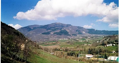 Monte Penice Mountain, Emilia-Romagna21 km SE
-
Bagnolo Mountain, Fabbrica Curone23 km S
-
Fiume Ticino River, Switzerland25 km N
Sources & licences
Data last updated: · 2 independent sources