Punta Truba Manna
Located in Pula, Province of Cagliari Coordinates: 38°57′14″ N 8°55′42″ E
- Elevation
- 497 m
- above sea level
- Local time
- UTC+01:00
- Europe/Rome · UTC+01:00
- Airports
- CAG Cagliari Elmas Airport35 km
- AHO Alghero-Fertilia Airport194 km
About Punta Truba Manna
Punta Truba Manna is a mountain. Location: Pula, Province of Cagliari. Elevation: 497 m. The best months to visit are May–September. The nearest airport is Cagliari Elmas Airport (35 km). Nearby sights include Punta Eva and Punta Conca Moio.
Photos of Punta Truba Manna
-
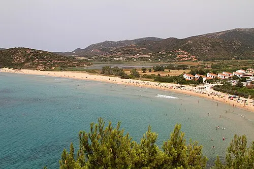
Spiaggia di Chia Carlo Pelagalli · CC BY-SA 3.0 -
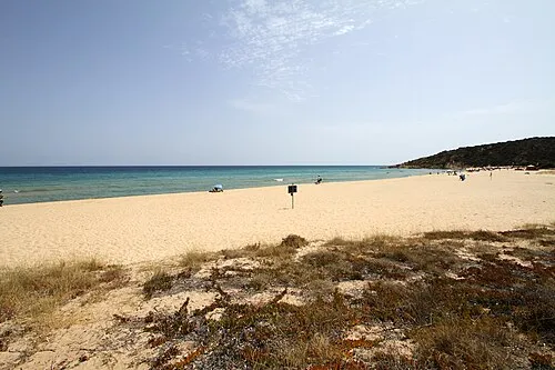
Spiaggia di Sa Colonia Carlo Pelagalli · CC BY-SA 3.0 -
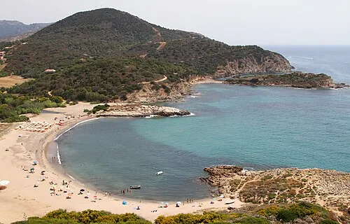
Spiaggia di Su Portu Carlo Pelagalli · CC BY-SA 3.0


Climate of Punta Truba Manna
Best months for sightseeingBest months for sightseeing: May–September.
This month · November
Outside the best season
Day 15° · Night 8° · Rain 77 mm
- Hottest month
- August (day 28°)
- Coldest month
- January (night 4°)
- Wettest month
- November (77 mm)
- Driest month
- July (5 mm)
Bars: average monthly low and high temperature. Below: precipitation. Monthly averages for 1970–2000 at about 18 km resolution, adjusted for elevation. Highlighted months are mild and relatively dry. Source: WorldClim 2.1 (CC BY 4.0).
Show values as a table
| Month | Jan | Feb | Mar | Apr | May | Jun | Jul | Aug | Sep | Oct | Nov | Dec |
|---|---|---|---|---|---|---|---|---|---|---|---|---|
| Average high (°C) | 11° | 12° | 13° | 16° | 20° | 24° | 27° | 28° | 24° | 20° | 15° | 12° |
| Average low (°C) | 4° | 4° | 5° | 7° | 10° | 14° | 17° | 17° | 15° | 12° | 8° | 5° |
| Precipitation (mm) | 67 | 73 | 57 | 54 | 31 | 14 | 5 | 9 | 43 | 69 | 77 | 71 |
Other places to visit in this season: May June July August September
How to get to Punta Truba Manna
The nearest airport is Cagliari Elmas Airport (CAG), 35 km to the north as the crow flies.
Airports
- Cagliari Elmas Airport (CAG) Cagliari 35 kmnorth
- Alghero-Fertilia Airport (AHO) Alghero 194 kmnorth
- Tabarka-Aïn Draham International Airport (TBJ) Tabarka 219 kmsouth
Straight-line distances; road distances are longer. Airport data: OurAirports.
Day trips from Punta Truba Manna
Within 100 km: 5 historic and cultural sites, 61 natural sites, 81 lakes, rivers and coasts.
0–25 km36 places
- Spiaggia di Tuerredda Beach 12 kmSW
- Spiaggia di Campana Dune Beach 9 kmSW
- Spiaggia del Pinus Village Beach 4 kmS
- Spiaggia Riva dei Pini Beach 4 kmS
25–60 km83 places
- Poetto Beach 34 kmNE
- Cape Teulada Natural site 27 kmW
- Spiaggia di Coacuaddus Beach 42 kmW
- Spiaggia di Porto Pino Beach 27 kmW
60–100 km28 places
- Punta Trebinalonga Mountain 94 kmN
- Spiaggia di Marina Rei Beach 66 kmNE
- Spiaggia Del Rei Sole Beach 67 kmNE
- Spiaggia Porto Pirastu Beach 70 kmNE
Straight-line distances.
Nearest towns and villages
-
Santa Margherita di Pula Village, Pula3.2 km S
-
Eden Rock Village, Domus de Maria3.2 km SW
-
Is Molas Village, Pula5.5 km NE
-
Domus de Maria Municipality, Province of South Sardinia5.7 km W
-
Fox e Sali-Monte Agumu Village, Pula5.6 km NE
-
S'Abuleu Village, Pula5.8 km NE
Nearby attractions & nature
Everything nearby-
Punta Eva Mountain, Pula1.4 km N
-
Punta Conca Moio Mountain, Pula2.4 km NE
-
Spiaggia di Campumatta Beach, Pula2.5 km E
-
Spiaggia Di Calaverde Beach, Province of Cagliari2.3 km S
-
Spiaggia di Perla Marina Beach, Pula2.9 km S
-
Spiaggia di Cala d'Ostia Beach, Pula3 km E
-
Spiaggia Riva dei Pini Beach, Pula3.6 km S
-
Spiaggia del Pinus Village Beach, Pula4.3 km S
Sources & licences
Data last updated: · 2 independent sources