- Elevation
- 211 m
- above sea level
- Local time
- UTC+01:00
- Europe/Rome · UTC+01:00
- Airports
- OLB Olbia Costa Smeralda Airport30 km
- FSC Figari Sud-Corse Airport106 km
About Punta d'Abbaìa
Punta d'Abbaìa is a mountain. Location: Budoni, Province of Sassari. Elevation: 211 m. The best months to visit are May–July, September–October. The nearest airport is Olbia Costa Smeralda Airport (30 km). Nearby sights include Monte Rena and Spiaggia di Budoni.
Photos of Punta d'Abbaìa
-
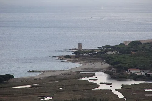
Spiaggia di San Giovanni Gianni Careddu · CC BY-SA 4.0 -
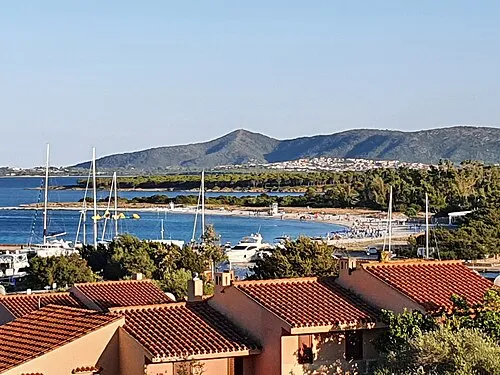
Spiaggia di Porto Ottiolu Luckyz · CC BY-SA 3.0 -
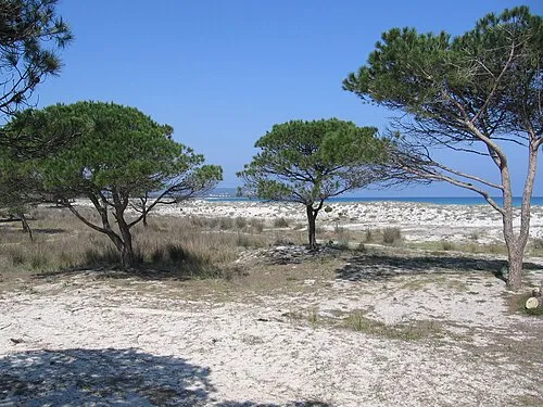
Spiaggia di Budoni Klaus Eltrop · CC BY-SA 3.0


Climate of Punta d'Abbaìa
Best months for sightseeingBest months for sightseeing: May–July, September–October.
This month · November
Outside the best season
Day 16° · Night 10° · Rain 56 mm
- Hottest month
- August (day 28°)
- Coldest month
- January (night 6°)
- Wettest month
- December (81 mm)
- Driest month
- July (5 mm)
Bars: average monthly low and high temperature. Below: precipitation. Monthly averages for 1970–2000 at about 18 km resolution, adjusted for elevation. Highlighted months are mild and relatively dry. Source: WorldClim 2.1 (CC BY 4.0).
Show values as a table
| Month | Jan | Feb | Mar | Apr | May | Jun | Jul | Aug | Sep | Oct | Nov | Dec |
|---|---|---|---|---|---|---|---|---|---|---|---|---|
| Average high (°C) | 12° | 12° | 14° | 16° | 20° | 24° | 28° | 28° | 25° | 20° | 16° | 13° |
| Average low (°C) | 6° | 6° | 7° | 9° | 12° | 17° | 20° | 20° | 17° | 14° | 10° | 7° |
| Precipitation (mm) | 46 | 54 | 51 | 42 | 28 | 17 | 5 | 17 | 31 | 59 | 56 | 81 |
Other places to visit in this season: May June July September October
How to get to Punta d'Abbaìa
The nearest airport is Olbia Costa Smeralda Airport (OLB), 30 km to the northwest as the crow flies. The nearest large city is Nice, 393 km to the northwest.
Airports
- Olbia Costa Smeralda Airport (OLB) Olbia (SS) 30 kmnorthwest
- Figari Sud-Corse Airport (FSC) Figari 106 kmnorthwest
- Alghero-Fertilia Airport (AHO) Alghero 121 kmwest
Nearby large cities
- Nice Population: 342.7K 393 kmnorthwest
Straight-line distances; road distances are longer. Airport data: OurAirports.
Day trips from Punta d'Abbaìa
Within 100 km: 9 historic and cultural sites, 80 natural sites, 136 lakes, rivers and coasts.
0–25 km24 places
- Spiaggia di Salina Manna Beach 18 kmN
- Spiaggia di Punta Est Beach 18 kmN
- Spiaggia dell'Isola Piana Beach 24 kmN
- Punta Ultia Mountain 8 kmNW
25–60 km45 places
- Spiaggia di Porto Istana Beach 26 kmN
- Spiaggia di Murta Maria Beach 27 kmNW
- Cala Bitta Beach 54 kmNW
- Spiaggia Razza di Juncu per cani Beach 45 kmN
60–100 km156 places
- Presqu'île de Rondinara Natural site 95 kmNW
- Golfe de Porto Novo Natural site 99 kmN
- Ruisseau de Stencia River 96 kmNW
- Tour de Sant'Amanza Landmark 91 kmNW
Straight-line distances.
Nearest towns and villages
-
 Tanaunella Village, Budoni0.8 km N
-
 Limpiddu Village, Budoni2.1 km NW
-
Solità Village, Budoni2.6 km W
-
Budoni Village, Budoni3.5 km NW
-
San Lorenzo Village, Budoni3.5 km W
-
Sas Murtas Village, Posada2.2 km W
Nearby attractions & nature
Everything nearby-
Monte Rena Mountain, Budoni2.7 km W
-
Spiaggia di Budoni Beach, Budoni3.3 km N
-
Monte Piluccas Mountain, Budoni4.6 km NW
-
Spiaggia di Porto Ottiolu Beach, Budoni6.7 km N
-
Punta Ultia Mountain, Budoni7.8 km NW
-
Punta Loccarì Mountain, San Teodoro7.9 km N
-
Spiaggia di San Giovanni Beach, Posada6.5 km S
-
Punta Arena Mountain, San Teodoro8.6 km NW
Sources & licences
Data last updated: · 2 independent sources