Su Muntiju e S'Omine
Located in Erula, Province of Sassari Coordinates: 40°46′59″ N 8°56′22″ E
- Population
- 11
- 11
- Elevation
- 459 m
- above sea level
- Local time
- UTC+01:00
- Europe/Rome · UTC+01:00
- Airports
- OLB Olbia Costa Smeralda Airport51 km
- AHO Alghero-Fertilia Airport57 km
About Su Muntiju e S'Omine
Su Muntiju e S'Omine is a village. Location: Erula, Province of Sassari. Population: 11. Elevation: 459 m. The best months to visit are May–September. The nearest airport is Olbia Costa Smeralda Airport (51 km). Nearby sights include Monte sa Chessa Ruia and Punta Ispiene.
Photos of Su Muntiju e S'Omine
-
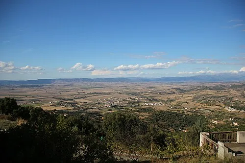
Monte Sassu Gianni Careddu · CC BY-SA 4.0 -
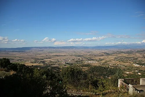
Monte San Giuseppe Gianni Careddu · CC BY-SA 4.0 -
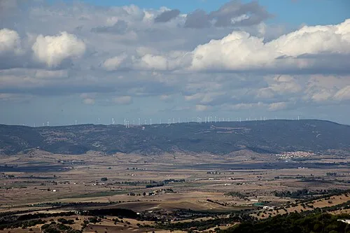
Punta Ispiene Gianni Careddu · CC BY-SA 4.0 -
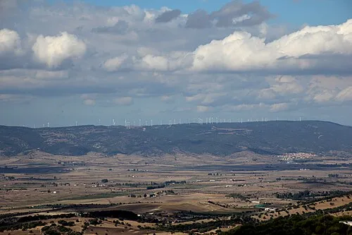
Monte sa Chessa Ruia Gianni Careddu · CC BY-SA 4.0


Climate of Su Muntiju e S'Omine
Best months for sightseeingBest months for sightseeing: May–September.
This month · November
A wet month
Day 15° · Night 8° · Rain 101 mm
- Hottest month
- July (day 28°)
- Coldest month
- January (night 4°)
- Wettest month
- November (101 mm)
- Driest month
- July (8 mm)
Bars: average monthly low and high temperature. Below: precipitation. Monthly averages for 1970–2000 at about 18 km resolution, adjusted for elevation. Highlighted months are mild and relatively dry. Source: WorldClim 2.1 (CC BY 4.0).
Show values as a table
| Month | Jan | Feb | Mar | Apr | May | Jun | Jul | Aug | Sep | Oct | Nov | Dec |
|---|---|---|---|---|---|---|---|---|---|---|---|---|
| Average high (°C) | 10° | 11° | 13° | 15° | 20° | 24° | 28° | 28° | 24° | 20° | 15° | 11° |
| Average low (°C) | 4° | 4° | 5° | 7° | 11° | 14° | 17° | 17° | 15° | 12° | 8° | 5° |
| Precipitation (mm) | 67 | 71 | 61 | 57 | 40 | 25 | 8 | 18 | 38 | 84 | 101 | 98 |
Other places to visit in this season: May June July August September
How to get to Su Muntiju e S'Omine
The nearest airport is Olbia Costa Smeralda Airport (OLB), 51 km to the east as the crow flies. The nearest large city is Nice, 353 km to the north.
Airports
- Olbia Costa Smeralda Airport (OLB) Olbia (SS) 51 kmeast
- Alghero-Fertilia Airport (AHO) Alghero 57 kmwest
- Figari Sud-Corse Airport (FSC) Figari 81 kmnorth
Nearby large cities
- Nice Population: 342.7K 353 kmnorth
- Toulon Population: 168.7K 360 kmnorthwest
Straight-line distances; road distances are longer. Airport data: OurAirports.
Day trips from Su Muntiju e S'Omine
Within 100 km: 34 historic and cultural sites, 215 natural sites, 182 lakes, rivers and coasts.
0–25 km28 places
- Spiaggia Li Mindi di Badesi Beach 23 kmN
- Spiaggia della Baia delle Mimose Beach 21 kmNW
- Spiaggia di Valledoria Beach 20 kmNW
- Spiaggia di San Pietro Beach 20 kmNW
25–60 km98 places
- Cala Bitta Beach 59 kmNE
- Calabona Beach 59 kmSW
- Spiaggia La Marinedda Beach 26 kmN
- Spiaggia di Lu Bagnu Beach 25 kmNW
60–100 km305 places
- Asinara Island 65 kmNW
- Punta de su Torrione Mountain 65 kmW
- Plage de Carataggio Beach 94 kmN
- Plage de Capu Laurosu Beach 98 kmN
Straight-line distances.
Nearby attractions & nature
Everything nearby-
Monte sa Chessa Ruia Mountain, Erula1.9 km S
-
Punta Ispiene Mountain, Erula1.9 km W
-
Monte San Giuseppe Mountain, Tula6 km SE
-
Monte Sassu Mountain, Ozieri7.6 km S
-
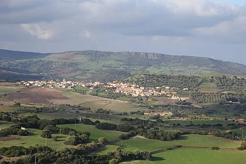 Monte Orria Mountain, Martis13 km W
-
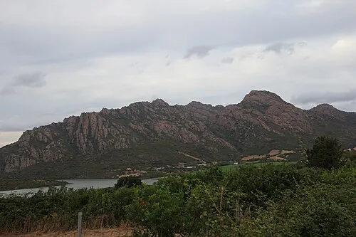 Punta Ventosa Mountain, Viddalba13 km N
Sources & licences
Data last updated: