- Population
- 235
- 235
- Elevation
- 590 m
- above sea level
- Local time
- UTC+01:00
- Europe/Rome · UTC+01:00
- Airports
- CIY Comiso Airport33 km
- CTA Catania-Fontanarossa Airport57 km
About Testa dell'Acqua
Testa dell'Acqua is a village. Location: Noto, Province of Syracuse. Population: 235. Elevation: 590 m. The best months to visit are May–September. The nearest airport is Comiso Airport (33 km). Nearby sights include Mount Alveria and Villa Romana del Tellaro.
Climate of Testa dell'Acqua
Best months for sightseeingBest months for sightseeing: May–September.
This month · November
Outside the best season
Day 16° · Night 9° · Rain 71 mm
- Hottest month
- August (day 28°)
- Coldest month
- February (night 5°)
- Wettest month
- October (85 mm)
- Driest month
- July (3 mm)
Bars: average monthly low and high temperature. Below: precipitation. Monthly averages for 1970–2000 at about 18 km resolution, adjusted for elevation. Highlighted months are mild and relatively dry. Source: WorldClim 2.1 (CC BY 4.0).
Show values as a table
| Month | Jan | Feb | Mar | Apr | May | Jun | Jul | Aug | Sep | Oct | Nov | Dec |
|---|---|---|---|---|---|---|---|---|---|---|---|---|
| Average high (°C) | 12° | 12° | 13° | 16° | 20° | 25° | 28° | 28° | 25° | 21° | 16° | 13° |
| Average low (°C) | 5° | 5° | 5° | 7° | 11° | 15° | 18° | 18° | 16° | 13° | 9° | 6° |
| Precipitation (mm) | 74 | 43 | 44 | 28 | 15 | 5 | 3 | 11 | 37 | 85 | 71 | 83 |
Other places to visit in this season: May June July August September
How to get to Testa dell'Acqua
The nearest airport is Comiso Airport (CIY), 33 km to the west as the crow flies. For international flights: Catania-Fontanarossa Airport (CTA) (57 km).
Airports
- Comiso Airport (CIY) Comiso 33 kmwest
- Catania-Fontanarossa Airport (CTA) Catania 57 kmnorth
- Malta International Airport (MLA) Valletta 131 kmsouth
Straight-line distances; road distances are longer. Airport data: OurAirports.
Day trips from Testa dell'Acqua
Within 100 km: 18 historic and cultural sites, 14 natural sites, 52 lakes, rivers and coasts.
0–25 km16 places
- Cala Mosche Beach 19 kmSE
- Spiaggia Vendicari Beach 21 kmSE
- Eloro Beach Beach 18 kmSE
- Spiaggia Lido di Avola Beach 17 kmE
25–60 km38 places
- Playa di Catania Beach 58 kmN
- Spiaggia Marina di Modica Beach 33 kmSW
- Spiaggia Sampieri Beach 34 kmSW
- Plaja Ulisse Beach 29 kmS
60–100 km30 places
- Spiaggia San Marco Beach 96 kmN
- Lido Panama Beach Beach 78 kmW
- Lido Manfria Beach 75 kmW
- Spiaggia di Marianello Beach 94 kmW
Straight-line distances.
Nearby attractions & nature
Everything nearby-
Mount Alveria Mountain, Noto5.1 km SE
-
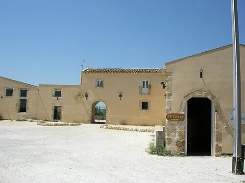 Villa Romana del Tellaro Historic site, Noto17 km SE
-
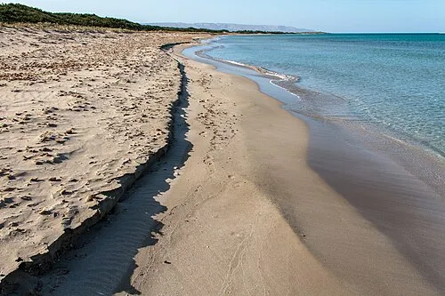 Spiaggia Vendicari Beach, Noto21 km SE
-
Cala Mosche Beach, Noto19 km SE
-
Spiaggia Lido di Noto Beach, Noto17 km SE
-
Spiaggia San Lorenzo Beach, Noto25 km SE
Other cities and towns in Noto
-
Madonna Marina Village, Noto12 km SE
-
San Paolo Village, Noto14 km S
-
 Calabernardo Village, Noto18 km SE
-
Lido di Noto Village, Noto17 km SE
-
Coda di Lupo Village, Noto15 km S
-
Fondo Morte Village, Noto27 km SE
Sources & licences
Data last updated: