Morro d'Alba
Located in Province of Ancona, The Marches Coordinates: 43°36′05″ N 13°12′48″ E
- Population
- 1,854
- 1.9K
- Elevation
- 196 m
- above sea level
- Local time
- UTC+01:00
- Europe/Rome · UTC+01:00
- Places inside
- 1
- listed under Morro d'Alba
- Airports
- AOI Marche Airport12 km
- RMI Federico Fellini International Airport67 km
About Morro d'Alba
Morro d'Alba is a municipality. Location: Province of Ancona, The Marches. Population: 1,854. Elevation: 196 m. The best months to visit are May–July, September–October. The nearest airport is Marche Airport (12 km). Nearby sights include Spiaggia di Marzocca and Spiaggia Marina di Rocca Priora.
Climate of Morro d'Alba
Best months for sightseeingBest months for sightseeing: May–July, September–October.
This month · November
Outside the best season
Day 13° · Night 5° · Rain 88 mm
- Hottest month
- July (day 28°)
- Coldest month
- January (night 1°)
- Wettest month
- November (88 mm)
- Driest month
- January (46 mm)
Bars: average monthly low and high temperature. Below: precipitation. Monthly averages for 1970–2000 at about 18 km resolution, adjusted for elevation. Highlighted months are mild and relatively dry. Source: WorldClim 2.1 (CC BY 4.0).
Show values as a table
| Month | Jan | Feb | Mar | Apr | May | Jun | Jul | Aug | Sep | Oct | Nov | Dec |
|---|---|---|---|---|---|---|---|---|---|---|---|---|
| Average high (°C) | 8° | 9° | 13° | 16° | 21° | 25° | 28° | 28° | 24° | 19° | 13° | 9° |
| Average low (°C) | 1° | 1° | 3° | 6° | 10° | 14° | 17° | 17° | 13° | 9° | 5° | 2° |
| Precipitation (mm) | 46 | 50 | 57 | 61 | 57 | 61 | 46 | 71 | 75 | 77 | 88 | 62 |
Other places to visit in this season: May June July September October
How to get to Morro d'Alba
The nearest airport is Marche Airport (AOI), 12 km to the east as the crow flies. For international flights: Federico Fellini International Airport (RMI) (67 km). The nearest large city is Rijeka, 215 km to the northeast.
Airports
- Marche Airport (AOI) Falconara Marittima (AN) 12 kmeast
- Federico Fellini International Airport (RMI) Rimini (RN) 67 kmnorthwest
- Perugia San Francesco d'Assisi – Umbria International Airport (PEG) Perugia (PG) 80 kmsouthwest
Nearby large cities
- Rijeka Population: 108K 215 kmnortheast
- Split Population: 149.8K 261 kmeast
- Ljubljana Population: 272.2K 291 kmnorth
- Zagreb Population: 663.6K 329 kmnortheast
- Klagenfurt Population: 100.3K 347 kmnorth
Straight-line distances; road distances are longer. Airport data: OurAirports.
Day trips from Morro d'Alba
Within 100 km: 29 historic and cultural sites, 175 natural sites, 55 lakes, rivers and coasts.
0–25 km13 places
- Bersaglio Beach 15 kmE
- Spiaggia di Falconara Marittim Beach 16 kmE
- Spiaggia Marina di Rocca Priora Beach 13 kmE
- Spiaggia di Collemarino Beach 18 kmE
25–60 km108 places
- Monte del Pantano Mountain 56 kmW
- Augusto Stefano Beach 57 kmNW
- Spiaggia Cattolica Beach 56 kmNW
- Portoverde Beach Beach 57 kmNW
60–100 km138 places
- Appennino Umbro Mountain 70 kmSW
- Spiaggia Pinarella Beach 98 kmNW
- Spiaggia Cesenatico Beach 93 kmNW
- Vatikaki Beach 75 kmNW
Straight-line distances.
Places in Morro d'Alba
1 placeBar: population relative to the most populous place in this list.
Nearby attractions & nature
Everything nearby-
Spiaggia di Marzocca Beach, Senigallia10 km NE
-
Spiaggia Marina di Rocca Priora Beach, Falconara Marittima13 km E
-
Bersaglio Beach, Falconara Marittima15 km E
-
Spiaggia di Falconara Marittim Beach, Falconara Marittima16 km E
-
Le Piagge Mountain, Apiro24 km S
-
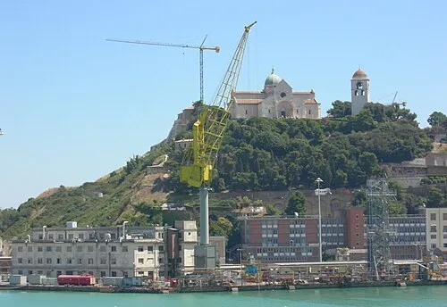 Monte Guasco Mountain, Ancona24 km E
-
Monte Murano Mountain, Serra San Quirico25 km SW
-
Spiaggia di Senigallia Beach, Senigallia14 km N
Sources & licences
Data last updated: