- Elevation
- 201 m
- above sea level
- Local time
- UTC+01:00
- Europe/Rome · UTC+01:00
- Airports
- AOI Marche Airport30 km
- PEG Perugia San Francesco d'Assisi – Umbria International Airport91 km
About Monte Tabor
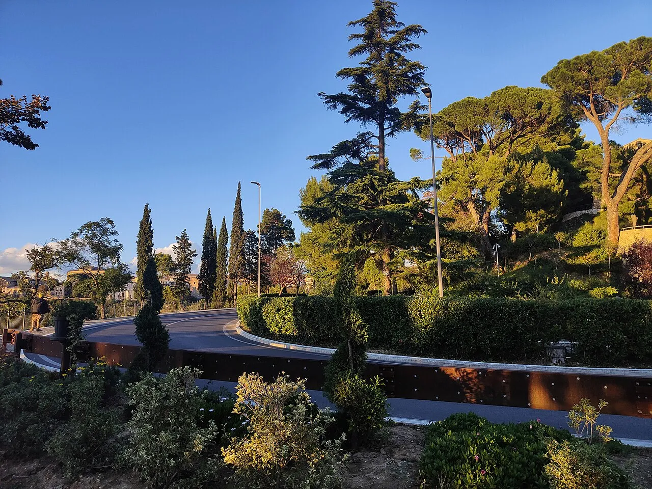
Monte Tabor is a mountain. Location: Recanati, Province of Macerata. Elevation: 201 m.
Monte Tabor (Italian pronunciation: [ˈmonte ˈtaːbor]) is a hill in Recanati, Marche, Italy. It is also dubbed "the Hill of Infinity" because it is described as the site of a spiritual epiphany in Giacomo Leopardi's famous poem "L'infinito". It is named after Mount Tabor in historical Palestine, believed by many Christians to be the site of another spiritual manifestation, the Transfiguration of Jesus.
Source: Wikipedia · CC BY-SA 4.0
At a glance
- Heritage designation
- Italian national heritage
Source: Wikidata
Photos of Monte Tabor
-
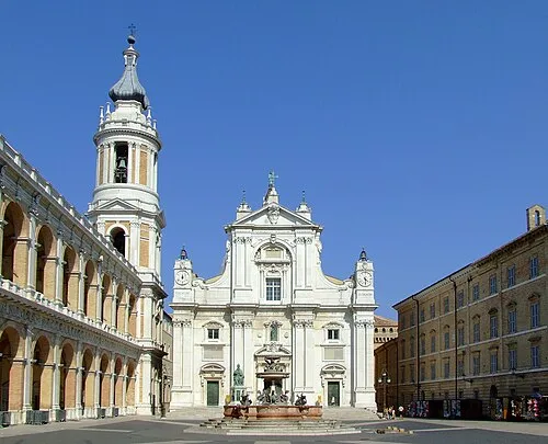
Shrine of the Holy House Loreto250706.JPG : Mroselli derivative work: Rabanus Flavus · CC BY-SA 2.5

Climate of Monte Tabor
Best months for sightseeingBest months for sightseeing: May–July, September–October.
This month · November
Outside the best season
Day 13° · Night 5° · Rain 77 mm
- Hottest month
- July (day 28°)
- Coldest month
- January (night 1°)
- Wettest month
- November (77 mm)
- Driest month
- July (43 mm)
Bars: average monthly low and high temperature. Below: precipitation. Monthly averages for 1970–2000 at about 18 km resolution, adjusted for elevation. Highlighted months are mild and relatively dry. Source: WorldClim 2.1 (CC BY 4.0).
Show values as a table
| Month | Jan | Feb | Mar | Apr | May | Jun | Jul | Aug | Sep | Oct | Nov | Dec |
|---|---|---|---|---|---|---|---|---|---|---|---|---|
| Average high (°C) | 9° | 10° | 13° | 16° | 21° | 25° | 28° | 28° | 24° | 19° | 13° | 10° |
| Average low (°C) | 1° | 1° | 3° | 6° | 10° | 14° | 17° | 17° | 13° | 9° | 5° | 2° |
| Precipitation (mm) | 46 | 44 | 54 | 58 | 49 | 58 | 43 | 63 | 70 | 72 | 77 | 59 |
Other places to visit in this season: May June July September October
How to get to Monte Tabor
The nearest airport is Marche Airport (AOI), 30 km to the northwest as the crow flies. For international flights: Perugia San Francesco d'Assisi – Umbria International Airport (PEG) (91 km). The nearest large city is Rijeka, 227 km to the north.
Airports
- Marche Airport (AOI) Falconara Marittima (AN) 30 kmnorthwest
- Perugia San Francesco d'Assisi – Umbria International Airport (PEG) Perugia (PG) 91 kmwest
- Federico Fellini International Airport (RMI) Rimini (RN) 103 kmnorthwest
Nearby large cities
- Rijeka Population: 108K 227 kmnorth
- Split Population: 149.8K 234 kmeast
- Ljubljana Population: 272.2K 305 kmnorth
- Banja Luka Population: 221.1K 331 kmnortheast
- Zagreb Population: 663.6K 331 kmnortheast
Straight-line distances; road distances are longer. Airport data: OurAirports.
Day trips from Monte Tabor
Within 100 km: 46 historic and cultural sites, 152 natural sites, 50 lakes, rivers and coasts.
0–25 km20 places
- Spiaggia Porto Sant'Elpidio Beach 22 kmSE
- La Playa de Cococciò Beach 20 kmSE
- Spiaggia di Portocivitanova Beach 17 kmSE
- Spiaggia di Porto Potenza Picena Beach 12 kmE
25–60 km81 places
- Bersaglio Beach 30 kmNW
- Spiaggia Marina Palmense Beach 34 kmSE
- Spiaggia Lido di Fermo Beach 28 kmSE
- Spiaggia Cupra Marittima Beach 47 kmSE
60–100 km147 places
- Appennino Umbro Mountain 83 kmW
- Monte del Pantano Mountain 85 kmW
- Giulianova Beach Beach 76 kmSE
- Augusto Stefano Beach 93 kmNW
Straight-line distances.
Nearest towns and villages
-
Scuola San Pietro Village, Recanati0.1 km E
-
Recanati Town, Recanati1.6 km N
-
Spaccio Romitelli Village, Recanati2.2 km S
-
Villaggio Fratesca Village, Recanati3.1 km N
-
Spaccio Costa dei Ricchi Village, Recanati2.8 km W
-
Becerica Village, Montelupone2.8 km SE
Nearby attractions & nature
Everything nearby-
Valle Cantalupo Natural site, The Marches5.2 km N
-
Shrine of the Holy House Attraction, Loreto7.2 km NE
-
Monte San Pietro Mountain, Osimo14 km NW
-
Monte Larciano Mountain, Ancona16 km N
-
Monte della Crescia Mountain, Osimo17 km NW
-
Spiaggia di Fontespina Beach, Civitanova Marche15 km SE
-
Spiaggia di Porto Potenza Picena Beach, Potenza Picena12 km E
-
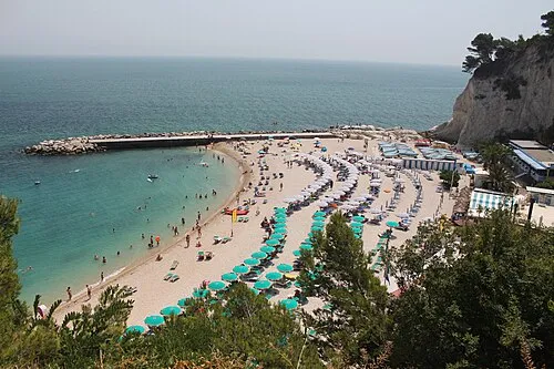 Spiaggia Urbani Beach, Sirolo16 km N
Sources & licences
Data last updated: · 2 independent sources