- Population
- 7,955
- 8K
- Elevation
- 1,148 m
- above sea level
- Local time
- UTC+01:00
- Europe/Rome · UTC+01:00
- Places inside
- 23
- listed under Renon
- Airports
- BZO Bolzano Airport14 km
- INN Innsbruck Airport80 km
About Renon
Renon is a municipality. Location: South Tyrol, Trentino-Alto Adige. Population: 7,955. Elevation: 1,148 m. The best months to visit are June–September. The nearest airport is Bolzano Airport (14 km). Nearby sights include Museion and Valle Sarentina.
Photos of Renon
-
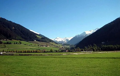
Valle Sarentina Adrian Michael · CC BY 2.5

Climate of Renon
Best months for sightseeingBest months for sightseeing: June–September.
This month · November
A cold month
Day 6° · Night -1° · Rain 49 mm
- Hottest month
- July (day 22°)
- Coldest month
- January (night -4°)
- Wettest month
- July (94 mm)
- Driest month
- February (26 mm)
Bars: average monthly low and high temperature. Below: precipitation. Monthly averages for 1970–2000 at about 18 km resolution, adjusted for elevation. Highlighted months are mild and relatively dry. Source: WorldClim 2.1 (CC BY 4.0).
Show values as a table
| Month | Jan | Feb | Mar | Apr | May | Jun | Jul | Aug | Sep | Oct | Nov | Dec |
|---|---|---|---|---|---|---|---|---|---|---|---|---|
| Average high (°C) | 3° | 4° | 7° | 11° | 16° | 19° | 22° | 21° | 18° | 13° | 6° | 3° |
| Average low (°C) | -4° | -4° | -1° | 1° | 6° | 9° | 12° | 12° | 9° | 4° | -1° | -3° |
| Precipitation (mm) | 28 | 26 | 35 | 45 | 70 | 90 | 94 | 89 | 70 | 67 | 49 | 32 |
Other places to visit in this season: June July August September
How to get to Renon
The nearest airport is Bolzano Airport (BZO), 14 km to the southwest as the crow flies. For international flights: Innsbruck Airport (INN) (80 km). The nearest large city is Innsbruck, 80 km to the north.
Airports
- Bolzano Airport (BZO) Bolzano (BZ) 14 kmsouthwest
- Innsbruck Airport (INN) Innsbruck 80 kmnorth
- Treviso Airport (TSF) Treviso (TV) 114 kmsoutheast
Nearby large cities
- Innsbruck Population: 132.5K 80 kmnorth
- Munich Population: 1.5M 178 kmnorth
- Salzburg Population: 157.2K 184 kmnortheast
- Augsburg Population: 301.1K 208 kmnorth
- Klagenfurt Population: 100.3K 218 kmeast
Straight-line distances; road distances are longer. Airport data: OurAirports.
Day trips from Renon
Within 100 km: 54 historic and cultural sites, 3,419 natural sites, 218 lakes, rivers and coasts.
0–25 km93 places
- Monte Pez Mountain 10 kmE
- Karnspitz Mountain 24 kmN
- Rosengartenspitze Mountain 16 kmSE
- Col Rodella Mountain 23 kmE
25–60 km1,015 places
- Piz Gralba Mountain 26 kmE
- Piz Miara Mountain 26 kmE
- Croda Nera Mountain 28 kmSE
- Wild See Lake 51 kmN
60–100 km2,583 places
- Spadalone Mountain 72 kmSW
- Dosso Rotondo Mountain 92 kmSW
- Lai da Juata Lake 86 kmW
- Lai da Costainas Lake 76 kmW
Straight-line distances.
Places in Renon
23 placesRenon
Population: 7K

Collalbo
Population: 1.7K
Soprabolzano
Population: 1K
Auna di Sotto
Population: 602

Vanga
Population: 234

Auna di Sopra
Population: 224
- 7 Longostagno 216
- 8 Longomoso 144
- 9 Zona Artigianale Collalbo 104
- 10 Campodazzo 90
- 11 Weber Im Moos 72
- 12 Case Nere 64
- 13 Am Kaseracker 55
- 14 Siffiano 48
- 15 Daunenstep 45
- 16 Signato 45
- 17 Sill 38
- 18 Costalovara 36
- 19 Zona Artigianale Auna di Sotto 25
- 20 Gissmann 17
- 21 Santa Trinità 17
Bar: population relative to the most populous place in this list.
Cities & villages1
- Prato all'Isarco · Village
Mountains & nature1
- Monte Tondo · Mountain
Nearby attractions & nature
Everything nearby-
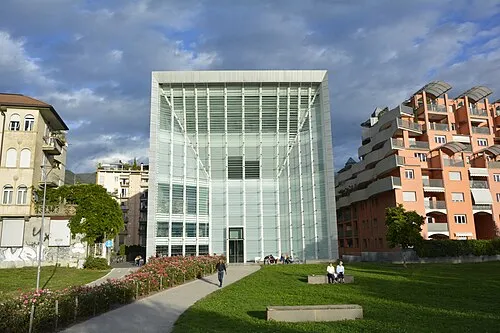 Museion Museum, Bolzano/Bozen9.7 km SW
-
Valle Sarentina Natural site, Trentino-Alto Adige6.4 km NW
-
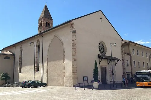 Chiesa dei Domenicani Attraction, Bolzano/Bozen9.4 km SW
-
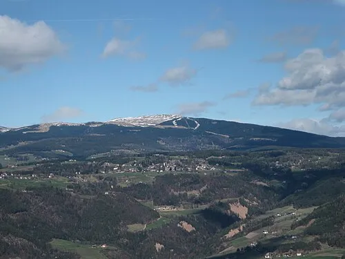 Rittner Horn Mountain, Barbian8.1 km N
-
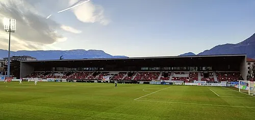 Stadio Druso Landmark, Bolzano/Bozen10 km SW
-
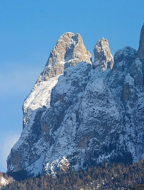 Punta Santner Mountain, Castelrotto/Kastelruth9 km E
-
Monte Balzo Mountain, Tiers8.2 km SE
-
Monte Nicola Mountain, Tiers9 km SE
Sources & licences
Data last updated: