- Population
- 403
- 403
- Elevation
- 307 m
- above sea level
- Local time
- UTC+01:00
- Europe/Rome · UTC+01:00
- Airports
- PSA Pisa International Airport44 km
- PMF Parma Airport87 km
About Pariana
Pariana is a village. Location: Massa, Province of Massa-Carrara. Population: 403. Elevation: 307 m. The best months to visit are May–September. The nearest airport is Pisa International Airport (44 km). Nearby sights include Stadio degli Oliveti and Monte Altissimo.
Photos of Pariana
-
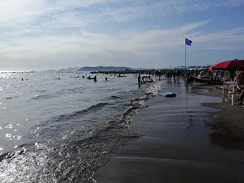
Spiaggia Marina di Massa Bramfab · CC BY-SA 4.0 -
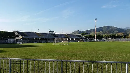
Stadio degli Oliveti Alix4499 · CC BY-SA 4.0


Climate of Pariana
Best months for sightseeingBest months for sightseeing: May–September.
This month · November
A wet month
Day 12° · Night 5° · Rain 173 mm
- Hottest month
- July (day 27°)
- Coldest month
- January (night 1°)
- Wettest month
- November (173 mm)
- Driest month
- July (37 mm)
Bars: average monthly low and high temperature. Below: precipitation. Monthly averages for 1970–2000 at about 18 km resolution, adjusted for elevation. Highlighted months are mild and relatively dry. Source: WorldClim 2.1 (CC BY 4.0).
Show values as a table
| Month | Jan | Feb | Mar | Apr | May | Jun | Jul | Aug | Sep | Oct | Nov | Dec |
|---|---|---|---|---|---|---|---|---|---|---|---|---|
| Average high (°C) | 8° | 10° | 12° | 15° | 20° | 24° | 27° | 27° | 23° | 18° | 12° | 9° |
| Average low (°C) | 1° | 1° | 3° | 6° | 10° | 13° | 16° | 16° | 13° | 9° | 5° | 2° |
| Precipitation (mm) | 136 | 105 | 114 | 119 | 88 | 72 | 37 | 70 | 110 | 169 | 173 | 138 |
Other places to visit in this season: May June July August September
How to get to Pariana
The nearest airport is Pisa International Airport (PSA), 44 km to the southeast as the crow flies. The nearest large city is Nice, 236 km to the west.
Airports
- Pisa International Airport (PSA) Pisa (PI) 44 kmsoutheast
- Parma Airport (PMF) Parma (PR) 87 kmnorth
- Florence Airport, Peretola (FLR) Firenze (FI) 88 kmeast
Nearby large cities
- Nice Population: 342.7K 236 kmwest
- Toulon Population: 168.7K 357 kmwest
- Rijeka Population: 108K 368 kmnortheast
- Innsbruck Population: 132.5K 370 kmnorth
- Grenoble Population: 158.6K 375 kmwest
Straight-line distances; road distances are longer. Airport data: OurAirports.
Day trips from Pariana
Within 100 km: 59 historic and cultural sites, 252 natural sites, 39 lakes, rivers and coasts.
0–25 km21 places
- La Lecciona Beach 24 kmS
- Spiaggia della Marinella di San Terenzo Beach 22 kmW
- Spiaggia Forte dei Marmi Beach 10 kmS
- Spiaggia Marina di Pietrasanta Beach 13 kmS
25–60 km96 places
- Spiaggia del Felciaio Beach 60 kmS
- Spiaggia libera per cani Beach 53 kmS
- La Spiaggia di Levanto Beach 47 kmW
- Spiaggia Verruca Beach 53 kmS
60–100 km233 places
- Rotteri Mountain 85 kmNW
- Poggio di Iavello Mountain 74 kmE
- Gifarco Mountain 85 kmNW
- Bagni Pagana Beach 82 kmNW
Straight-line distances.
Nearby attractions & nature
Everything nearby-
Stadio degli Oliveti Landmark, Massa4.1 km SW
-
Monte Altissimo Mountain, Liguria5.7 km E
-
Spiaggia Marina di Massa Beach, Massa6.7 km SW
-
Monte Contrario Mountain, Massa8.7 km NE
-
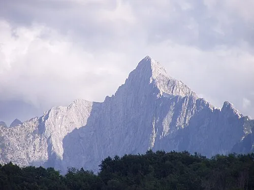 Monte Pizzo d'Uccello Mountain, Fivizzano10 km N
-
Monte Cavallo Mountain, Emilia-Romagna9.1 km NE
Sources & licences
Data last updated: