Punta Ala
Located in Castiglione della Pescaia, Provincia di Grosseto Coordinates: 42°48′12″ N 10°45′21″ E

- Population
- 402
- 402
- Elevation
- 38 m
- above sea level
- Local time
- UTC+01:00
- Europe/Rome · UTC+01:00
- Airports
- EBA Marina di Campo Airport42 km
- PSA Pisa International Airport102 km
About Punta Ala
Punta Ala is a village. Location: Castiglione della Pescaia, Provincia di Grosseto. Population: 402. Elevation: 38 m.
Punta Ala (formerly Punta Troia) is a frazione of the town of Castiglione della Pescaia, in the province of Grosseto, Tuscany, Italy. The small town with a population of 402 people lies at the bottom of the northern hillsides of the promontory of the same name. The coastal town is a popular summer seaside destination.
Source: Wikipedia · CC BY-SA 4.0
Photos of Punta Ala
-

DVDP · Public domain -

MPFerra · CC BY-SA 4.0 -

Earth Science and Remote Sensing Unit , Lyndon B. Johnson Space Center · Public domain -

trolvag · CC BY-SA 3.0 -

trolvag · CC BY-SA 3.0


Climate of Punta Ala
Best months for sightseeingBest months for sightseeing: May–July, September–October.
This month · November
Outside the best season
Day 16° · Night 9° · Rain 82 mm
- Hottest month
- August (day 28°)
- Coldest month
- January (night 5°)
- Wettest month
- November (82 mm)
- Driest month
- July (15 mm)
Bars: average monthly low and high temperature. Below: precipitation. Monthly averages for 1970–2000 at about 18 km resolution, adjusted for elevation. Highlighted months are mild and relatively dry. Source: WorldClim 2.1 (CC BY 4.0).
Show values as a table
| Month | Jan | Feb | Mar | Apr | May | Jun | Jul | Aug | Sep | Oct | Nov | Dec |
|---|---|---|---|---|---|---|---|---|---|---|---|---|
| Average high (°C) | 12° | 12° | 14° | 17° | 21° | 25° | 28° | 28° | 25° | 21° | 16° | 12° |
| Average low (°C) | 5° | 5° | 7° | 9° | 13° | 16° | 19° | 19° | 17° | 13° | 9° | 6° |
| Precipitation (mm) | 51 | 50 | 48 | 46 | 38 | 24 | 15 | 34 | 65 | 78 | 82 | 58 |
Other places to visit in this season: May June July September October
How to get to Punta Ala
The nearest airport is Marina di Campo Airport (EBA), 42 km to the west as the crow flies. For international flights: Pisa International Airport (PSA) (102 km). The nearest large city is Nice, 300 km to the west.
Airports
- Marina di Campo Airport (EBA) Campo nell'Elba (LI) 42 kmwest
- Pisa International Airport (PSA) Pisa (PI) 102 kmnorth
- Bastia-Poretta International airport (BIA) Bastia 108 kmwest
Nearby large cities
- Nice Population: 342.7K 300 kmwest
- Toulon Population: 168.7K 395 kmwest
Straight-line distances; road distances are longer. Airport data: OurAirports.
Day trips from Punta Ala
Within 100 km: 103 historic and cultural sites, 116 natural sites, 67 lakes, rivers and coasts.
0–25 km25 places
- Medusa Beach 23 kmSE
- Oasi Beach 23 kmSE
- Kite Beach Fiumara Beach 19 kmSE
- Cala Civette Beach 5 kmN
25–60 km178 places
- Poggio Mosconcino Mountain 31 kmE
- Parco della Rimembranza Natural site 30 kmE
- Parco di Villa Pizzetti Natural site 28 kmE
- Parco del fiume Ombrone Silvano Signori Natural site 31 kmE
60–100 km83 places
- Ultima Spiaggia Beach 74 kmSE
- Siaggia delle graticciare Beach 75 kmSE
- La capannuccia Beach 60 kmSE
- Cala del Leone Beach 80 kmNW
Straight-line distances.
Nearby attractions & nature
Everything nearby-
Poggio Peroni Mountain, Castiglione della Pescaia2.3 km SE
-
Le Bozze Mountain, Castiglione della Pescaia2.8 km E
-
Poggio Santa Petronilla Mountain, Castiglione della Pescaia4.4 km NE
-
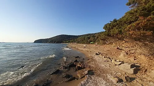 Cala Civette Beach, Italy5.2 km N
-
Poggio di Furia Mountain, Castiglione della Pescaia7.9 km E
-
Poggio Sentinella Mountain, Scarlino7.2 km N
Other cities and towns in Castiglione della Pescaia
-
Ampio Village, Castiglione della Pescaia16 km E
-
 Vetulonia Village, Castiglione della Pescaia19 km E
-
 Ponti di Badia Village, Castiglione della Pescaia15 km E
-
 Buriano Village, Castiglione della Pescaia19 km E
-
Porta a Colle Village, Castiglione della Pescaia19 km E
-
Vaticino Village, Castiglione della Pescaia20 km E
Sources & licences
Data last updated: · 2 independent sources