- Population
- 26
- 26
- Elevation
- 517 m
- above sea level
- Local time
- UTC+01:00
- Europe/Rome · UTC+01:00
- Airports
- VRN Verona Villafranca Valerio Catullo Airport40 km
- TSF Treviso Airport70 km
About Zarantonelli
Zarantonelli is a village. Location: Valdagno, Province of Vicenza. Population: 26. Elevation: 517 m. The best months to visit are May–September. The nearest airport is Verona Villafranca Valerio Catullo Airport (40 km). Nearby sights include Cima di Marana and Monte Campetto.
Climate of Zarantonelli
Best months for sightseeingBest months for sightseeing: May–September.
This month · November
A cold month
Day 9° · Night 2° · Rain 68 mm
- Hottest month
- July (day 27°)
- Coldest month
- January (night -2°)
- Wettest month
- June (90 mm)
- Driest month
- February (42 mm)
Bars: average monthly low and high temperature. Below: precipitation. Monthly averages for 1970–2000 at about 18 km resolution, adjusted for elevation. Highlighted months are mild and relatively dry. Source: WorldClim 2.1 (CC BY 4.0).
Show values as a table
| Month | Jan | Feb | Mar | Apr | May | Jun | Jul | Aug | Sep | Oct | Nov | Dec |
|---|---|---|---|---|---|---|---|---|---|---|---|---|
| Average high (°C) | 5° | 7° | 11° | 14° | 20° | 24° | 27° | 26° | 22° | 16° | 9° | 6° |
| Average low (°C) | -2° | -1° | 2° | 6° | 11° | 14° | 16° | 16° | 12° | 8° | 2° | -2° |
| Precipitation (mm) | 46 | 42 | 56 | 70 | 83 | 90 | 74 | 86 | 78 | 88 | 68 | 49 |
Other places to visit in this season: May June July August September
How to get to Zarantonelli
The nearest airport is Verona Villafranca Valerio Catullo Airport (VRN), 40 km to the southwest as the crow flies. The nearest large city is Innsbruck, 184 km to the north.
Airports
- Verona Villafranca Valerio Catullo Airport (VRN) Caselle (VR) 40 kmsouthwest
- Treviso Airport (TSF) Treviso (TV) 70 kmeast
- Brescia Gabriele d'Annunzio Airport (VBS) Montichiari (BS) 78 kmwest
Nearby large cities
- Innsbruck Population: 132.5K 184 kmnorth
- Rijeka Population: 108K 248 kmeast
- Ljubljana Population: 272.2K 254 kmeast
- Klagenfurt Population: 100.3K 259 kmnortheast
- Salzburg Population: 157.2K 278 kmnortheast
Straight-line distances; road distances are longer. Airport data: OurAirports.
Day trips from Zarantonelli
Within 100 km: 76 historic and cultural sites, 987 natural sites, 20 lakes, rivers and coasts.
0–25 km64 places
- Santa Corona Attraction 21 kmE
- Lora Mountain 23 kmNW
- Monti Lessini Mountain 10 kmNW
- Corno Barila Mountain 14 kmW
25–60 km318 places
- Dosso Rotondo Mountain 31 kmNW
- Selvata Mountain 26 kmNW
- Dossa Mountain 55 kmN
- Monte Toraro Mountain 28 kmN
60–100 km701 places
- Burano Island 89 kmE
- Sacca Fisola Island 82 kmE
- San Clemente Island 84 kmE
- Spadalone Mountain 74 kmNW
Straight-line distances.
Nearby attractions & nature
Everything nearby-
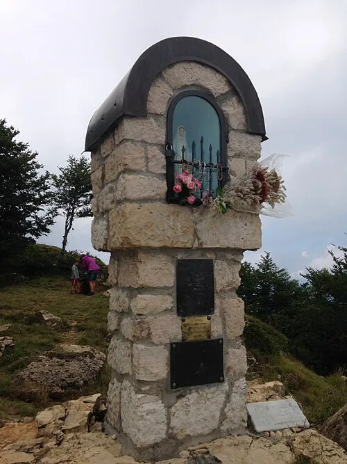 Cima di Marana Mountain, Recoaro Terme8.2 km NW
-
Monte Campetto Mountain, Recoaro Terme9.7 km NW
-
Monte Telegrafo Mountain, Crespadoro11 km NW
-
Cima Campo d'Avanti Mountain, Recoaro Terme11 km NW
-
Monte Faiardan Mountain, Tregnago10 km SW
-
Monte Porto Mountain, Crespadoro12 km NW
Sources & licences
Data last updated: · 2 independent sources