- Local time
- UTC+09:00
- Asia/Tokyo · UTC+09:00
- Elevation
- 39 m
- above sea level
- Airports
- NKM Nagoya Airport / JASDF Komaki Air Base29 km
- NGO Chubu Centrair International Airport42 km
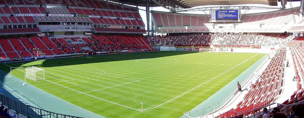
About Toyota Stadium
Toyota Stadium is a landmark. Location: Toyota-shi, Aichi.
Toyota Stadium (豊田スタジアム, Toyota Sutajiamu) is a stadium in Toyota, Aichi Prefecture, Japan. It has a retractable roof.
Source: Wikipedia · CC BY-SA 4.0
At a glance
- Built
- 1997
- Opened
- 2001
- Architect
- Kisho Kurokawa
- Area
- 4.1 ha
- Official website
- toyota-stadium.co.jp
Source: Wikidata
Photos of Toyota Stadium
-

TTTNIS · CC0 -

TTTNIS · CC0 -

Nryate · CC BY-SA 4.0 -

Nryate · CC BY-SA 4.0


Climate of Toyota Stadium
Best months for sightseeingBest months for sightseeing: May–June, October.
This month · November
A wet month
Day 17° · Night 8° · Rain 100 mm
Better nearby cities in November
- Fujinomiya · 132 km east18°
- Fuji · 138 km east20°
- Kofu · 142 km northeast17°
- Hottest month
- August (day 31°)
- Coldest month
- January (night 0°)
- Wettest month
- September (276 mm)
- Driest month
- December (61 mm)
Bars: average monthly low and high temperature. Below: precipitation. Monthly averages for 1970–2000 at about 18 km resolution, adjusted for elevation. Highlighted months are mild and relatively dry. Source: WorldClim 2.1 (CC BY 4.0).
Show values as a table
| Month | Jan | Feb | Mar | Apr | May | Jun | Jul | Aug | Sep | Oct | Nov | Dec |
|---|---|---|---|---|---|---|---|---|---|---|---|---|
| Average high (°C) | 9° | 9° | 13° | 19° | 23° | 26° | 29° | 31° | 27° | 22° | 17° | 11° |
| Average low (°C) | 0° | 1° | 4° | 9° | 14° | 18° | 22° | 23° | 20° | 13° | 8° | 2° |
| Precipitation (mm) | 64 | 84 | 140 | 204 | 203 | 274 | 275 | 244 | 276 | 166 | 100 | 61 |
How to get to Toyota Stadium
The nearest airport is Nagoya Airport / JASDF Komaki Air Base (NKM), 29 km to the northwest as the crow flies. For international flights: Chubu Centrair International Airport (NGO) (42 km). The nearest large city is Toyota, 2 km to the west.
Airports
- Nagoya Airport / JASDF Komaki Air Base (NKM) Nagoya 29 kmnorthwest
- Chubu Centrair International Airport (NGO) Tokoname 42 kmsouthwest
- Mount Fuji Shizuoka Airport (FSZ) Makinohara / Shimada 99 kmeast
Nearby large cities
- Toyota Population: 426.2K 2 kmwest
- Okazaki Population: 384.7K 15 kmsouth
- Anjo Population: 188.7K 16 kmsouthwest
- Seto Population: 127.8K 18 kmnorth
- Kariya Population: 153.8K 20 kmsouthwest
Straight-line distances; road distances are longer. Airport data: OurAirports.
Day trips from Toyota Stadium
Within 100 km: 7 historic and cultural sites, 19 natural sites, 27 lakes, rivers and coasts.
0–25 km2 places
- Okazaki castle Historic site 14 kmS
- Atsuta Shrine Noh Stage Attraction 24 kmW
25–60 km25 places
- Himakajima Island 45 kmS
- Shino-jima Island 48 kmS
- Mikawa-wan Natural site 43 kmS
- Hongū-zan Mountain 30 kmSE
60–100 km26 places
- Tōshi-jima Island 68 kmSW
- Sakate-jima Island 72 kmSW
- Kami-jima Island 62 kmS
- Kashiko Island Island 92 kmS
Straight-line distances.
Nearby attractions & nature
Everything nearby-
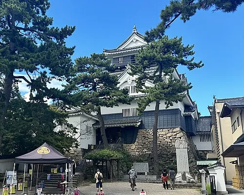 Okazaki castle Historic site, Okazaki-shi14 km S
-
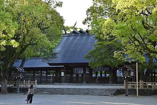 Atsuta Shrine Noh Stage Attraction, Atsuta24 km W
Nearest towns and villages
Sources & licences
Data last updated: · 2 independent sources