- Local time
- UTC+09:00
- Asia/Tokyo · UTC+09:00
- Elevation
- 15 m
- above sea level
- Airports
- NKM Nagoya Airport / JASDF Komaki Air Base15 km
- NGO Chubu Centrair International Airport31 km
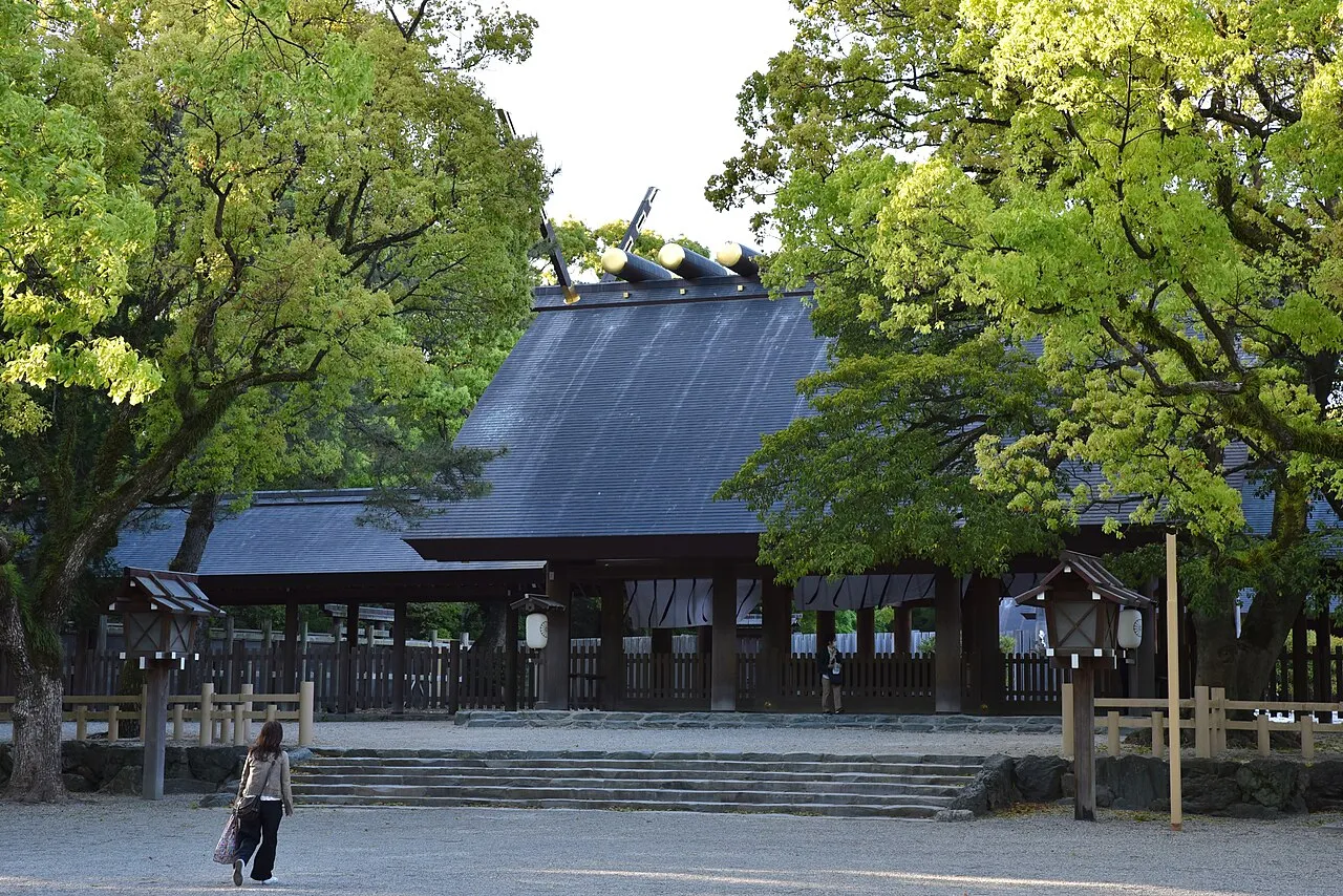
About Atsuta Shrine Noh Stage
Atsuta Shrine Noh Stage is a tourist attraction. Location: Atsuta, Nagoya.
Atsuta Shrine (熱田神宮, Atsuta-jingū) is a Shinto shrine, home to the sacred sword Kusanagi no Tsurugi, one of the three Imperial Regalia of Japan—traditionally believed to have been established during the reign of Emperor Keikō (reigned 71–130 CE). It is located in Atsuta-ku, Nagoya, Aichi Prefecture in Japan. The shrine is familiarly known as Atsuta-Sama (Venerable Atsuta) or simply as Miya (the Shrine). Since ancient times, it has been especially revered, ranking with the Ise Shrine.
Source: Wikipedia · CC BY-SA 4.0
At a glance
- Architectural style
- Shinmei-zukuri, Owari-zukuri
- Official website
- atsutajingu.or.jp
Source: Wikidata
Photos of Atsuta Shrine Noh Stage
-

Lin Xiangru · CC BY-SA 4.0 -

Saigen Jiro · CC0 -

円周率3パーセント · CC BY-SA 4.0 -

円周率3パーセント · CC BY-SA 4.0 -

Hyppolyte de Saint-Rambert · CC BY 4.0


Climate of Atsuta Shrine Noh Stage
Best months for sightseeingBest months for sightseeing: April–June, October.
This month · November
Outside the best season
Day 17° · Night 8° · Rain 96 mm
Better nearby cities in November
- Fujinomiya · 156 km east18°
- Fuji · 161 km east20°
- Kofu · 162 km east17°
- Hottest month
- August (day 32°)
- Coldest month
- January (night 0°)
- Wettest month
- June (273 mm)
- Driest month
- December (53 mm)
Bars: average monthly low and high temperature. Below: precipitation. Monthly averages for 1970–2000 at about 18 km resolution, adjusted for elevation. Highlighted months are mild and relatively dry. Source: WorldClim 2.1 (CC BY 4.0).
Show values as a table
| Month | Jan | Feb | Mar | Apr | May | Jun | Jul | Aug | Sep | Oct | Nov | Dec |
|---|---|---|---|---|---|---|---|---|---|---|---|---|
| Average high (°C) | 9° | 9° | 13° | 19° | 23° | 26° | 30° | 32° | 28° | 22° | 17° | 11° |
| Average low (°C) | 0° | 1° | 4° | 9° | 14° | 19° | 22° | 23° | 20° | 13° | 8° | 3° |
| Precipitation (mm) | 59 | 80 | 131 | 186 | 191 | 273 | 266 | 196 | 252 | 151 | 96 | 53 |
Other places to visit in this season: April May June October
How to get to Atsuta Shrine Noh Stage
The nearest airport is Nagoya Airport / JASDF Komaki Air Base (NKM), 15 km to the north as the crow flies. For international flights: Chubu Centrair International Airport (NGO) (31 km). The nearest large city is Tōkai, 11 km to the south.
Airports
- Nagoya Airport / JASDF Komaki Air Base (NKM) Nagoya 15 kmnorth
- Chubu Centrair International Airport (NGO) Tokoname 31 kmsouth
- Mount Fuji Shizuoka Airport (FSZ) Makinohara / Shimada 123 kmeast
Nearby large cities
- Tōkai Population: 113.8K 11 kmsouth
- Kasugai Population: 308.7K 15 kmnortheast
- Kariya Population: 153.8K 17 kmsoutheast
- Komaki Population: 148.9K 18 kmnorth
- Inazawa Population: 134.8K 18 kmnorthwest
Straight-line distances; road distances are longer. Airport data: OurAirports.
Day trips from Atsuta Shrine Noh Stage
Within 100 km: 7 historic and cultural sites, 20 natural sites, 30 lakes, rivers and coasts.
0–25 km11 places
- Toyota Stadium Landmark 24 kmE
- Nikkō River River 9 kmSW
- Hori River River 4 kmSW
- Mount Komaki Mountain 19 kmN
25–60 km19 places
- Himakajima Island 47 kmS
- Shino-jima Island 50 kmS
- Mikawa-wan Natural site 51 kmSE
- Hongū-zan Mountain 53 kmSE
60–100 km27 places
- Tōshi-jima Island 67 kmS
- Sakate-jima Island 71 kmS
- Kami-jima Island 64 kmS
- Kashiko Island Island 91 kmS
Straight-line distances.
Nearby attractions & nature
Everything nearby-
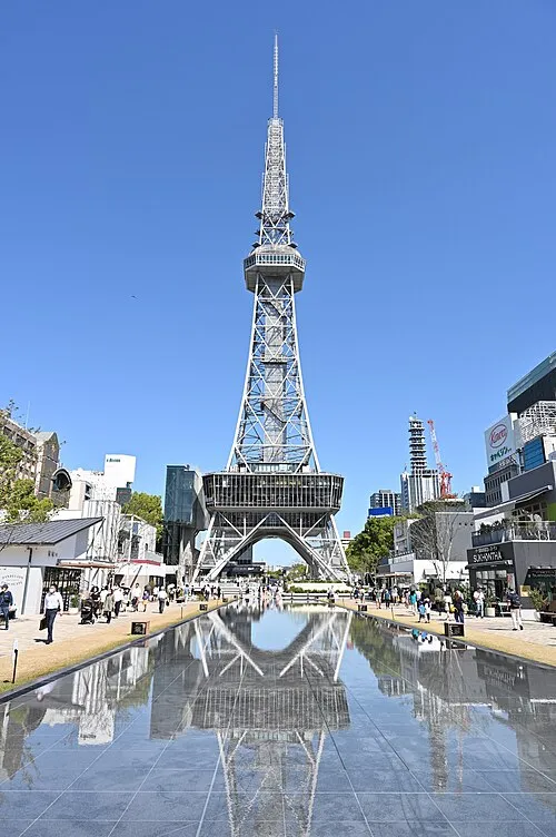 Nagoya TV Tower Landmark, Naka5.4 km N
-
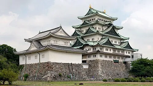 Nagoya castle Historic site, Naka6.9 km N
-
Hori River River, Aichi3.8 km SW
-
SCMaglev and Railway Park Museum, Minato-ku9.8 km SW
-
 Shonai River River, Japan12 km SW
-
Nikkō River River, Aichi9.1 km SW
-
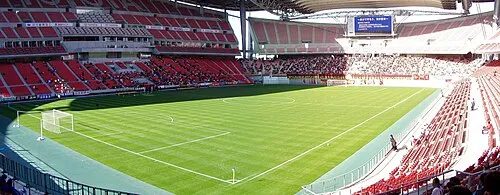 Toyota Stadium Landmark, Toyota-shi24 km E
-
 Kiso River River, Mie18 km SW
Nearest towns and villages


Sources & licences
Data last updated: · 2 independent sources