Minmaya
Located in Sotogahama-machi, Higashitsugaru-gun Coordinates: 41°12′54″ N 140°24′17″ E
- Elevation
- 140 m
- above sea level
- Local time
- UTC+09:00
- Asia/Tokyo · UTC+09:00
- Airports
- AOJ Aomori Airport59 km
- HKD Hakodate Airport71 km
About Minmaya
Minmaya is a village. Location: Sotogahama-machi, Higashitsugaru-gun. Elevation: 140 m.
Minmaya (三厩村, Minmaya-mura) was a village located in Higashitsugaru District in northern Aomori Prefecture, Japan. Minmaya Village was located on the north coast of Tsugaru Peninsula bordering on Tsugaru Strait. The area was part of Hirosaki Domain during the Edo period. After the Meiji Restoration, Minmaya Village was created on April 1, 1889.
Source: Wikipedia · CC BY-SA 4.0
At a glance
- Built
- 1889
- Area
- 65.3 km²
Source: Wikidata
Climate of Minmaya
Best months for sightseeingBest months for sightseeing: June–September.
This month · November
A wet month
Day 9° · Night 3° · Rain 110 mm
- Hottest month
- August (day 25°)
- Coldest month
- January (night -6°)
- Wettest month
- September (164 mm)
- Driest month
- April (77 mm)
Bars: average monthly low and high temperature. Below: precipitation. Monthly averages for 1970–2000 at about 18 km resolution, adjusted for elevation. Highlighted months are mild and relatively dry. Source: WorldClim 2.1 (CC BY 4.0).
Show values as a table
| Month | Jan | Feb | Mar | Apr | May | Jun | Jul | Aug | Sep | Oct | Nov | Dec |
|---|---|---|---|---|---|---|---|---|---|---|---|---|
| Average high (°C) | -1° | 0° | 4° | 10° | 16° | 19° | 22° | 25° | 22° | 16° | 9° | 2° |
| Average low (°C) | -6° | -5° | -2° | 4° | 9° | 12° | 17° | 19° | 15° | 9° | 3° | -3° |
| Precipitation (mm) | 101 | 83 | 79 | 77 | 89 | 95 | 136 | 144 | 164 | 113 | 110 | 104 |
Other places to visit in this season: June July August September
How to get to Minmaya
The nearest airport is Aomori Airport (AOJ), 59 km to the southeast as the crow flies. The nearest large city is Aomori, 52 km to the southeast.
Airports
- Aomori Airport (AOJ) Aomori 59 kmsoutheast
- Hakodate Airport (HKD) Hakodate 71 kmnortheast
- Misawa Airport / Misawa Air Base (MSJ) Misawa 99 kmsoutheast
Nearby large cities
- Aomori Population: 298.4K 52 kmsoutheast
- Hakodate Population: 275.7K 68 kmnortheast
- Hirosaki Population: 168.7K 69 kmsouth
- Hachinohe Population: 239K 122 kmsoutheast
- Akita Population: 307.7K 168 kmsouth
Straight-line distances; road distances are longer. Airport data: OurAirports.
Day trips from Minmaya
Within 100 km: 6 historic and cultural sites, 20 natural sites, 14 lakes, rivers and coasts.
0–25 km2 places
- Iwaki River River 22 kmS
- Lake Jūsan Lake 22 kmS
25–60 km16 places
- Tai-jima Island 38 kmE
- Usoriyama-ko Lake 59 kmE
- Osore-zan Mountain 56 kmE
- Mutsu Bay Natural site 39 kmE
60–100 km22 places
- Eboshi-dake Mountain 68 kmSE
- Tokoro River River 97 kmN
- Shiryōkaku Historic site 74 kmNE
- Hakodate Arena Landmark 70 kmNE
Straight-line distances.
Nearby attractions & nature
Everything nearby-
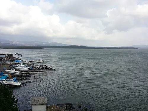 Lake Jūsan Lake, Aomori22 km S
-
 Iwaki River River, Aomori22 km S
Sources & licences
Data last updated: · 2 independent sources