Yomogita Mura
Located in Higashitsugaru-gun, Aomori Coordinates: 40°59′42″ N 140°35′47″ E

- Population
- 3,122
- 3.1K
- Elevation
- 81 m
- above sea level
- Local time
- UTC+09:00
- Asia/Tokyo · UTC+09:00
- Places inside
- 1
- listed under Yomogita Mura
- Airports
- AOJ Aomori Airport30 km
- MSJ Misawa Airport / Misawa Air Base73 km
About Yomogita Mura
Yomogita Mura is a municipality. Location: Higashitsugaru-gun, Aomori. Population: 3,122. Elevation: 81 m.
Yomogita (蓬田村, Yomogita-mura) is a village located in Aomori Prefecture, Japan and a part of the Aomori metropolitan area. As of 31 January 2023, the village had an estimated population of 2740 in 1129 households, and a population density of 32 persons per km2. The total area of the village is 80.84 square kilometres (31.21 sq mi).
Source: Wikipedia · CC BY-SA 4.0
Travel notes for Yomogita Mura
From Wikivoyage
Yomogita (蓬田) is a village in Tsugaru Peninsula, Aomori.
Understand+
A fishing and farming village on the Mutsu Bay outside Aomori City, Yomogita is no tourist destination. But if you're passing through on a drive, a bike tour, or a Seishun-18 ticket, there are a few nice stops.
Get in+
From Aomori: local trains on the JR East Tsugaru Line stop at Nakazawa, Yomogita, Gosawa, and Seheji stations before continuing north to Sotoghama Town. There are 8 or 9 trains a day. By car, Yomogita is about half an hour from central Aomori City.
From Hakodate, Hokkaido: Hakucho and Super Hakucho stop at Kanita Station. You can transfer to the local Tsugaru Line there, or take a taxi.
Source: Wikivoyage · CC BY-SA 4.0 · abridged
Places bordering Yomogita Mura
- Aomori
- Goshogawara
- Sotogahama-machi
Population of Yomogita Mura over time
| 2010 | 3,271 | |
|---|---|---|
| 2015 | 2,896 | |
| 2021 | 2,591 |
Censuses and official estimates; source: Wikidata.
Climate of Yomogita Mura
Best months for sightseeingBest months for sightseeing: June–September.
This month · November
A wet month
Day 10° · Night 3° · Rain 118 mm
- Hottest month
- August (day 26°)
- Coldest month
- January (night -5°)
- Wettest month
- September (153 mm)
- Driest month
- April (76 mm)
Bars: average monthly low and high temperature. Below: precipitation. Monthly averages for 1970–2000 at about 18 km resolution, adjusted for elevation. Highlighted months are mild and relatively dry. Source: WorldClim 2.1 (CC BY 4.0).
Show values as a table
| Month | Jan | Feb | Mar | Apr | May | Jun | Jul | Aug | Sep | Oct | Nov | Dec |
|---|---|---|---|---|---|---|---|---|---|---|---|---|
| Average high (°C) | 1° | 1° | 5° | 12° | 17° | 20° | 24° | 26° | 22° | 17° | 10° | 3° |
| Average low (°C) | -5° | -4° | -2° | 4° | 9° | 13° | 17° | 19° | 15° | 9° | 3° | -2° |
| Precipitation (mm) | 112 | 92 | 80 | 76 | 81 | 90 | 121 | 144 | 153 | 116 | 118 | 117 |
Other places to visit in this season: June July August September
How to get to Yomogita Mura
The nearest airport is Aomori Airport (AOJ), 30 km to the south as the crow flies. The nearest large city is Aomori, 23 km to the southeast.
Airports
- Aomori Airport (AOJ) Aomori 30 kmsouth
- Misawa Airport / Misawa Air Base (MSJ) Misawa 73 kmsoutheast
- Hakodate Airport (HKD) Hakodate 88 kmnorth
Nearby large cities
- Aomori Population: 298.4K 23 kmsoutheast
- Hirosaki Population: 168.7K 46 kmsouth
- Hakodate Population: 275.7K 88 kmnorth
- Hachinohe Population: 239K 94 kmsoutheast
- Akita Population: 307.7K 148 kmsouth
Straight-line distances; road distances are longer. Airport data: OurAirports.
Day trips from Yomogita Mura
Within 100 km: 6 historic and cultural sites, 16 natural sites, 15 lakes, rivers and coasts.
0–25 km7 places
- Tai-jima Island 24 kmNE
- Mutsu Bay Natural site 22 kmNE
- Iwaki River River 19 kmW
- Aomori Wan Natural site 18 kmSE
25–60 km12 places
- Usoriyama-ko Lake 55 kmNE
- Osore-zan Mountain 52 kmNE
- Eboshi-dake Mountain 41 kmSE
- Natsudomari Hantō Natural site 28 kmE
60–100 km18 places
- Mount Nagayama Mountain 73 kmNW
- Shiryōkaku Historic site 93 kmN
- Hakodate Arena Landmark 89 kmN
- Mount Hakodate Mountain 85 kmN
Straight-line distances.
Places in Yomogita Mura
1 placeBar: population relative to the most populous place in this list.
Nearby attractions & nature
Everything nearby-
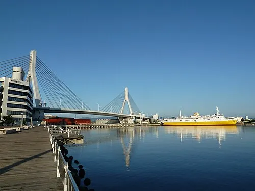 Aomori Bay Bridge Landmark, Aomori Shi22 km SE
-
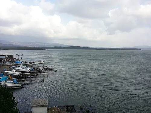 Lake Jūsan Lake, Aomori21 km W
-
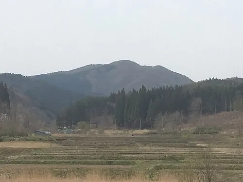 Mount Bonju Mountain, Goshogawara Shi22 km S
-
 Iwaki River River, Aomori19 km W
-
 Mutsu Bay Natural site, Aomori22 km NE
-
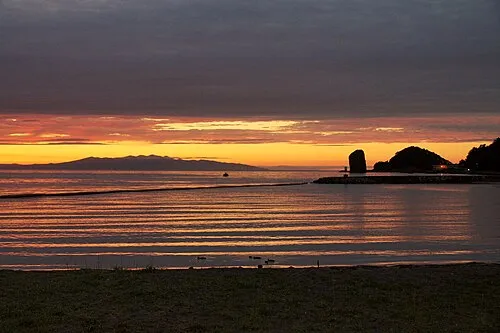 Aomori Wan Natural site, Aomori18 km SE
-
Tai-jima Island, Japan24 km NE
Other cities and towns in Higashitsugaru-gun
-
 Hiranai Machi Municipality, Higashitsugaru-gun32 km E
-
Hiranai Town, Hiranai Machi31 km E
Sources & licences
Data last updated: · 2 independent sources