- Elevation
- 141 m
- above sea level
- Local time
- UTC+09:00
- Asia/Tokyo · UTC+09:00
- Airports
- AOJ Aomori Airport29 km
- ONJ Odate Noshiro Airport39 km
About Ikarigaseki
Ikarigaseki is a village. Location: Hirakawa Shi, Aomori. Elevation: 141 m.
Ikarigaseki (碇ヶ関村, Ikarigaseki-mura) was a village located in Minamitsugaru District in central Aomori Prefecture, Japan. Ikarigaseki was founded on April 1, 1889. On January 1, 2006, Ikarigaseki, along with the towns of Hiraka and Onoe (all from Minamitsugaru District), was merged to create the new city of Hirakawa, and thus no longer exists as an independent municipality. At the time of its merger, Ikarigaseki had an estimated population of 3,140 and a population density of 29.8 persons per km2.
Source: Wikipedia · CC BY-SA 4.0
At a glance
- Built
- 1889
- Area
- 105 km²
Source: Wikidata
Places bordering Ikarigaseki
- Ōwani Machi
- Ōdate
- Kosaka
Climate of Ikarigaseki
Best months for sightseeingBest months for sightseeing: May–July, September.
This month · November
A wet month
Day 10° · Night 3° · Rain 127 mm
- Hottest month
- August (day 28°)
- Coldest month
- January (night -5°)
- Wettest month
- September (164 mm)
- Driest month
- March (89 mm)
Bars: average monthly low and high temperature. Below: precipitation. Monthly averages for 1970–2000 at about 18 km resolution, adjusted for elevation. Highlighted months are mild and relatively dry. Source: WorldClim 2.1 (CC BY 4.0).
Show values as a table
| Month | Jan | Feb | Mar | Apr | May | Jun | Jul | Aug | Sep | Oct | Nov | Dec |
|---|---|---|---|---|---|---|---|---|---|---|---|---|
| Average high (°C) | 1° | 1° | 5° | 12° | 18° | 22° | 26° | 28° | 23° | 17° | 10° | 4° |
| Average low (°C) | -5° | -5° | -2° | 4° | 9° | 14° | 19° | 20° | 15° | 8° | 3° | -2° |
| Precipitation (mm) | 115 | 95 | 89 | 93 | 89 | 108 | 152 | 160 | 164 | 123 | 127 | 128 |
Other places to visit in this season: May June July September
How to get to Ikarigaseki
The nearest airport is Aomori Airport (AOJ), 29 km to the north as the crow flies. The nearest large city is Hirosaki, 18 km to the northwest.
Airports
- Aomori Airport (AOJ) Aomori 29 kmnorth
- Odate Noshiro Airport (ONJ) Kitaakita 39 kmsouthwest
- Misawa Airport / Misawa Air Base (MSJ) Misawa 67 kmeast
Nearby large cities
- Hirosaki Population: 168.7K 18 kmnorthwest
- Aomori Population: 298.4K 39 kmnorth
- Hachinohe Population: 239K 74 kmeast
- Akita Population: 307.7K 95 kmsouthwest
- Morioka Population: 290.7K 97 kmsoutheast
Straight-line distances; road distances are longer. Airport data: OurAirports.
Day trips from Ikarigaseki
Within 100 km: 4 historic and cultural sites, 16 natural sites, 16 lakes, rivers and coasts.
0–25 km2 places
- Seibi En Attraction 16 kmN
- Lake Towada Lake 22 kmE
25–60 km12 places
- Shirakami Sanchi Mountain 37 kmW
- Mount Iwaki Mountain 34 kmNW
- Mount Bonju Mountain 36 kmN
- Eboshi-dake Mountain 52 kmNE
60–100 km22 places
- Arata River River 73 kmSE
- Lake Ogarawa Lake 69 kmNE
- Oirase River River 72 kmE
- Mabechi River River 76 kmE
Straight-line distances.
Nearby attractions & nature
Everything nearby-
Seibi En Attraction, Hirakawa Shi16 km N
-
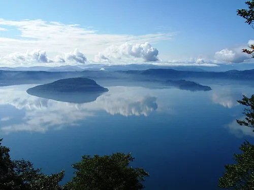 Lake Towada Lake, Japan22 km E
Sources & licences
Data last updated: · 2 independent sources