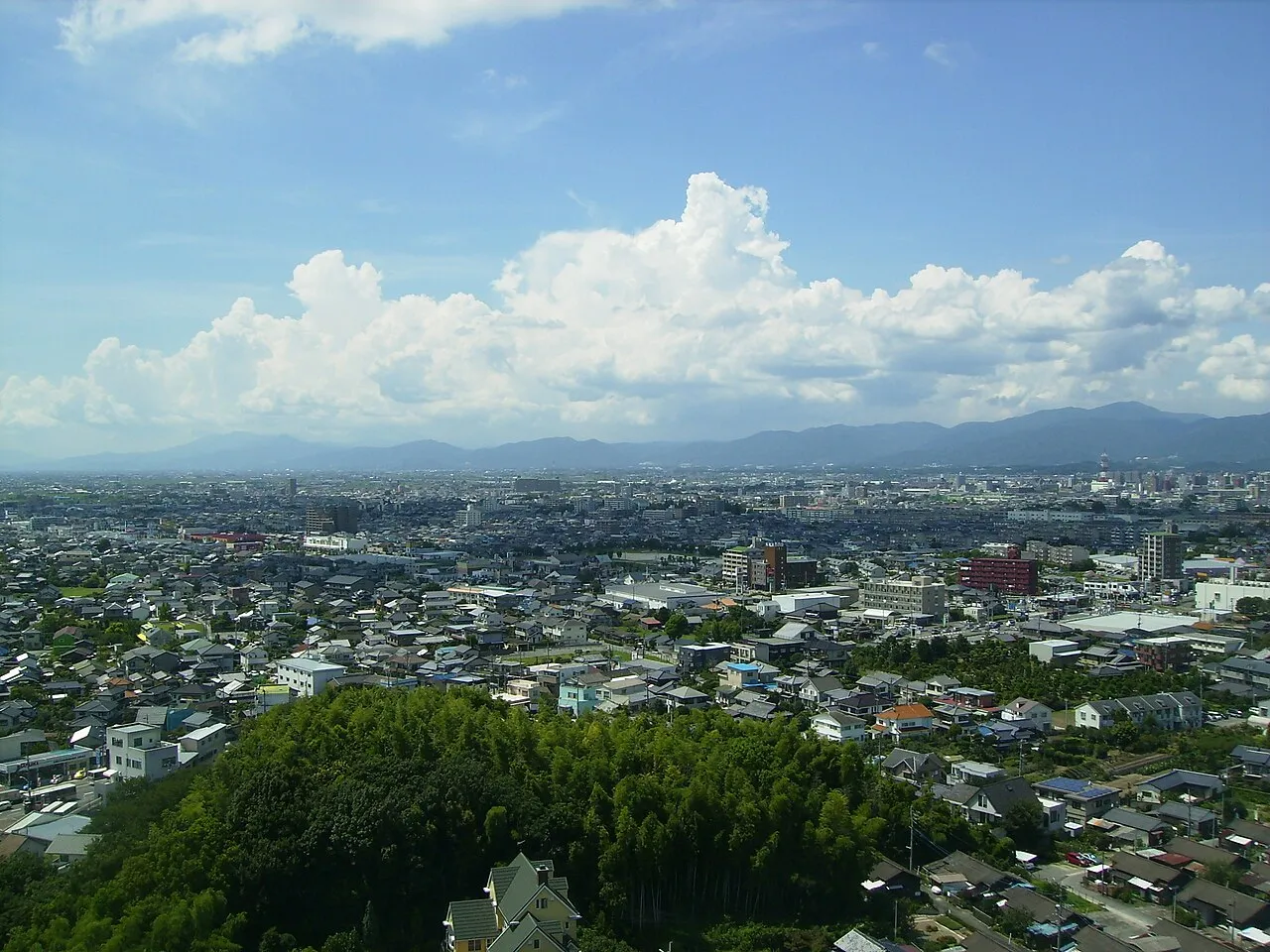
- Population
- 303,579
- 303.6K
- Elevation
- 10 m
- above sea level
- Local time
- UTC+09:00
- Asia/Tokyo · UTC+09:00
- Airports
- HSG Kyushu Saga International Airport27 km
- FUK Fukuoka Airport30 km
About Kurume
Kurume is a city. Location: Kurume Shi, Fukuoka. Population: 303,579. Elevation: 10 m. The best months to visit are May, October. The nearest airport is Kyushu Saga International Airport (27 km). Nearby sights include Kyushu Historical Museum and Mount Sefuri.
Photos of Kurume
-

そらみみ · CC BY-SA 4.0 -

そらみみ · CC BY-SA 4.0 -

Mount Sefuri Pontafon · CC BY-SA 4.0 -

Kyushu Historical Museum 厄無し / Yakunashi · CC BY-SA 3.0


Travel notes for Kurume
From Wikivoyage
Kurume (久留米) is a city in Fukuoka Prefecture, Kyushu, Japan.
Understand+
Tourist information site:
The local tourist association has a multilingual guide.
Get in+
By train:
Kurume is on the JR Kagoshima Main Line.
From Hakata station in Fukuoka there are generally one local and two rapid trains per hour operating to Kurume, with more trains during rush hours. Rapid trains take 40 minutes, and local trains take about an hour, at the same cost of ¥720.
Paying a ¥600 surcharge (¥900 for a reserved seat) will allow you to travel on one of the many limited express trains that operate on the Kagoshima line, which will bring you from Fukuoka to Kurume in half an hour. These trains operate on the same or higher frequency than regular trains, and include the Relay Tsubame for Kagoshima (connecting to the Kyushu Shinkansen), the Ariake for Kumamoto and Hikarinomori, and the Yufu trains for Yufuin, Oita and Beppu.
If you have a Japan Rail Pass you can take any of these limited express trains at no extra charge; for unreserved seating, simply show your pass to the conductor on the train.
Kurume is also on served by Nishitetsu Railway on the Tenjin Omuta Line, stopping at Nishitetsu Kurume station which is about 2.5 km east of the JR station. From Nishitetsu Fukuoka station in the Tenjin area of Fukuoka, take any Omuta-bound train. Train tickets can be purchased from the ticket machines at the station, and cost ¥600. Limited Express trains depart every 30 minutes on the hour and half-hour, and take approximately 30 minutes.
By bus:
Highway buses bound for Nishitetesu Kurume station can be boarded at Fukuoka airport and run two or three times an hour until 10 at night. One can also board Kurume-bound highway buses at Nishitetsu Tenjin Station or JR Hakata Station. Buses take about an hour to reach Kurume.
By car:
If you are driving to Kurume, you will be able to park your car in one of roughly a dozen cheap parking lots, a happy side effect to the Japanese economic depression. Look for parking signs near either of the stations. Expect to pay around ¥100 per hour.
Source: Wikivoyage · CC BY-SA 4.0 · abridged
Climate of Kurume
Best months for sightseeingBest months for sightseeing: May, October.
This month · November
Outside the best season
Day 17° · Night 8° · Rain 69 mm
Better nearby cities in November
- Beppu · 91 km east17°
- Ōita · 101 km east18°
- Nobeoka · 135 km southeast18°
- Hottest month
- August (day 32°)
- Coldest month
- January (night 1°)
- Wettest month
- July (339 mm)
- Driest month
- December (57 mm)
Bars: average monthly low and high temperature. Below: precipitation. Monthly averages for 1970–2000 at about 18 km resolution, adjusted for elevation. Highlighted months are mild and relatively dry. Source: WorldClim 2.1 (CC BY 4.0).
Show values as a table
| Month | Jan | Feb | Mar | Apr | May | Jun | Jul | Aug | Sep | Oct | Nov | Dec |
|---|---|---|---|---|---|---|---|---|---|---|---|---|
| Average high (°C) | 9° | 10° | 14° | 20° | 24° | 27° | 30° | 32° | 28° | 23° | 17° | 12° |
| Average low (°C) | 1° | 2° | 5° | 10° | 14° | 19° | 23° | 24° | 20° | 14° | 8° | 3° |
| Precipitation (mm) | 61 | 78 | 113 | 155 | 175 | 338 | 339 | 186 | 192 | 94 | 69 | 57 |
How to get to Kurume
The nearest airport is Kyushu Saga International Airport (HSG), 27 km to the southwest as the crow flies. The nearest large city is Chikushino-shi, 20 km to the north.
Airports
- Kyushu Saga International Airport (HSG) Saga 27 kmsouthwest
- Fukuoka Airport (FUK) Fukuoka 30 kmnorth
- Kumamoto Airport (KMJ) Kumamoto 62 kmsoutheast
Nearby large cities
- Chikushino-shi Population: 103.3K 20 kmnorth
- Saga Population: 233.3K 22 kmsouthwest
- Kasuga Population: 111K 24 kmnorth
- Ōnojō Population: 102.1K 25 kmnorth
- Omuta Population: 132K 32 kmsouth
Straight-line distances; road distances are longer. Airport data: OurAirports.
Day trips from Kurume
Within 100 km: 21 historic and cultural sites, 24 natural sites, 17 lakes, rivers and coasts.
0–25 km4 places
- Chikugo River River 25 kmSW
- Kyūshū Kokuritsu Hakubutsukan Museum 22 kmN
- Mount Sefuri Mountain 19 kmNW
- Kyushu Historical Museum Museum 14 kmN
25–60 km23 places
- Kumamoto castle Historic site 59 kmS
- Shika Island Island 44 kmNW
- Mt. Abura Mountain 26 kmNW
- Mount Kinbō Mountain 57 kmS
60–100 km35 places
- Iki Island Island 90 kmNW
- Hiko Shima Island 77 kmNE
- Hario Jima Island 73 kmW
- Nishisonoki-hantō Natural site 84 kmSW
Straight-line distances.
Kurume and similar cities
Side by side with cities of similar size in the same country: population, elevation and climate.
| Measure | Kurume | Akashi | Yokkaichi | Akita |
|---|---|---|---|---|
| Population | 303.6K | 303.6K | 305.4K | 307.7K |
| Elevation | 10 m | 37 m | 8 m | 14 m |
| Summer day (hottest month) | 32° | 32° | 31° | 28° |
| Winter night (coldest month) | 1° | 1° | 1° | -3° |
| Annual rainfall | 1,857 mm | 1,321 mm | 1,784 mm | 1,617 mm |
| Best months | May, Oct | May, Oct | May–Jun, Oct | May–Jun, Sep |
| Distance | — | 441 km | 592 km | 1,114 km |
Climate values are 1970–2000 monthly averages; straight-line distance.
Nearby attractions & nature
Everything nearby-
Kyushu Historical Museum Museum, Ogōri-shi14 km N
-
Mount Sefuri Mountain, Sawara19 km NW
-
Kyūshū Kokuritsu Hakubutsukan Museum, Dazaifu-shi22 km N
-
Chikugo River River, Japan25 km SW
Sources & licences
Data last updated: