- Population
- 21,398
- 21.4K
- Elevation
- 35 m
- above sea level
- Local time
- UTC+09:00
- Asia/Tokyo · UTC+09:00
- Airports
- KKJ Kitakyushu Airport30 km
- FUK Fukuoka Airport31 km
About Akaike
Akaike is a town. Location: Fukuchi Machi, Tagawa-gun. Population: 21,398. Elevation: 35 m. The best months to visit are May, October. The nearest airport is Kitakyushu Airport (30 km). Nearby sights include Space World and Mount Sarakura.
Climate of Akaike
Best months for sightseeingBest months for sightseeing: May, October.
This month · November
Outside the best season
Day 17° · Night 8° · Rain 79 mm
Better nearby cities in November
- Beppu · 82 km southeast17°
- Ōita · 93 km southeast18°
- Nobeoka · 149 km southeast18°
- Hottest month
- August (day 31°)
- Coldest month
- January (night 2°)
- Wettest month
- July (316 mm)
- Driest month
- December (63 mm)
Bars: average monthly low and high temperature. Below: precipitation. Monthly averages for 1970–2000 at about 18 km resolution, adjusted for elevation. Highlighted months are mild and relatively dry. Source: WorldClim 2.1 (CC BY 4.0).
Show values as a table
| Month | Jan | Feb | Mar | Apr | May | Jun | Jul | Aug | Sep | Oct | Nov | Dec |
|---|---|---|---|---|---|---|---|---|---|---|---|---|
| Average high (°C) | 9° | 10° | 13° | 18° | 23° | 26° | 30° | 31° | 27° | 22° | 17° | 12° |
| Average low (°C) | 2° | 2° | 5° | 10° | 14° | 19° | 23° | 24° | 20° | 14° | 8° | 3° |
| Precipitation (mm) | 78 | 88 | 113 | 155 | 161 | 288 | 316 | 157 | 200 | 99 | 79 | 63 |
How to get to Akaike
The nearest airport is Kitakyushu Airport (KKJ), 30 km to the northeast as the crow flies. The nearest large city is Iizuka, 10 km to the southwest.
Airports
- Kitakyushu Airport (KKJ) Kitakyushu 30 kmnortheast
- Fukuoka Airport (FUK) Fukuoka 31 kmwest
- Yamaguchi Ube Airport (UBJ) Ube 54 kmnortheast
Nearby large cities
- Iizuka Population: 126.4K 10 kmsouthwest
- Ōnojō Population: 102.1K 32 kmsouthwest
- Chikushino-shi Population: 103.3K 32 kmsouthwest
- Shimonoseki Population: 265.7K 33 kmnortheast
- Kasuga Population: 111K 34 kmsouthwest
Straight-line distances; road distances are longer. Airport data: OurAirports.
Day trips from Akaike
Within 100 km: 18 historic and cultural sites, 17 natural sites, 15 lakes, rivers and coasts.
0–25 km4 places
- Wakato Ōhashi Landmark 24 kmN
- Mount Sarakura Mountain 17 kmN
- Space World Natural site 21 kmN
- Mount Hōman Mountain 25 kmSW
25–60 km24 places
- Hiko Shima Island 30 kmNE
- Kōzan Ji Attraction 39 kmNE
- Kanmon Kyō Landmark 35 kmNE
- Ganryū-jima Island 31 kmNE
60–100 km22 places
- Iki Island Island 97 kmW
- Okino-shima Island 87 kmNW
- Kumamoto castle Historic site 98 kmS
- Mount Tsurumi Mountain 77 kmSE
Straight-line distances.
Nearby attractions & nature
Everything nearby-
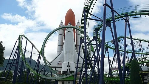 Space World Natural site, Yahata-higashi Ku21 km N
-
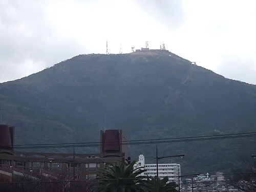 Mount Sarakura Mountain, Yahata-higashi Ku17 km N
-
Wakato Ōhashi Landmark, Fukuoka24 km N
-
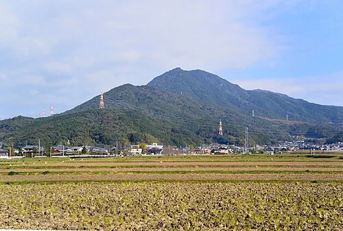 Mount Hōman Mountain, Dazaifu-shi25 km SW
Sources & licences
Data last updated: