- Elevation
- 177 m
- above sea level
- Local time
- UTC+09:00
- Asia/Tokyo · UTC+09:00
- Airports
- FKS Fukushima Airport64 km
- KIJ Niigata Airport78 km
About Shiokawamachi-tōta
Shiokawamachi-tōta is a village. Location: Kitakata-shi, Fukushima. Elevation: 177 m.
Shiokawa (塩川町, Shiokawa-machi) was a town located in Yama District, Fukushima Prefecture, Japan.
Source: Wikipedia · CC BY-SA 4.0
At a glance
- Built
- 1909
Source: Wikidata
Climate of Shiokawamachi-tōta
Best months for sightseeingBest months for sightseeing: May–June, September–October.
This month · November
Outside the best season
Day 13° · Night 3° · Rain 93 mm
Better nearby cities in November
- Kofu · 245 km southwest17°
- Isehara · 250 km south18°
- Odawara · 268 km south19°
- Hottest month
- August (day 30°)
- Coldest month
- January (night -4°)
- Wettest month
- July (159 mm)
- Driest month
- February (81 mm)
Bars: average monthly low and high temperature. Below: precipitation. Monthly averages for 1970–2000 at about 18 km resolution, adjusted for elevation. Highlighted months are mild and relatively dry. Source: WorldClim 2.1 (CC BY 4.0).
Show values as a table
| Month | Jan | Feb | Mar | Apr | May | Jun | Jul | Aug | Sep | Oct | Nov | Dec |
|---|---|---|---|---|---|---|---|---|---|---|---|---|
| Average high (°C) | 3° | 4° | 8° | 16° | 21° | 24° | 28° | 30° | 25° | 19° | 13° | 6° |
| Average low (°C) | -4° | -4° | -1° | 5° | 10° | 16° | 19° | 21° | 16° | 9° | 3° | -1° |
| Precipitation (mm) | 103 | 81 | 81 | 81 | 83 | 126 | 159 | 132 | 148 | 108 | 93 | 100 |
Other places to visit in this season: May June September October
How to get to Shiokawamachi-tōta
The nearest airport is Fukushima Airport (FKS), 64 km to the southeast as the crow flies. For international flights: Niigata Airport (KIJ) (78 km). The nearest large city is Aizu-Wakamatsu, 13 km to the southeast.
Airports
- Fukushima Airport (FKS) Sukagawa 64 kmsoutheast
- Niigata Airport (KIJ) Niigata 78 kmnorthwest
- Yamagata Airport (GAJ) Higashine 100 kmnortheast
Nearby large cities
- Aizu-Wakamatsu Population: 118.2K 13 kmsoutheast
- Kōriyama Population: 327.7K 50 kmsoutheast
- Fukushima Population: 294.2K 55 kmeast
- Yamagata Population: 248.8K 83 kmnortheast
- Nagaoka Population: 266.9K 92 kmwest
Straight-line distances; road distances are longer. Airport data: OurAirports.
Day trips from Shiokawamachi-tōta
Within 100 km: 1 historic or cultural site, 21 natural sites, 6 lakes, rivers and coasts.
0–25 km7 places
- Lake Hibara Lake 19 kmNE
- Tadami River River 12 kmW
- Lake Inawashiro Lake 23 kmSE
- Tsuruga Castle Historic site 13 kmS
25–60 km7 places
- Echigo Sanmyaku Mountain 26 kmN
- Mount Azuma-kofuji Mountain 37 kmE
- Mount Adatara Mountain 36 kmE
- Iide San Mountain 32 kmNW
60–100 km14 places
- Asahi Dake Mountain 75 kmN
- Mount Zaō Mountain 78 kmNE
- Mount Zaō Mountain 77 kmNE
- Uono River River 97 kmW
Straight-line distances.
Nearby attractions & nature
Everything nearby-
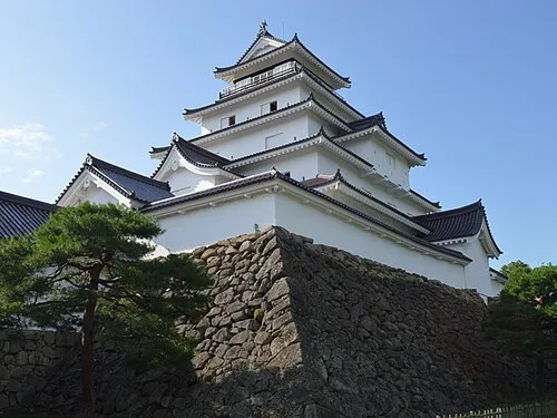 Tsuruga Castle Historic site, Aizu-wakamatsu Shi13 km S
-
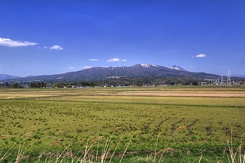 Nekomaga Dake Mountain, Bandai Machi13 km E
-
Iimori Yama Mountain, Kitakata-shi24 km N
-
 Tadami River River, Fukushima12 km W
-
 Lake Hibara Lake, Fukushima19 km NE
-
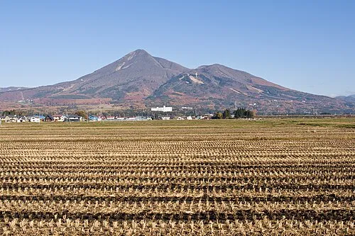 Mount Bandai Mountain, Bandai Machi17 km E
Sources & licences
Data last updated: · 2 independent sources