Sukagawa
Local name: 須賀川市
Located in Sukagawa Shi, Fukushima Coordinates: 37°17′00″ N 140°23′00″ E
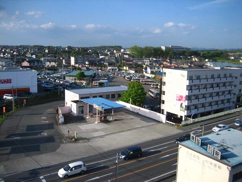
- Population
- 74,992
- 75K
- Elevation
- 261 m
- above sea level
- Local time
- UTC+09:00
- Asia/Tokyo · UTC+09:00
- Airports
- FKS Fukushima Airport8 km
- SDJ Sendai Airport106 km
About Sukagawa
Sukagawa is a city. Location: Sukagawa Shi, Fukushima. Population: 74,992. Elevation: 261 m.
Sukagawa (須賀川市, Sukagawa-shi) is a city located in Fukushima Prefecture, Japan. As of 1 May 2018, the city had an estimated population of 76,251 in 38824 households, and a population density of 270 persons per km2. The total area of the city was 279.43 square kilometres (107.9 sq mi).
Source: Wikipedia · CC BY-SA 4.0
Photos of Sukagawa
-

Fumihiko Ueno · CC BY 3.0 -

Miyuki Meinaka · CC BY-SA 4.0 -

Ebiebi2 · CC BY-SA 4.0 -

妖精書士 · CC0 -

Altomarina · CC BY-SA 3.0


Travel notes for Sukagawa
From Wikivoyage
Sukagawa (須賀川) is a city in Fukushima Prefecture.
Understand+
Tourist information sites:
The local tourist association has a Japanese-only guide site with integrated Google Translate.
The city government's official site has a Japanese-only tourism section.
Get in+
By train:
Sukagawa is situated on the Tohoku Main Line, with regular trains running to Tokyo (via Shirakawa) in the south and Sendai (via Koriyama) in the north. The fastest way to get to and from Tokyo is by catching a Shinkansen (bullet train) to Koriyama and then changhing to a local train for the trip to Sukagawa.
By plane:
Sukagawa is home to the only airport in Fukushima prefecture.
1 Fukushima Airport (FKS IATA). Daily flights provide links to Osaka, Sapporo and Okinawa. Less regular international flights are also available to Seoul and Shanghai.
Source: Wikivoyage · CC BY-SA 4.0 · abridged
Places bordering Sukagawa
- Kōriyama
- Ten’ei Mura
- Kagamiishi Machi
- Tamakawa Mura
- Hirata Mura
Twin towns and sister cities of Sukagawa
- Naganuma· Japan
- Toyonaka· Japan
- Zama· Japan
Source: Wikidata. Only places with a page on this site are shown.
Population of Sukagawa over time
| 2010 | 79,267 | |
|---|---|---|
| 2015 | 77,441 | |
| 2021 | 74,778 |
Censuses and official estimates; source: Wikidata.
Climate of Sukagawa
Best months for sightseeingBest months for sightseeing: May–July, September.
This month · November
Outside the best season
Day 13° · Night 3° · Rain 62 mm
Better nearby cities in November
- Isehara · 230 km southwest18°
- Kofu · 242 km southwest17°
- Odawara · 251 km southwest19°
- Hottest month
- August (day 28°)
- Coldest month
- January (night -4°)
- Wettest month
- September (176 mm)
- Driest month
- January (36 mm)
Bars: average monthly low and high temperature. Below: precipitation. Monthly averages for 1970–2000 at about 18 km resolution, adjusted for elevation. Highlighted months are mild and relatively dry. Source: WorldClim 2.1 (CC BY 4.0).
Show values as a table
| Month | Jan | Feb | Mar | Apr | May | Jun | Jul | Aug | Sep | Oct | Nov | Dec |
|---|---|---|---|---|---|---|---|---|---|---|---|---|
| Average high (°C) | 5° | 5° | 9° | 15° | 20° | 23° | 26° | 28° | 24° | 18° | 13° | 8° |
| Average low (°C) | -4° | -3° | -1° | 5° | 10° | 15° | 18° | 20° | 16° | 9° | 3° | -1° |
| Precipitation (mm) | 36 | 45 | 70 | 97 | 106 | 148 | 152 | 166 | 176 | 128 | 62 | 44 |
Other places to visit in this season: May June July September
How to get to Sukagawa
The nearest airport is Fukushima Airport (FKS), 8 km to the southeast as the crow flies. For international flights: Sendai Airport (SDJ) (106 km). The nearest large city is Kōriyama, 13 km to the north.
Airports
- Fukushima Airport (FKS) Sukagawa 8 kmsoutheast
- Sendai Airport (SDJ) Natori 106 kmnortheast
- Ibaraki Airport (IBR) Omitama 122 kmsouth
Nearby large cities
- Kōriyama Population: 327.7K 13 kmnorth
- Aizu-Wakamatsu Population: 118.2K 45 kmnorthwest
- Iwaki Population: 357.3K 51 kmsoutheast
- Fukushima Population: 294.2K 52 kmnorth
- Hitachi Population: 174.5K 79 kmsouth
Straight-line distances; road distances are longer. Airport data: OurAirports.
Day trips from Sukagawa
Within 100 km: 1 historic or cultural site, 17 natural sites, 5 lakes, rivers and coasts.
25–60 km11 places
- Lake Hibara Lake 54 kmNW
- Mount Azuma-kofuji Mountain 50 kmN
- Mount Adatara Mountain 38 kmN
- Mount Nasu Mountain 43 kmSW
60–100 km12 places
- Abukuma River River 97 kmNE
- Echigo Sanmyaku Mountain 78 kmNW
- Mount Zaō Mountain 95 kmN
- Mount Zaō Mountain 94 kmN
Straight-line distances.
Sukagawa and similar cities
Side by side with cities of similar size in the same country: population, elevation and climate.
| Measure | Sukagawa | Katano | Okegawa | Kai |
|---|---|---|---|---|
| Population | 75K | 75K | 75.1K | 75.3K |
| Elevation | 261 m | 31 m | 22 m | 340 m |
| Summer day (hottest month) | 28° | 32° | 30° | 31° |
| Winter night (coldest month) | -4° | 1° | -1° | -3° |
| Annual rainfall | 1,230 mm | 1,472 mm | 1,376 mm | 1,401 mm |
| Best months | May–Jul, Sep | May, Oct | May–Jun, Oct | Apr–Jun, Oct |
| Distance | — | 505 km | 160 km | 244 km |
Climate values are 1970–2000 monthly averages; straight-line distance.
Sources & licences
Data last updated: · 2 independent sources