- Population
- 18,223
- 18.2K
- Elevation
- 362 m
- above sea level
- Local time
- UTC+09:00
- Asia/Tokyo · UTC+09:00
- Places inside
- 1
- listed under Miharu Machi
- Airports
- FKS Fukushima Airport24 km
- SDJ Sendai Airport86 km
About Miharu Machi
Miharu Machi is a municipality. Location: Tamura-gun, Fukushima. Population: 18,223. Elevation: 362 m.
Miharu (三春町, Miharu-machi) is a town located in Fukushima Prefecture, Japan. As of 1 March 2020, the town had an estimated population of 17,471 in 6348 households, and a population density of 240 persons per km2. The total area of the town was 72.76 square kilometres (28.09 sq mi).
Source: Wikipedia · CC BY-SA 4.0
Places bordering Miharu Machi
- Kōriyama
- Tamura
- Motomiya
- Nihommatsu
Twin towns and sister cities of Miharu Machi
- Ichinoseki· Japan
Source: Wikidata. Only places with a page on this site are shown.
Population of Miharu Machi over time
| 2010 | 18,191 | |
|---|---|---|
| 2015 | 18,304 | |
| 2021 | 17,319 |
Censuses and official estimates; source: Wikidata.
Climate of Miharu Machi
Best months for sightseeingBest months for sightseeing: May–July, September.
This month · November
Outside the best season
Day 12° · Night 3° · Rain 61 mm
Better nearby cities in November
- Isehara · 251 km southwest18°
- Kofu · 262 km southwest17°
- Odawara · 271 km southwest19°
- Hottest month
- August (day 28°)
- Coldest month
- January (night -4°)
- Wettest month
- September (166 mm)
- Driest month
- January (41 mm)
Bars: average monthly low and high temperature. Below: precipitation. Monthly averages for 1970–2000 at about 18 km resolution, adjusted for elevation. Highlighted months are mild and relatively dry. Source: WorldClim 2.1 (CC BY 4.0).
Show values as a table
| Month | Jan | Feb | Mar | Apr | May | Jun | Jul | Aug | Sep | Oct | Nov | Dec |
|---|---|---|---|---|---|---|---|---|---|---|---|---|
| Average high (°C) | 4° | 4° | 8° | 15° | 20° | 22° | 26° | 28° | 23° | 18° | 12° | 7° |
| Average low (°C) | -4° | -4° | -2° | 4° | 9° | 14° | 18° | 19° | 15° | 9° | 3° | -2° |
| Precipitation (mm) | 41 | 46 | 67 | 89 | 96 | 136 | 151 | 153 | 166 | 122 | 61 | 50 |
Other places to visit in this season: May June July September
How to get to Miharu Machi
The nearest airport is Fukushima Airport (FKS), 24 km to the south as the crow flies. For international flights: Sendai Airport (SDJ) (86 km). The nearest large city is Kōriyama, 11 km to the southwest.
Airports
- Fukushima Airport (FKS) Sukagawa 24 kmsouth
- Sendai Airport (SDJ) Natori 86 kmnortheast
- Yamagata Airport (GAJ) Higashine 108 kmnorth
Nearby large cities
- Kōriyama Population: 327.7K 11 kmsouthwest
- Fukushima Population: 294.2K 34 kmnorth
- Aizu-Wakamatsu Population: 118.2K 49 kmwest
- Iwaki Population: 357.3K 55 kmsoutheast
- Yamagata Population: 248.8K 89 kmnorth
Straight-line distances; road distances are longer. Airport data: OurAirports.
Day trips from Miharu Machi
Within 100 km: 1 historic or cultural site, 13 natural sites, 5 lakes, rivers and coasts.
25–60 km9 places
- Lake Hibara Lake 48 kmNW
- Mount Azuma-kofuji Mountain 37 kmNW
- Mount Adatara Mountain 27 kmNW
- Chausu Dake Mountain 59 kmSW
60–100 km10 places
- Abukuma River River 77 kmNE
- Echigo Sanmyaku Mountain 73 kmNW
- Mount Zaō Mountain 78 kmN
- Mount Zaō Mountain 77 kmN
Straight-line distances.
Places in Miharu Machi
1 place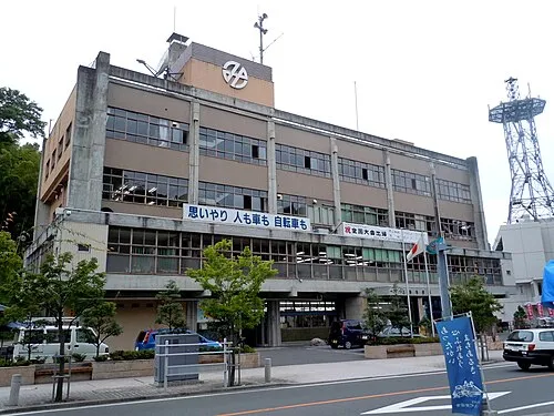
Miharu
Population: 17.5K
Sources & licences
Data last updated: · 2 independent sources