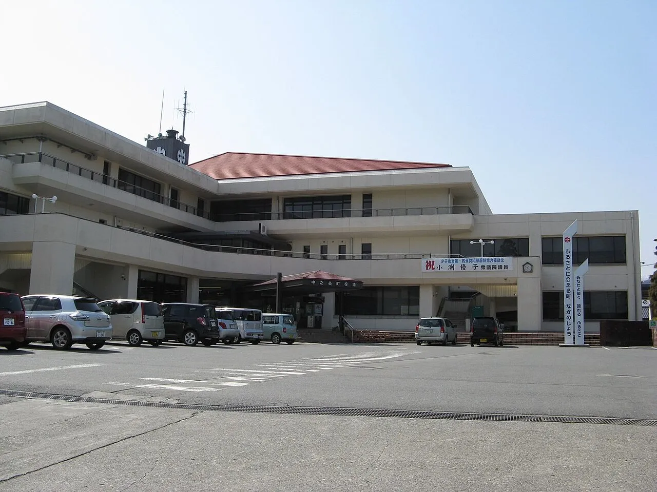
- Population
- 15,571
- 15.6K
- Elevation
- 371 m
- above sea level
- Local time
- UTC+09:00
- Asia/Tokyo · UTC+09:00
- Airports
- MMJ Shinshu-Matsumoto Airport95 km
- HND Tokyo Haneda International Airport143 km
About Nakanojō
Nakanojō is a town. Location: Nakanojō Machi, Agatsuma-gun. Population: 15,571. Elevation: 371 m.
Nakanojō (中之条町, Nakanojō-machi) is a town located in Gunma Prefecture, Japan. As of 1 August 2020, the town had an estimated population of 15,571 in 6,737 households, and a population density of 35 persons per km2. The total area of the town is 439.28 square kilometres (169.61 sq mi).
Source: Wikipedia · CC BY-SA 4.0
Photos of Nakanojō
-

Qurren · CC BY-SA 3.0 -

Qurren · CC BY-SA 3.0 -

Qurren · CC BY-SA 3.0


Travel notes for Nakanojō
From Wikivoyage
Nakanojō (中之条) is a town of 15,500 people (2020) in Gunma. Nakanojō is surrounded by high peaks of over 1000 m in height, with the Agatsuma River passing through the center of town from west to east. The town's area is 83% mountains and forests (197 km²).
Understand+
Nakanojō is most famous for its biannual art exhibition, which is put up throughout the town.
The economy of Nakanojō is heavily dependent on seasonal tourism primarily in connection with its onsen hot spring resorts.
Nakanojo Town is a member of Japan's Most Beautiful Villages Association, which is rich in nature.
The local tourist association has a multilingual guide site.
Get in+
Nakanojō is easily accessible by train from Takasaki station on the East Japan Railway Agatsuma Line.
You can reach it via Japan National Highways 145, 292, 353, and 405.
By bus:
Several companies serve the town:
Kanetsu Kotsu
Nakanojo Municipal Bus (Naganohara Kusatsuguchi Station - Hanashiki Onsen - Nozori Lake)
Takayama Bus (Haramachi Beisia- Nakanojo Station -Nakayama Motojuku)
Highway Bus Joshu Yumeguri (Shinjuku Station-Nakanojo Station Entrance/Kusatsu Onsen) (JR Bus Kanto operates)
Highway Bus Shima Onsen (Shinonome Shako/Tokyo Station Yaesu Exit-Shima Onsen) (operated by Kanetsu Kotsu)
Source: Wikivoyage · CC BY-SA 4.0 · abridged
Places bordering Nakanojō
- Shibukawa
- Minakami Machi
- Kusatsu Machi
- Takayama Mura
- Naganohara Machi
- Higashiagatsuma Machi
- Yuzawa
- Yamanouchi Machi
- Takayama Mura
- Sakae Mura
Population of Nakanojō over time
| 2010 | 18,216 | |
|---|---|---|
| 2015 | 16,850 | |
| 2021 | 15,186 |
Censuses and official estimates; source: Wikidata.
Climate of Nakanojō
Best months for sightseeingBest months for sightseeing: May–June, September–October.
This month · November
Outside the best season
Day 14° · Night 4° · Rain 72 mm
Better nearby cities in November
- Kofu · 105 km south17°
- Isehara · 139 km south18°
- Odawara · 151 km south19°
- Hottest month
- August (day 29°)
- Coldest month
- January (night -4°)
- Wettest month
- September (194 mm)
- Driest month
- December (67 mm)
Bars: average monthly low and high temperature. Below: precipitation. Monthly averages for 1970–2000 at about 18 km resolution, adjusted for elevation. Highlighted months are mild and relatively dry. Source: WorldClim 2.1 (CC BY 4.0).
Show values as a table
| Month | Jan | Feb | Mar | Apr | May | Jun | Jul | Aug | Sep | Oct | Nov | Dec |
|---|---|---|---|---|---|---|---|---|---|---|---|---|
| Average high (°C) | 6° | 6° | 9° | 16° | 21° | 24° | 28° | 29° | 24° | 19° | 14° | 9° |
| Average low (°C) | -4° | -3° | -1° | 5° | 10° | 15° | 19° | 20° | 16° | 10° | 4° | -1° |
| Precipitation (mm) | 87 | 87 | 81 | 91 | 106 | 166 | 186 | 186 | 194 | 125 | 72 | 67 |
Other places to visit in this season: May June September October
How to get to Nakanojō
The nearest airport is Shinshu-Matsumoto Airport (MMJ), 95 km to the southwest as the crow flies. For international flights: Tokyo Haneda International Airport (HND) (143 km). The nearest large city is Maebashi, 30 km to the southeast.
Airports
- Shinshu-Matsumoto Airport (MMJ) Matsumoto 95 kmsouthwest
- Tokyo Haneda International Airport (HND) Tokyo 143 kmsoutheast
- Toyama Kitokito Airport (TOY) Toyama 148 kmwest
Nearby large cities
- Maebashi Population: 332.1K 30 kmsoutheast
- Takasaki Population: 373K 32 kmsoutheast
- Isesaki Population: 211.8K 44 kmsoutheast
- Kiryū Population: 109K 49 kmsoutheast
- Ueda Population: 157.5K 54 kmwest
Straight-line distances; road distances are longer. Airport data: OurAirports.
Day trips from Nakanojō
Within 100 km: 3 historic and cultural sites, 45 natural sites, 15 lakes, rivers and coasts.
0–25 km4 places
- Lake Haruna Lake 13 kmS
- Mount Haruna Mountain 14 kmS
- Agatsuma River River 18 kmSE
- Takama Yama Mountain 14 kmW
25–60 km14 places
- Umeda Ko Lake 53 kmE
- Tanigawa Dake Mountain 29 kmN
- Lake Chūzenji Lake 58 kmE
- Mount Nikkō-Shirane Mountain 53 kmNE
60–100 km45 places
- Honshu Island 100 kmSW
- Mount Bukō Mountain 74 kmS
- Iruma River River 98 kmSE
- Arakawa River River 85 kmNW
Straight-line distances.
Nearby attractions & nature
Everything nearby-
 Lake Haruna Lake, Gunma13 km S
-
Takama Yama Mountain, Naganohara Machi14 km W
-
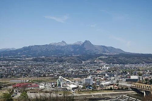 Mount Haruna Mountain, Gunma14 km S
-
 Agatsuma River River, Gunma18 km SE
Sources & licences
Data last updated: · 2 independent sources