- Population
- 372,973
- 373K
- Elevation
- 93 m
- above sea level
- Local time
- UTC+09:00
- Asia/Tokyo · UTC+09:00
- Airports
- MMJ Shinshu-Matsumoto Airport100 km
- HND Tokyo Haneda International Airport111 km
About Takasaki
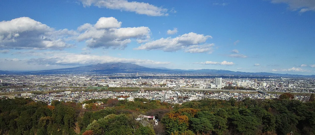
Takasaki is a city. Location: Takasaki Shi, Gunma. Population: 372,973. Elevation: 93 m.
Takasaki (高崎市, Takasaki-shi; [takasakiɕi]) is a city located in Gunma Prefecture, Japan. As of 31 August 2020, the city had an estimated population of 372,369 in 167,345 households, and a population density of 810 persons per km2. The total area of the city is 459.16 square kilometres (177.28 sq mi). Takasaki is famous as the hometown of the Daruma doll, theoretically representing the Buddhist sage Bodhidharma and in modern practice a symbol of good luck.
Source: Wikipedia · CC BY-SA 4.0
Photos of Takasaki
-

G.S.optics · CC0 -

スーパーソー? · CC0 -

スーパーソー? · CC0 -

Neo776tk2 · Public domain -

yeowatzup · CC BY 2.0


Travel notes for Takasaki
From Wikivoyage
Takasaki (高崎) is a city in Gunma prefecture in Honshu, Japan.
Understand+
Takasaki, about 100km north of Tokyo, is famous as the hometown of the Daruma doll. It is also the hometown of former Japanese Prime Minister Yasuhiro Nakasone.
Tourist information site:
The local tourist association has a bilingual guide site.
Get in+
By plane:
From Narita Airport (NRT IATA), Takasaki is served by Azalea Limousine Buses operated by Chiba Kotsu; buses leave once every 1 1/2-2 hours (3 hours to/from Takasaki Station, ¥4500). By train, the easiest (and most expensive) way to reach Maebashi is to take the Narita Express to Tokyo Station, then the Joetsu Shinkansen to Takasaki (Approx. 2 1/4 hours, ¥7800, no charge with the Japan Rail Pass or JR East Pass). Reservations for the Narita Express and Shinkansen can all be made from Narita Airport.
From Haneda Airport (HND IATA), Limousine buses operate to/from Takasaki Station (3 hours, ¥3500). Going by train is much faster, but more expensive and requires more transfers: The Keikyu Line to Shinagawa, the Yamanote Line to Tokyo, and the Shinkansen to Takasaki (Approx. 1 3/4 hours, ¥5200; cheaper with unreserved shinkansen seat). You can purchase tickets for the JR portion of the journey upon reaching Shinagawa.
By train:
1 Takasaki Station, 222 Yashimachō. Takasaki is a stop on the Joetsu Shinkansen and Nagano Shinkansen lines, and is a hub for the JR Takasaki, Hachiko, Ryomo, Joetsu and Shin-etsu lines. Frequent Shinkansen services depart Tokyo station for Takasaki every 15-30 minutes, with more frequent departures for the evening rush. You can reach Takasaki in about one hour, at a cost of ¥4800. Regular trains on the Takasaki Line depart from Ueno station 2-3 times per hour, reaching Takasaki in about 2 hours at a cost of ¥1890. There are also hourly departures for Takasaki on the Shonan-Shinjuku Line which runs via Shinjuku station (1 3/4 - 2 hours, ¥1890 from Shinjuku). (updated Jun 2023)
By bus:
Nippon Chuo Bus operates several daytime bus services from the Tokyo area to Takasaki. All buses stop at the Hilton Tokyo in Shinjuku, with some buses also stopping in Ikebukuro and Akihabara (2 1/4 hours to/from Shinjuku, ¥1500).
Source: Wikivoyage · CC BY-SA 4.0 · abridged
Places bordering Takasaki
- Maebashi Shi
- Fujioka
- Annaka
- Shibukawa
- Tomioka
- Shintō Mura
- Tamamura Machi
- Higashiagatsuma Machi
- Naganohara Machi
- Kanra-machi
- Kamisato-machi
- Karuizawa Machi
Population of Takasaki over time
| 2010 | 371,302 | |
|---|---|---|
| 2015 | 370,884 | |
| 2021 | 372,639 |
Censuses and official estimates; source: Wikidata.
Climate of Takasaki
Best months for sightseeingBest months for sightseeing: May, October.
This month · November
Outside the best season
Day 16° · Night 5° · Rain 67 mm
Better nearby cities in November
- Kofu · 84 km southwest17°
- Isehara · 107 km south18°
- Odawara · 121 km south19°
- Hottest month
- August (day 31°)
- Coldest month
- January (night -3°)
- Wettest month
- September (185 mm)
- Driest month
- December (46 mm)
Bars: average monthly low and high temperature. Below: precipitation. Monthly averages for 1970–2000 at about 18 km resolution, adjusted for elevation. Highlighted months are mild and relatively dry. Source: WorldClim 2.1 (CC BY 4.0).
Show values as a table
| Month | Jan | Feb | Mar | Apr | May | Jun | Jul | Aug | Sep | Oct | Nov | Dec |
|---|---|---|---|---|---|---|---|---|---|---|---|---|
| Average high (°C) | 9° | 10° | 13° | 19° | 23° | 26° | 29° | 31° | 26° | 21° | 16° | 12° |
| Average low (°C) | -3° | -2° | 1° | 7° | 12° | 17° | 21° | 22° | 18° | 12° | 5° | 0° |
| Precipitation (mm) | 51 | 60 | 70 | 84 | 100 | 155 | 150 | 168 | 185 | 125 | 67 | 46 |
How to get to Takasaki
The nearest airport is Shinshu-Matsumoto Airport (MMJ), 100 km to the west as the crow flies. For international flights: Tokyo Haneda International Airport (HND) (111 km). The nearest large city is Maebashi, 10 km to the northeast.
Airports
- Shinshu-Matsumoto Airport (MMJ) Matsumoto 100 kmwest
- Tokyo Haneda International Airport (HND) Tokyo 111 kmsoutheast
- Ibaraki Airport (IBR) Omitama 127 kmeast
Nearby large cities
- Maebashi Population: 332.1K 10 kmnortheast
- Isesaki Population: 211.8K 17 kmeast
- Fukayachō Population: 141.3K 28 kmsoutheast
- Kiryū Population: 109K 29 kmeast
- Ōta Population: 224.4K 32 kmeast
Straight-line distances; road distances are longer. Airport data: OurAirports.
Day trips from Takasaki
Within 100 km: 30 historic and cultural sites, 51 natural sites, 19 lakes, rivers and coasts.
0–25 km5 places
- Lake Haruna Lake 21 kmNW
- Mount Haruna Mountain 20 kmNW
- Agatsuma River River 19 kmN
- Mount Myōgi Mountain 25 kmW
25–60 km14 places
- Umeda Ko Lake 39 kmNE
- Mount Bukō Mountain 43 kmS
- Azumaya San Mountain 59 kmNW
- Tanigawa Dake Mountain 56 kmN
60–100 km81 places
- Honshu Island 99 kmW
- Mount Nokogiri Mountain 95 kmSW
- Saitama Super Arena Landmark 74 kmSE
- Iruma River River 67 kmSE
Straight-line distances.
Takasaki and similar cities
Side by side with cities of similar size in the same country: population, elevation and climate.
| Measure | Takasaki | Nagano | Minato | Toyohashi |
|---|---|---|---|---|
| Population | 373K | 372.8K | 375.3K | 377.5K |
| Elevation | 93 m | 372 m | 5 m | 12 m |
| Summer day (hottest month) | 31° | 31° | 31° | 30° |
| Winter night (coldest month) | -3° | -4° | 2° | 1° |
| Annual rainfall | 1,261 mm | 1,181 mm | 1,391 mm | 1,939 mm |
| Best months | May, Oct | May | May–Jun, Oct | May–Jun, Oct |
| Distance | — | 83 km | 423 km | 228 km |
Climate values are 1970–2000 monthly averages; straight-line distance.
Nearby attractions & nature
Everything nearby-
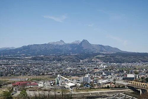 Mount Haruna Mountain, Gunma20 km NW
-
 Lake Haruna Lake, Gunma21 km NW
-
Karasu River River, Japan15 km SE
-
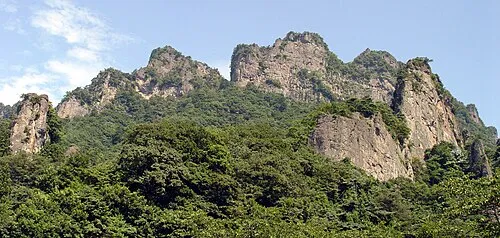 Mount Myōgi Mountain, Gunma25 km W
-
Agatsuma River River, Gunma19 km N
Sources & licences
Data last updated: · 2 independent sources