- Population
- 47,911
- 47.9K
- Elevation
- 158 m
- above sea level
- Local time
- UTC+09:00
- Asia/Tokyo · UTC+09:00
- Airports
- MMJ Shinshu-Matsumoto Airport88 km
- HND Tokyo Haneda International Airport112 km
About Tomioka
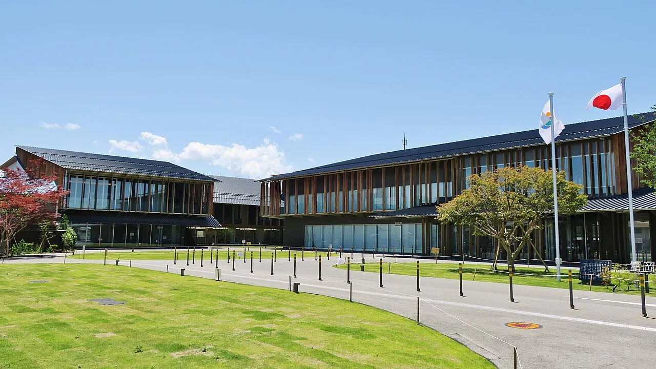
Tomioka is a city. Location: Tomioka-shi, Gunma. Population: 47,911. Elevation: 158 m.
Tomioka (富岡市, Tomioka-shi) is a city located in Gunma Prefecture, Japan. As of 1 September 2020, the city had an estimated population of 57,013 in 20,367 households, and a population density of 390 persons per km2. The total area of the city is 122.85 square kilometres (47.43 sq mi). It is the location of the Tomioka Silk Mill, a UNESCO World Heritage Site.
Source: Wikipedia · CC BY-SA 4.0
Photos of Tomioka
-

Masahiro TAKAGI · CC BY 2.0 -

Saigen Jiro · CC0 -

Qurren · CC BY-SA 3.0 -
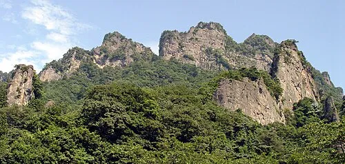
Mount Myōgi Jesse Fuller · CC BY-SA 3.0


Travel notes for Tomioka
From Wikivoyage
Tomioka (富岡) is a city in southwestern Gunma Prefecture, Japan.
Understand+
Tourist information site:
The local tourist association has a Japanese-only guide site with machine translation.
Get in+
By train:
Tomioka is served by the non-JR Jōshin Line, which runs from the nearby railway hub at Takasaki. The line has 8 stations in the city, but the main one is Jōshū-Tomioka. There are usually one or two trains an hour from Takasaki to Jōshū-Tomioka, taking 40 minutes and ¥790.
Jōshin Railway sells a combination ticket, which covers a return journey between Takasaki and Jōshū-Tomioka and admission to the Silk Mill, for ¥2140 (a saving of ¥440). They also sell a one-day free ticket (which allows unlimited travel on the line) for ¥2220.
The Jōshin Line is not covered by the Japan Rail Pass or the JR East Passes, but it is covered by the JR TOKYO Wide Pass, which is available to holders of non-Japanese passports. Note also that the Jōshin Line does not accept IC Cards (Suica, Pasmo, Icoca etc.)
By bus:
Tomioka Interchange on the Jōshin-etsu Expressway (about 2.5km south of the Silk Mill) is served by a fairly frequent direct bus service towards Tokyo:
Seibu Bus and Chikuma Bus run 16 buses a day from Ikebukuro Station East Exit, Shimo-Ochiai Station, Nerima Ward Office, and Kawagoe-Matoba Bus Stop, taking 2 hours 5 minutes (and continuing on to Karuizawa, Komoro or Ueda). Two buses a day start back from Shinjuku.
Chikuma Bus also runs 2 buses a day from Tachikawa Station North Exit and Tamagawa-Jōsui Station, taking 2 hours 10 minutes (and continuing on to Komoro or Ueda).
All of these buses cost ¥2100. You can buy two tickets for ¥3700, or 4 tickets for ¥7200.
Nippon Chūō Bus runs an overnight service named "Silk Liner" from Osaka Namba (OCAT) and Kyoto Station Hachijō Exit to Nippon Chūō Taxi Tomioka Eigyōsho (on the main road 350m south of Nishi-Tomioka Station and 500m northwest of the Silk Mill), taking 8 hours 15 minutes and ¥9200 (¥16,560 return, valid for 10 days). Note that this bus leaves Tomioka for Kansai after 11:45pm, and arrives at Tomioka before 4:45am.
Source: Wikivoyage · CC BY-SA 4.0 · abridged
Places bordering Tomioka
- Takasaki
- Annaka
- Kanra-machi
Twin towns and sister cities of Tomioka
- Okaya· Japan
- Fukayachō· Japan
- Yokosuka· Japan
- Kōnan· Japan
Source: Wikidata. Only places with a page on this site are shown.
Population of Tomioka over time
| 2010 | 52,070 | |
|---|---|---|
| 2014 | 51,056 | |
| 2015 | 49,746 | |
| 2021 | 46,928 |
Censuses and official estimates; source: Wikidata.
Climate of Tomioka
Best months for sightseeingBest months for sightseeing: May, October.
This month · November
Outside the best season
Day 16° · Night 5° · Rain 63 mm
Better nearby cities in November
- Kofu · 72 km southwest17°
- Isehara · 102 km south18°
- Odawara · 114 km south19°
- Hottest month
- August (day 31°)
- Coldest month
- January (night -3°)
- Wettest month
- September (182 mm)
- Driest month
- December (43 mm)
Bars: average monthly low and high temperature. Below: precipitation. Monthly averages for 1970–2000 at about 18 km resolution, adjusted for elevation. Highlighted months are mild and relatively dry. Source: WorldClim 2.1 (CC BY 4.0).
Show values as a table
| Month | Jan | Feb | Mar | Apr | May | Jun | Jul | Aug | Sep | Oct | Nov | Dec |
|---|---|---|---|---|---|---|---|---|---|---|---|---|
| Average high (°C) | 9° | 9° | 12° | 18° | 23° | 25° | 29° | 31° | 26° | 20° | 16° | 11° |
| Average low (°C) | -3° | -2° | 1° | 7° | 12° | 17° | 20° | 21° | 18° | 11° | 5° | -1° |
| Precipitation (mm) | 51 | 60 | 70 | 81 | 97 | 154 | 151 | 166 | 182 | 120 | 63 | 43 |
How to get to Tomioka
The nearest airport is Shinshu-Matsumoto Airport (MMJ), 88 km to the west as the crow flies. For international flights: Tokyo Haneda International Airport (HND) (112 km). The nearest large city is Takasaki, 14 km to the northeast.
Airports
- Shinshu-Matsumoto Airport (MMJ) Matsumoto 88 kmwest
- Tokyo Haneda International Airport (HND) Tokyo 112 kmsoutheast
- Ibaraki Airport (IBR) Omitama 137 kmeast
Nearby large cities
- Takasaki Population: 373K 14 kmnortheast
- Maebashi Population: 332.1K 23 kmnortheast
- Isesaki Population: 211.8K 28 kmeast
- Fukayachō Population: 141.3K 35 kmeast
- Kiryū Population: 109K 42 kmnortheast
Straight-line distances; road distances are longer. Airport data: OurAirports.
Day trips from Tomioka
Within 100 km: 23 historic and cultural sites, 56 natural sites, 20 lakes, rivers and coasts.
0–25 km4 places
- Mount Myōgi Mountain 14 kmW
- Karasu River River 25 kmE
- Lake Haruna Lake 25 kmN
- Mount Haruna Mountain 24 kmN
25–60 km23 places
- Umeda Ko Lake 52 kmNE
- Mount Bukō Mountain 38 kmSE
- Chichibu Tama Kai National Park Natural site 47 kmS
- Mount Ryōkami Mountain 26 kmS
60–100 km72 places
- Honshu Island 86 kmW
- Saitama Super Arena Landmark 77 kmSE
- Iruma River River 70 kmSE
- Lake Shoji Lake 89 kmS
Straight-line distances.
Nearby attractions & nature
Everything nearby-
Mount Myōgi Mountain, Gunma14 km W
-
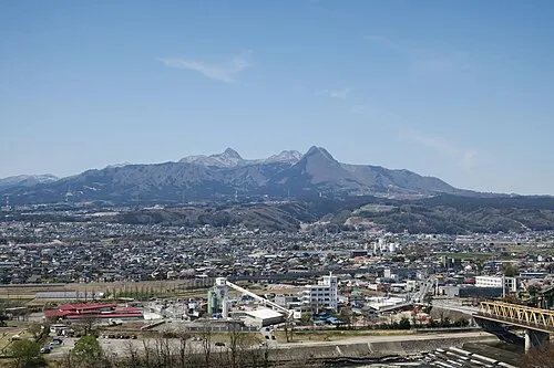 Mount Haruna Mountain, Gunma24 km N
-
 Lake Haruna Lake, Gunma25 km N
-
Karasu River River, Japan25 km E
Sources & licences
Data last updated: · 2 independent sources