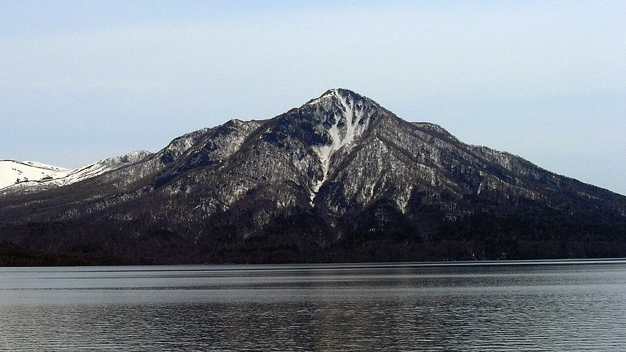
- Elevation
- 1,103 m
- above sea level
- Local time
- UTC+09:00
- Asia/Tokyo · UTC+09:00
- Airports
- CTS New Chitose Airport27 km
- OKD Sapporo Okadama Airport45 km
About Mount Fuppushi
Mount Fuppushi is a mountain. Location: Chitose Shi, Hokkaido. Elevation: 1,103 m.
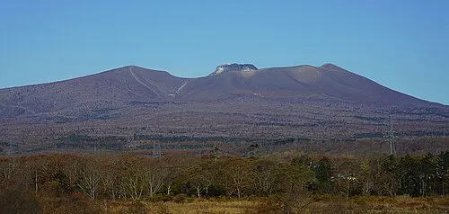
Mount Fuppushi (風不死岳, Fuppushi-dake) is a dormant volcano located in Shikotsu-Toya National Park in Hokkaido, Japan. It sits adjacent to Mount Tarumae and opposite Mount Eniwa. Mount Fuppushi is on the south shore of Lake Shikotsu, the caldera lake that spawned the volcanoes.
Source: Wikipedia · CC BY-SA 4.0
Photos of Mount Fuppushi
-

Planet Labs, Inc · CC BY-SA 4.0 -

Koda6029 · CC BY-SA 4.0 -

Koda6029 · CC BY-SA 4.0 -

663highland · CC BY 2.5 -

Katsumasa Miyazaki · CC BY-SA 3.0


Climate of Mount Fuppushi
This month · November
A wet month
Day 2° · Night -6° · Rain 109 mm
- Hottest month
- August (day 17°)
- Coldest month
- January (night -15°)
- Wettest month
- August (180 mm)
- Driest month
- February (66 mm)
Bars: average monthly low and high temperature. Below: precipitation. Monthly averages for 1970–2000 at about 18 km resolution, adjusted for elevation. Highlighted months are mild and relatively dry. Source: WorldClim 2.1 (CC BY 4.0).
Show values as a table
| Month | Jan | Feb | Mar | Apr | May | Jun | Jul | Aug | Sep | Oct | Nov | Dec |
|---|---|---|---|---|---|---|---|---|---|---|---|---|
| Average high (°C) | -7° | -7° | -4° | 2° | 8° | 12° | 16° | 17° | 14° | 9° | 2° | -4° |
| Average low (°C) | -15° | -15° | -11° | -5° | 0° | 4° | 9° | 11° | 6° | -1° | -6° | -12° |
| Precipitation (mm) | 80 | 66 | 69 | 80 | 92 | 91 | 132 | 180 | 161 | 118 | 109 | 89 |
How to get to Mount Fuppushi
The nearest airport is New Chitose Airport (CTS), 27 km to the east as the crow flies. The nearest large city is Tomakomai, 21 km to the southeast.
Airports
- New Chitose Airport (CTS) Sapporo 27 kmeast
- Sapporo Okadama Airport (OKD) Sapporo 45 kmnorth
- Hakodate Airport (HKD) Hakodate 114 kmsouthwest
Nearby large cities
- Tomakomai Population: 174.8K 21 kmsoutheast
- Sapporo Population: 2M 39 kmnorth
- Ebetsu Population: 134K 46 kmnorth
- Otaru Population: 115.3K 60 kmnorthwest
- Hakodate Population: 275.7K 117 kmsouthwest
Straight-line distances; road distances are longer. Airport data: OurAirports.
Day trips from Mount Fuppushi
Within 100 km: 2 historic and cultural sites, 16 natural sites, 13 lakes, rivers and coasts.
0–25 km4 places
- Mount Tarumae Mountain 4 kmS
- Mount Morappu Mountain 5 kmNE
- Mount Monbetsu Mountain 8 kmN
- Mount Eniwa Mountain 10 kmNW
25–60 km13 places
- Kuttara-ko Lake 28 kmSW
- Saru River River 58 kmSE
- Yūbari River River 48 kmN
- Toyohira River River 48 kmN
60–100 km14 places
- Tokoro River River 89 kmSW
- Niikappu River River 87 kmSE
- Nukabira Yama Mountain 94 kmE
- Ishikari River River 61 kmN
Straight-line distances.
Nearest towns and villages
Nearby attractions & nature
Everything nearby-
 Mount Tarumae Mountain, Tomakomai Shi3.9 km S
-
Mount Morappu Mountain, Chitose Shi4.6 km NE
-
Mount Monbetsu Mountain, Chitose Shi7.9 km N
-
 Mount Eniwa Mountain, Chitose Shi10 km NW
Sources & licences
Data last updated: · 2 independent sources