- Population
- 17,759
- 17.8K
- Elevation
- 5 m
- above sea level
- Local time
- UTC+09:00
- Asia/Tokyo · UTC+09:00
- Airports
- CTS New Chitose Airport37 km
- OKD Sapporo Okadama Airport63 km
About Shiraoi
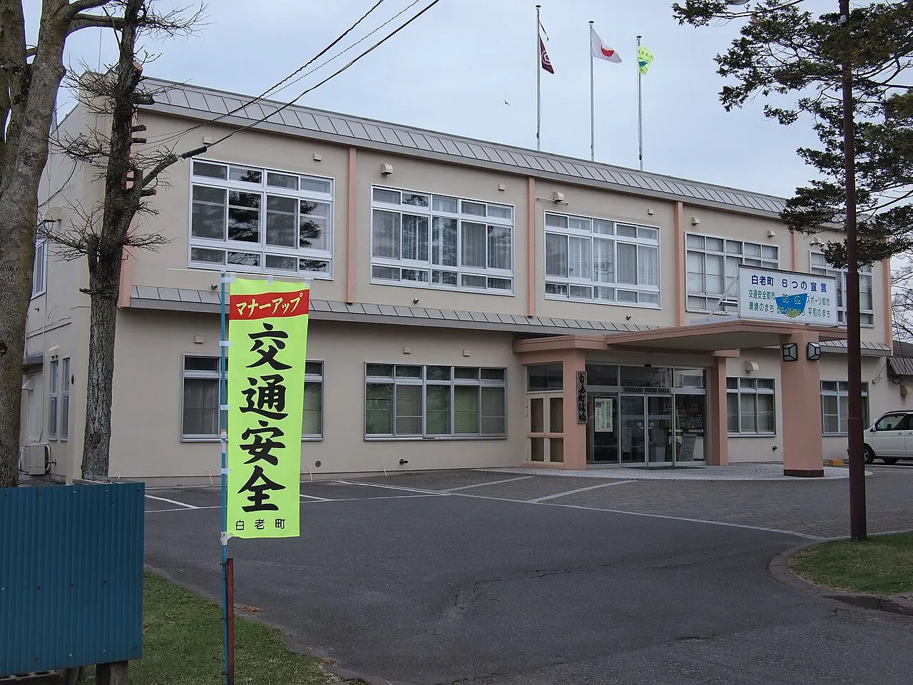
Shiraoi is a town. Location: Shiraoi Chō, Shiraoi-gun. Population: 17,759. Elevation: 5 m.
Shiraoi (Japanese: 白老町, Hepburn: Shiraoi-chō) is a town located in Iburi, Hokkaido, Japan. As of September 2016, the town had a population of 17,759. It was established in 1867 by the feudal lords of Sendai. Most of the area of the town is forested and parts lie within the Shikotsu-Tōya National Park.
Source: Wikipedia · CC BY-SA 4.0
Photos of Shiraoi
-

Ray Swi-hymn from Sijhih-Taipei, Taiwan · CC BY-SA 2.0 -

Ray Swi-hymn from Sijhih-Taipei, Taiwan · CC BY-SA 2.0 -

Ray Swi-hymn from Sijhih-Taipei, Taiwan · CC BY-SA 2.0


Travel notes for Shiraoi
From Wikivoyage
Shiraoi (白老) is a town in Iburi, Hokkaido. Shikotsu-Toya National Park on the west side of town.
Understand+
Tourist Information Site:
The local tourist association has a multilingual guide site.
Get in+
By plane:
Use the New Chitose Airport.
By train:
JR Muroran main line
By bus:
There is a bus service from Sapporo, New Chitose Airport, Tomakomai and Muroran.
By car:
Hokkaidō Expressway (Shiraoi I.C.) and National Route 36 runs the town.
Source: Wikivoyage · CC BY-SA 4.0 · abridged
Places bordering Shiraoi
- Chitose
- Tomakomai
- Noboribetsu
- Date
- Sōbetsu-machi
Twin towns and sister cities of Shiraoi
- Tsugaru· Japan
- Sendai· Japan
Source: Wikidata. Only places with a page on this site are shown.
Population of Shiraoi over time
| 2010 | 19,376 | |
|---|---|---|
| 2015 | 17,740 | |
| 2020 | 16,638 |
Censuses and official estimates; source: Wikidata.
Climate of Shiraoi
Best months for sightseeingBest months for sightseeing: June–September.
This month · November
A cold month
Day 9° · Night 0° · Rain 95 mm
- Hottest month
- August (day 24°)
- Coldest month
- January (night -9°)
- Wettest month
- August (185 mm)
- Driest month
- February (55 mm)
Bars: average monthly low and high temperature. Below: precipitation. Monthly averages for 1970–2000 at about 18 km resolution, adjusted for elevation. Highlighted months are mild and relatively dry. Source: WorldClim 2.1 (CC BY 4.0).
Show values as a table
| Month | Jan | Feb | Mar | Apr | May | Jun | Jul | Aug | Sep | Oct | Nov | Dec |
|---|---|---|---|---|---|---|---|---|---|---|---|---|
| Average high (°C) | 0° | 0° | 3° | 9° | 14° | 17° | 21° | 24° | 21° | 16° | 9° | 3° |
| Average low (°C) | -9° | -8° | -4° | 1° | 6° | 11° | 16° | 18° | 13° | 6° | 0° | -5° |
| Precipitation (mm) | 65 | 55 | 65 | 81 | 97 | 96 | 141 | 185 | 165 | 113 | 95 | 71 |
Other places to visit in this season: June July August September
How to get to Shiraoi
The nearest airport is New Chitose Airport (CTS), 37 km to the northeast as the crow flies. The nearest large city is Tomakomai, 23 km to the northeast.
Airports
- New Chitose Airport (CTS) Sapporo 37 kmnortheast
- Sapporo Okadama Airport (OKD) Sapporo 63 kmnorth
- Hakodate Airport (HKD) Hakodate 97 kmsouthwest
Nearby large cities
- Tomakomai Population: 174.8K 23 kmnortheast
- Sapporo Population: 2M 57 kmnorth
- Ebetsu Population: 134K 64 kmnorth
- Otaru Population: 115.3K 77 kmnorth
- Hakodate Population: 275.7K 100 kmsouthwest
Straight-line distances; road distances are longer. Airport data: OurAirports.
Day trips from Shiraoi
Within 100 km: 4 historic and cultural sites, 16 natural sites, 13 lakes, rivers and coasts.
0–25 km4 places
- Kuttara-ko Lake 15 kmW
- Mount Tarumae Mountain 15 kmN
- Mount Fuppushi Mountain 19 kmN
- Mount Morappu Mountain 23 kmN
25–60 km11 places
- Saru River River 55 kmE
- Mu River River 47 kmE
- Chitose River River 56 kmN
- Hokkaido University Botanical Gardens Attraction 57 kmN
60–100 km18 places
- Tokoro River River 72 kmSW
- Shiryōkaku Historic site 94 kmSW
- Hakodate Arena Landmark 97 kmSW
- Mount E Mountain 84 kmS
Straight-line distances.
Nearby attractions & nature
Everything nearby-
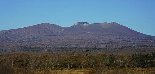 Mount Tarumae Mountain, Tomakomai Shi15 km N
-
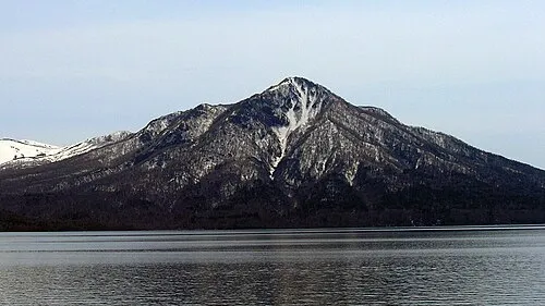 Mount Fuppushi Mountain, Chitose Shi19 km N
-
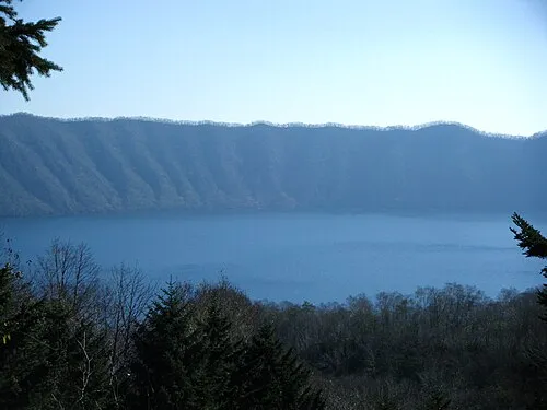 Kuttara-ko Lake, Hokkaido15 km W
-
Mount Morappu Mountain, Chitose Shi23 km N
Sources & licences
Data last updated: · 2 independent sources