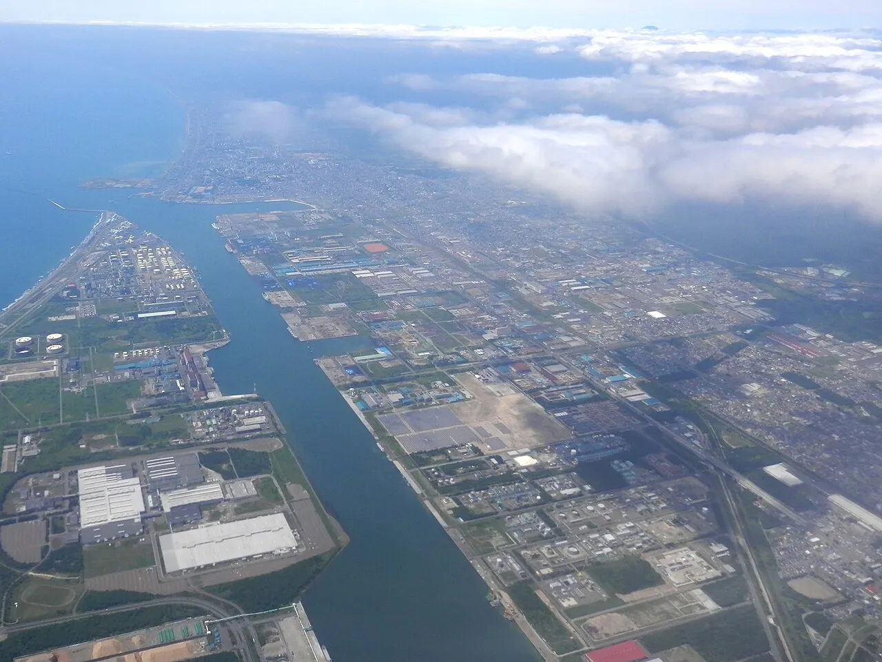
- Population
- 174,806
- 174.8K
- Elevation
- 7 m
- above sea level
- Local time
- UTC+09:00
- Asia/Tokyo · UTC+09:00
- Airports
- CTS New Chitose Airport17 km
- OKD Sapporo Okadama Airport56 km
About Tomakomai
Tomakomai is a city. Location: Tomakomai Shi, Hokkaido. Population: 174,806. Elevation: 7 m. The best months to visit are June–September. The nearest airport is New Chitose Airport (17 km). Nearby sights include Mount Tarumae and Mount Fuppushi.
Photos of Tomakomai
-

308 Bees · CC BY-SA 4.0 -

ノボホショコロトソ · CC BY 4.0 -

T DMY · CC BY 3.0 -
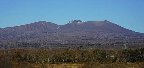
Mount Tarumae Ray Swi-hymn · CC BY-SA 2.0


Travel notes for Tomakomai
From Wikivoyage
Tomakomai (苫小牧) is a port city in Hokkaido, Japan.
Understand+
Tourist information site:
The local tourist association has a Japanese-only guide site.
Get in+
By train:
Tomakomai is the junction point for the JR Muroran, Hidaka and Chitose lines. The trip from Sapporo, via Chitose airport, takes about 45-60 min.
By boat:
Tomakomai is best known as a major port, with shipping services to points throughout Honshu. There are two separate terminals, both served by local buses from JR Tomakomai station (~20 min to either) and by long-distance buses direct from Sapporo (around 90 min).
1 Tomakomai-ko Ferry Terminal (苫小牧港フェリーターミナル).
Kawasaki Kinkai Kisen (川崎近海汽船) "Silver Ferry" to Hachinohe, 4x/day
Shosen Mitsui Ferry (商船三井フェリー) "Sunflower" to Oarai, 2x/day
Taiheiyo Ferry (太平洋フェリ) to Sendai (daily) and Nagoya (3-4x/week)
2 Tomakomai-ko East Ferry Terminal (苫小牧東港周文フェリーターミナル). This terminal is home for Shin-Nihonkai Ferry.
3 Shin-Nihonkai Ferry Tomakomai Terminal (新日本海フェリー 苫小牧東ターミナル), Hamaatsuma 17-6, Atsuma, ☏ +81 145 28-2800. This ferry has lines connecting daily to Tsuruga and Akita, and to Niigata 3 times a week.
Source: Wikivoyage · CC BY-SA 4.0 · abridged
Climate of Tomakomai
Best months for sightseeingBest months for sightseeing: June–September.
This month · November
A cold month
Day 9° · Night -1° · Rain 87 mm
- Hottest month
- August (day 24°)
- Coldest month
- January (night -10°)
- Wettest month
- August (184 mm)
- Driest month
- February (46 mm)
Bars: average monthly low and high temperature. Below: precipitation. Monthly averages for 1970–2000 at about 18 km resolution, adjusted for elevation. Highlighted months are mild and relatively dry. Source: WorldClim 2.1 (CC BY 4.0).
Show values as a table
| Month | Jan | Feb | Mar | Apr | May | Jun | Jul | Aug | Sep | Oct | Nov | Dec |
|---|---|---|---|---|---|---|---|---|---|---|---|---|
| Average high (°C) | -1° | 0° | 3° | 9° | 14° | 17° | 21° | 24° | 21° | 16° | 9° | 3° |
| Average low (°C) | -10° | -9° | -5° | 1° | 6° | 11° | 16° | 18° | 13° | 6° | -1° | -6° |
| Precipitation (mm) | 53 | 46 | 58 | 80 | 99 | 97 | 143 | 184 | 161 | 108 | 87 | 61 |
Other places to visit in this season: June July August September
How to get to Tomakomai
The nearest airport is New Chitose Airport (CTS), 17 km to the northeast as the crow flies. The nearest large city is Sapporo, 52 km to the northwest.
Airports
- New Chitose Airport (CTS) Sapporo 17 kmnortheast
- Sapporo Okadama Airport (OKD) Sapporo 56 kmnorth
- Hakodate Airport (HKD) Hakodate 116 kmsouthwest
Nearby large cities
- Sapporo Population: 2M 52 kmnorthwest
- Ebetsu Population: 134K 53 kmnorth
- Otaru Population: 115.3K 79 kmnorthwest
- Hakodate Population: 275.7K 119 kmsouthwest
- Obihiro Population: 166.5K 135 kmeast
Straight-line distances; road distances are longer. Airport data: OurAirports.
Day trips from Tomakomai
Within 100 km: 2 historic and cultural sites, 27 natural sites, 13 lakes, rivers and coasts.
0–25 km4 places
- Mount Monbetsu Mountain 23 kmNW
- Mount Tarumae Mountain 19 kmW
- Mount Fuppushi Mountain 21 kmNW
- Mount Morappu Mountain 21 kmNW
25–60 km10 places
- Mount Shiribetsu Mountain 59 kmW
- Mount Eniwa Mountain 31 kmNW
- Sapporo TV Tower Landmark 51 kmNW
- Yūbari River River 53 kmN
60–100 km28 places
- Mount Tomamu Mountain 95 kmNE
- Mount Fushimi Mountain 96 kmE
- Zenibako River River 66 kmNW
- Raiden-yama Mountain 98 kmW
Straight-line distances.
Tomakomai and similar cities
Side by side with cities of similar size in the same country: population, elevation and climate.
| Measure | Tomakomai | Hitachi | Sakura | Ube |
|---|---|---|---|---|
| Population | 174.8K | 174.5K | 173.7K | 173.7K |
| Elevation | 7 m | 51 m | 15 m | 6 m |
| Summer day (hottest month) | 24° | 28° | 29° | 30° |
| Winter night (coldest month) | -10° | -2° | -1° | 2° |
| Annual rainfall | 1,177 mm | 1,428 mm | 1,363 mm | 1,709 mm |
| Best months | Jun–Sep | May–Jul, Sep–Oct | May–Jul, Sep–Oct | May–Jun, Oct |
| Distance | — | 675 km | 777 km | 1,321 km |
Climate values are 1970–2000 monthly averages; straight-line distance.
Nearby attractions & nature
Everything nearby-
Mount Tarumae Mountain, Tomakomai Shi19 km W
-
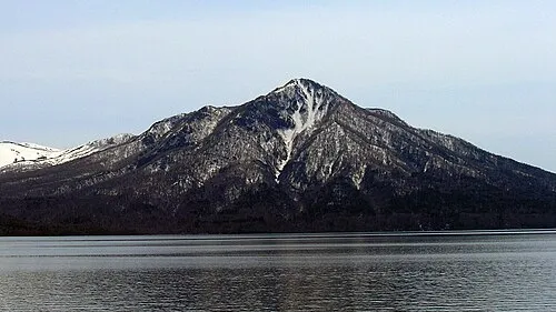 Mount Fuppushi Mountain, Chitose Shi21 km NW
-
Mount Monbetsu Mountain, Chitose Shi23 km NW
-
Mount Morappu Mountain, Chitose Shi21 km NW
Sources & licences
Data last updated: