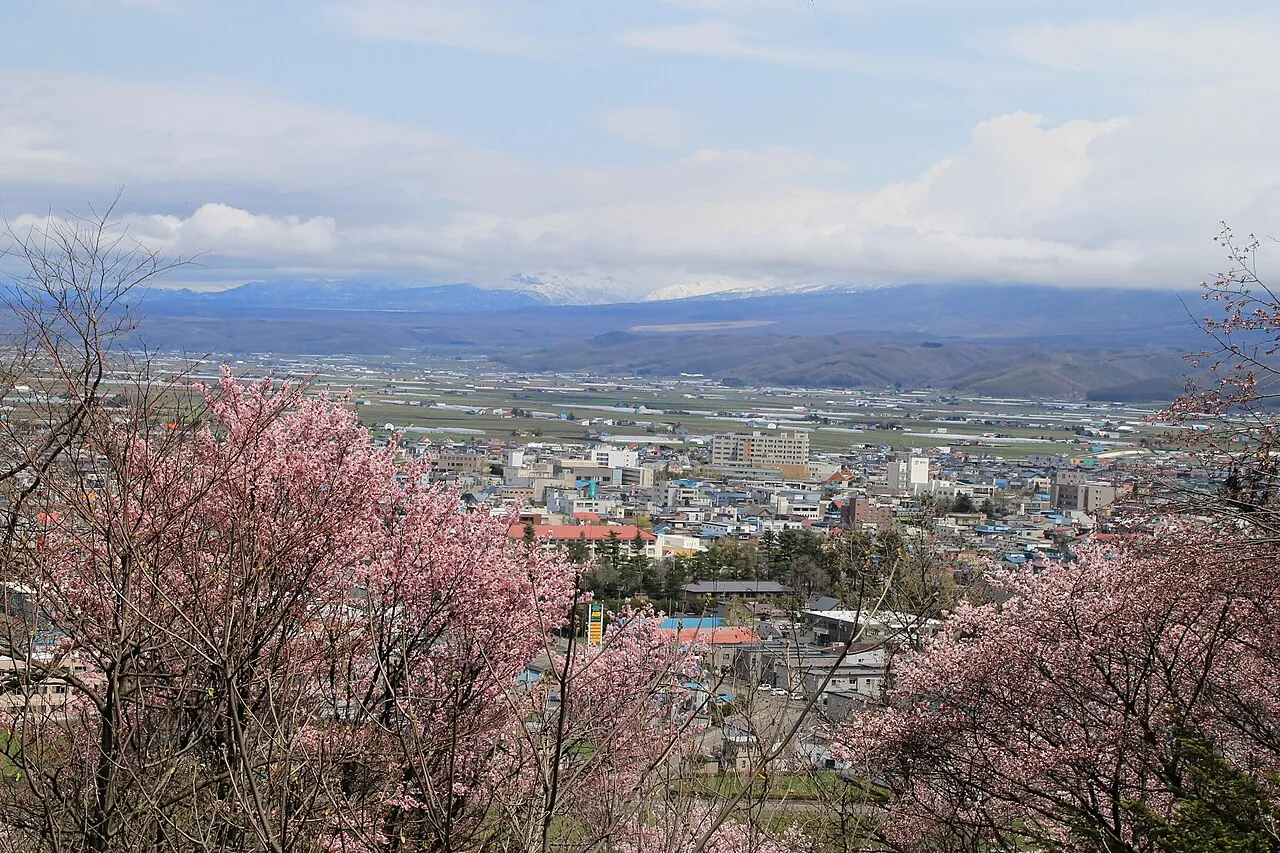
- Population
- 21,131
- 21.1K
- Elevation
- 170 m
- above sea level
- Local time
- UTC+09:00
- Asia/Tokyo · UTC+09:00
- Airports
- AKJ Asahikawa Airport36 km
- CTS New Chitose Airport85 km
About Furano
Furano is a city. Location: Furano Shi, Hokkaido. Population: 21,131. Elevation: 170 m. The best months to visit are June–September. The nearest airport is Asahikawa Airport (36 km). Nearby sights include Mount Kuma and Mount Ashibetsu.
Photos of Furano
-

Chensiyuan · CC BY-SA 4.0 -

MaedaAkihiko · CC0 -

lumoplank · CC0 -

ゆりのき橋 · CC BY 3.0 -

Douglas Perkins · CC BY 4.0


Travel notes for Furano
From Wikivoyage
Furano (富良野), which is in the geographical center of Japan's northern island of Hokkaido, is an amalgamation of several quaint farming towns around a small municipal center. Furano is famous for its remarkably light and dry powder snow, beautiful fields of lavender, vineyards, and its unique Hokkaido Belly Button Festival.
This guide covers three municipalities in Furano basin: Furano, Nakafurano and Kamifurano.
Understand+
Furano is known as Heso no Machi (the Belly Button Town) due to its central location. Furano's inland location (almost 100 km -- about as far inland as Japan gets) and high elevation result in a continental climate, the reason behind Furano's successful ski hill and wine industries. There is a very large temperature variation, so a light jacket is recommended even in the summer. Summer midday temperatures may exceed 30 °C, and midwinters will drop below -30 °C. Furano has very heavy snowfall in the winter.
The population is approximately 26,000, including the incorporated communities in the outskirts. The population of the main municipal area is said to be about 16,000. Don't expect to meet a large number of English speakers outside of the major hotel and tourist areas.
There has been a substantial increase in foreign skiers and snowboarders, particularly from Australia. Furano seems set to enjoy the same skiing success that Niseko has.
Meanwhile, the Furano Basin has become more and more famous for its summertime lavender fields, which draw multitudes of visitors from Taiwan and China as well as from all over Japan.
Tourist information:
Guide sites by local tourism associations:
Furano City: Furano Index, multilingual guide site.
Nakafurano Town: bilingual.
Kamifurano Town: multilingual .
Get in+
By plane:
The nearest airport to Furano is Asahikawa, which has flights to major Japanese cities but only limited seasonal connections elsewhere. Furano Bus has around 7 services per day directly from the airport (1 hour, ¥840).
During the ski season, Hokkaido Access Network also runs direct buses from Sapporo's much larger New Chitose Airport (3 hours, ¥5000).
By train:
Furano is the terminus of the JR Furano Line from Asahikawa. There are 12 direct local trains daily, leaving between 05:44 and 22:34 (as of Aug 2025). The journey from Asahikawa takes just under 1½ hours. Alternatively, the sightseeing train Furano Biei Norokko operates the same route, taking just over 1½ hours. Services operate irregularly; check the timetable. Service ends in 2026.
Furano is also on the JR Nemuro Line from Takikawa. In the summer (Jun–Sep), the Furano Lavendar Express makes one round-trip daily from Sapporo at 07:41, which begins its return departure from Furano at 16:54 (Aug 2025). In the winter ski season, there is one daily Ski Express Train from Sapporo at 08:04. When these trains do not operate, you'll need to connect via Takikawa. Local services to Takikawa leave 8 times a day and take 1 hour. An onward connection to Sapporo aboard a Limited Express also takes 1 hour. All services eastward towards Nemuro have been discontinued.
By bus:
Furano express, Chūō Bus (中央バス高速ふらの号). 08:00–19:20 (departure time at Sapporo). This bus connects Sapporo and Furano in 2½ hr. Approximately hourly service from Sapporo Station bus terminal. 2700¥. (updated Aug 2025)
Source: Wikivoyage · CC BY-SA 4.0 · abridged
Climate of Furano
Best months for sightseeingBest months for sightseeing: June–September.
This month · November
A cold month
Day 6° · Night -2° · Rain 92 mm
- Hottest month
- August (day 25°)
- Coldest month
- January (night -13°)
- Wettest month
- September (139 mm)
- Driest month
- February (42 mm)
Bars: average monthly low and high temperature. Below: precipitation. Monthly averages for 1970–2000 at about 18 km resolution, adjusted for elevation. Highlighted months are mild and relatively dry. Source: WorldClim 2.1 (CC BY 4.0).
Show values as a table
| Month | Jan | Feb | Mar | Apr | May | Jun | Jul | Aug | Sep | Oct | Nov | Dec |
|---|---|---|---|---|---|---|---|---|---|---|---|---|
| Average high (°C) | -4° | -3° | 2° | 9° | 16° | 20° | 24° | 25° | 20° | 14° | 6° | -1° |
| Average low (°C) | -13° | -13° | -8° | 0° | 6° | 11° | 15° | 16° | 11° | 4° | -2° | -8° |
| Precipitation (mm) | 59 | 42 | 49 | 59 | 73 | 74 | 103 | 131 | 139 | 110 | 92 | 70 |
Other places to visit in this season: June July August September
How to get to Furano
The nearest airport is Asahikawa Airport (AKJ), 36 km to the north as the crow flies. For international flights: New Chitose Airport (CTS) (85 km). The nearest large city is Asahikawa, 47 km to the north.
Airports
- Asahikawa Airport (AKJ) Higashikagura 36 kmnorth
- New Chitose Airport (CTS) Sapporo 85 kmsouthwest
- Sapporo Okadama Airport (OKD) Sapporo 85 kmwest
Nearby large cities
- Asahikawa Population: 333.5K 47 kmnorth
- Ebetsu Population: 134K 73 kmwest
- Obihiro Population: 166.5K 82 kmsoutheast
- Sapporo Population: 2M 90 kmwest
- Tomakomai Population: 174.8K 102 kmsouthwest
Straight-line distances; road distances are longer. Airport data: OurAirports.
Day trips from Furano
Within 100 km: 3 historic and cultural sites, 48 natural sites, 8 lakes, rivers and coasts.
0–25 km4 places
- Mount Rubeshibe Mountain 23 kmN
- Mount Oputateshike Mountain 24 kmNE
- Mount Ashibetsu Mountain 15 kmSW
- Mount Kuma Mountain 17 kmN
25–60 km20 places
- Hokkaido Island 46 kmE
- Mount Yūbari Mountain 30 kmS
- Mount Tokachi Mountain 25 kmE
- Mount Numanohara Mountain 51 kmE
60–100 km35 places
- Saru River River 99 kmS
- Yūbari River River 70 kmW
- Toyohira River River 74 kmW
- Mu River River 96 kmSW
Straight-line distances.
Nearby attractions & nature
Everything nearby-
Mount Kuma Mountain, Ashibetsu17 km N
-
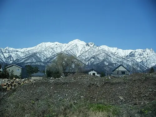 Mount Ashibetsu Mountain, Minamifurano Chō15 km SW
-
Mount Rubeshibe Mountain, Biei Chō23 km N
-
 Mount Oputateshike Mountain, Japan24 km NE
Sources & licences
Data last updated: