Aibetsu Chō
Local name: 愛別町
Located in Kamikawa-gun (Ishikari), Hokkaido Coordinates: 43°56′35″ N 142°38′08″ E
- Population
- 3,207
- 3.2K
- Elevation
- 417 m
- above sea level
- Local time
- UTC+09:00
- Asia/Tokyo · UTC+09:00
- Places inside
- 2
- listed under Aibetsu Chō
- Airports
- AKJ Asahikawa Airport34 km
- MBE Monbetsu Airport73 km
About Aibetsu Chō
Aibetsu Chō is a municipality. Location: Kamikawa-gun (Ishikari), Hokkaido. Population: 3,207. Elevation: 417 m.
Aibetsu (愛別町, Aibetsu-chō) is a town in Kamikawa Subprefecture, Hokkaido, Japan. As of 1 April 2024, the town had an estimated population of 2,571 in 1353 households, and a population density of 10 people per km2. The total area of the town is 250.13 km2 (96.58 sq mi).
Source: Wikipedia · CC BY-SA 4.0
Places bordering Aibetsu Chō
- Shibetsu
- Kamikawa
- Tōma
- Pippu
Population of Aibetsu Chō over time
| 2010 | 3,328 | |
|---|---|---|
| 2015 | 2,976 | |
| 2020 | 2,681 |
Censuses and official estimates; source: Wikidata.
Climate of Aibetsu Chō
Best months for sightseeingBest months for sightseeing: June–August.
This month · November
A wet month
Day 4° · Night -4° · Rain 107 mm
- Hottest month
- August (day 23°)
- Coldest month
- February (night -14°)
- Wettest month
- August (144 mm)
- Driest month
- February (47 mm)
Bars: average monthly low and high temperature. Below: precipitation. Monthly averages for 1970–2000 at about 18 km resolution, adjusted for elevation. Highlighted months are mild and relatively dry. Source: WorldClim 2.1 (CC BY 4.0).
Show values as a table
| Month | Jan | Feb | Mar | Apr | May | Jun | Jul | Aug | Sep | Oct | Nov | Dec |
|---|---|---|---|---|---|---|---|---|---|---|---|---|
| Average high (°C) | -6° | -5° | 0° | 7° | 14° | 18° | 22° | 23° | 18° | 12° | 4° | -3° |
| Average low (°C) | -14° | -14° | -10° | -2° | 4° | 9° | 14° | 15° | 9° | 2° | -4° | -10° |
| Precipitation (mm) | 66 | 47 | 57 | 63 | 77 | 75 | 104 | 144 | 142 | 119 | 107 | 81 |
How to get to Aibetsu Chō
The nearest airport is Asahikawa Airport (AKJ), 34 km to the southwest as the crow flies. The nearest large city is Asahikawa, 29 km to the southwest.
Airports
- Asahikawa Airport (AKJ) Higashikagura 34 kmsouthwest
- Monbetsu Airport (MBE) Monbetsu 73 kmnortheast
- Memanbetsu Airport (MMB) Ōzora 123 kmeast
Nearby large cities
- Asahikawa Population: 333.5K 29 kmsouthwest
- Kitami Population: 119.1K 102 kmeast
- Obihiro Population: 166.5K 123 kmsouth
- Ebetsu Population: 134K 128 kmsouthwest
- Sapporo Population: 2M 142 kmsouthwest
Straight-line distances; road distances are longer. Airport data: OurAirports.
Day trips from Aibetsu Chō
Within 100 km: 1 historic or cultural site, 36 natural sites, 6 lakes, rivers and coasts.
0–25 km3 places
- Mount Aibetsu Mountain 4 kmSE
- Mount Teshio Mountain 20 kmE
- Asahiyama Zoo Attraction 23 kmSW
25–60 km27 places
- Mount Midori Mountain 42 kmSE
- Mount Rubeshibe Mountain 50 kmSW
- Kitami Sanchi Mountain 48 kmN
- Daisetsu-zan Mountain 36 kmSE
60–100 km13 places
- Hokkaido Island 62 kmSE
- Mount Tomamu Mountain 96 kmS
- Mount Sahoro Mountain 87 kmS
- Yubetsu River River 85 kmNE
Straight-line distances.
Places in Aibetsu Chō
2 placesBar: population relative to the most populous place in this list.
Mountains & nature1
- Mount Aibetsu · Mountain
Nearby attractions & nature
Everything nearby-
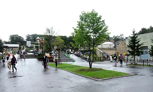 Asahiyama Zoo Attraction, Asahikawa City23 km SW
-
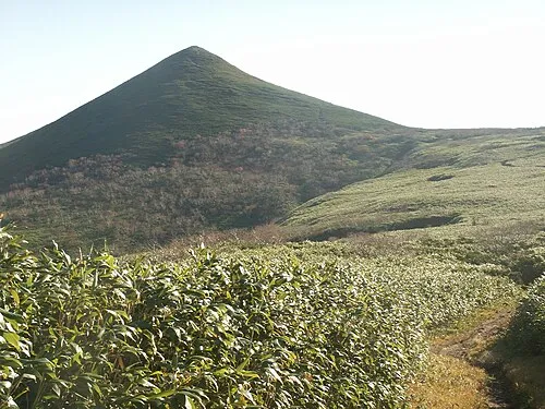 Mount Teshio Mountain, Takinoue Chō20 km E
Other cities and towns in Kamikawa-gun (Ishikari)
-
Higashikagura Chō Municipality, Kamikawa-gun (Ishikari)32 km S
-
Takasu Chō Municipality, Kamikawa-gun (Ishikari)25 km W
-
Higashikawa Chō Municipality, Kamikawa-gun (Ishikari)30 km S
-
Kamikawa Chō Municipality, Kamikawa-gun (Ishikari)32 km SE
-
Biei Chō Municipality, Kamikawa-gun (Ishikari)43 km S
-
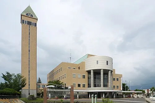 Biei Town, Biei Chō42 km S
Sources & licences
Data last updated: · 2 independent sources