Shirakami Misaki
Located in Matsumae Chō, Matsumae-gun Coordinates: 41°23′48″ N 140°11′50″ E

- Elevation
- 1 m
- above sea level
- Local time
- UTC+09:00
- Asia/Tokyo · UTC+09:00
- Airports
- HKD Hakodate Airport67 km
- AOJ Aomori Airport84 km
About Shirakami Misaki
Shirakami Misaki is a natural site. Location: Matsumae Chō, Matsumae-gun.
Cape Shirakami (白神岬, Shirakami-misaki) is a cape located on the southernmost tip of the Oshima Peninsula in Matsumae, Hokkaidō, Japan. It is the southernmost point of Hokkaidō. There are rugged, uniquely shaped rocks and sea cliffs. From the peak, on clear days, the view extends to Cape Tappi, the northernmost point on the Tsugaru Peninsula across the shore. During spring and autumn, this area becomes a resting spot for migrating birds and is a recommended area for bird watchers to visit.
Source: Wikipedia · CC BY-SA 4.0
Photos of Shirakami Misaki
-

切干大根 · CC BY-SA 4.0

Climate of Shirakami Misaki
Best months for sightseeingBest months for sightseeing: June–September.
This month · November
A cold month
Day 9° · Night 3° · Rain 98 mm
- Hottest month
- August (day 25°)
- Coldest month
- January (night -6°)
- Wettest month
- September (164 mm)
- Driest month
- February (77 mm)
Bars: average monthly low and high temperature. Below: precipitation. Monthly averages for 1970–2000 at about 18 km resolution, adjusted for elevation. Highlighted months are mild and relatively dry. Source: WorldClim 2.1 (CC BY 4.0).
Show values as a table
| Month | Jan | Feb | Mar | Apr | May | Jun | Jul | Aug | Sep | Oct | Nov | Dec |
|---|---|---|---|---|---|---|---|---|---|---|---|---|
| Average high (°C) | -1° | 1° | 5° | 11° | 16° | 19° | 23° | 25° | 22° | 17° | 9° | 2° |
| Average low (°C) | -6° | -5° | -1° | 4° | 9° | 13° | 17° | 19° | 16° | 10° | 3° | -3° |
| Precipitation (mm) | 93 | 77 | 79 | 80 | 93 | 97 | 146 | 143 | 164 | 107 | 98 | 94 |
Other places to visit in this season: June July August September
How to get to Shirakami Misaki
The nearest airport is Hakodate Airport (HKD), 67 km to the northeast as the crow flies. The nearest large city is Hakodate, 62 km to the northeast.
Airports
- Hakodate Airport (HKD) Hakodate 67 kmnortheast
- Aomori Airport (AOJ) Aomori 84 kmsoutheast
- Okushiri Airport (OIR) Okushiri Island 98 kmnorthwest
Nearby large cities
- Hakodate Population: 275.7K 62 kmnortheast
- Aomori Population: 298.4K 79 kmsoutheast
- Hirosaki Population: 168.7K 92 kmsouth
- Hachinohe Population: 239K 148 kmsoutheast
- Tomakomai Population: 174.8K 180 kmnortheast
Straight-line distances; road distances are longer. Airport data: OurAirports.
Day trips from Shirakami Misaki
Within 100 km: 6 historic and cultural sites, 16 natural sites, 12 lakes, rivers and coasts.
0–25 km3 places
- Mount Nagayama Mountain 22 kmN
- Daisengen-dake Mountain 20 kmN
- Fukuyama Jō Historic site 8 kmNW
25–60 km6 places
- Lake Jūsan Lake 43 kmS
- Kamome Island Island 53 kmN
- Mount Hakodate Mountain 58 kmNE
- Iwaki River River 45 kmS
60–100 km25 places
- Oirase Gawa River 81 kmS
- Seibi En Attraction 92 kmS
- Mount Iwaki Mountain 83 kmS
- Mount Bonju Mountain 74 kmSE
Straight-line distances.
Nearest towns and villages
-
Matsumae Town, Matsumae Chō8.6 km NW
-
Fukushima Village, Fukushima Chō10 km NE
-
 Fukushima Chō Municipality, Matsumae-gun15 km N
-
Shiriuchi Chō Municipality, Kamiiso-gun26 km NE
-
 Oshima-shiriuchi Neighbourhood, Shiriuchi Chō29 km NE
-
 Imabetsu Machi Municipality, Higashitsugaru-gun37 km SE
Nearby attractions & nature
Everything nearby-
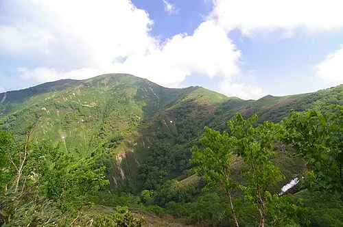 Daisengen-dake Mountain, Matsumae Chō20 km N
-
Fukuyama Jō Historic site, Matsumae Chō8.4 km NW
-
Mount Nagayama Mountain, Shiriuchi Chō22 km N
Sources & licences
Data last updated: · 2 independent sources