Kamui Misaki
Located in Shakotan Chō, Shakotan-gun Coordinates: 43°20′01″ N 140°20′45″ E
- Local time
- UTC+09:00
- Asia/Tokyo · UTC+09:00
- Airports
- OKD Sapporo Okadama Airport87 km
- CTS New Chitose Airport126 km
About Kamui Misaki
Kamui Misaki is a natural site. Location: Shakotan Chō, Shakotan-gun.
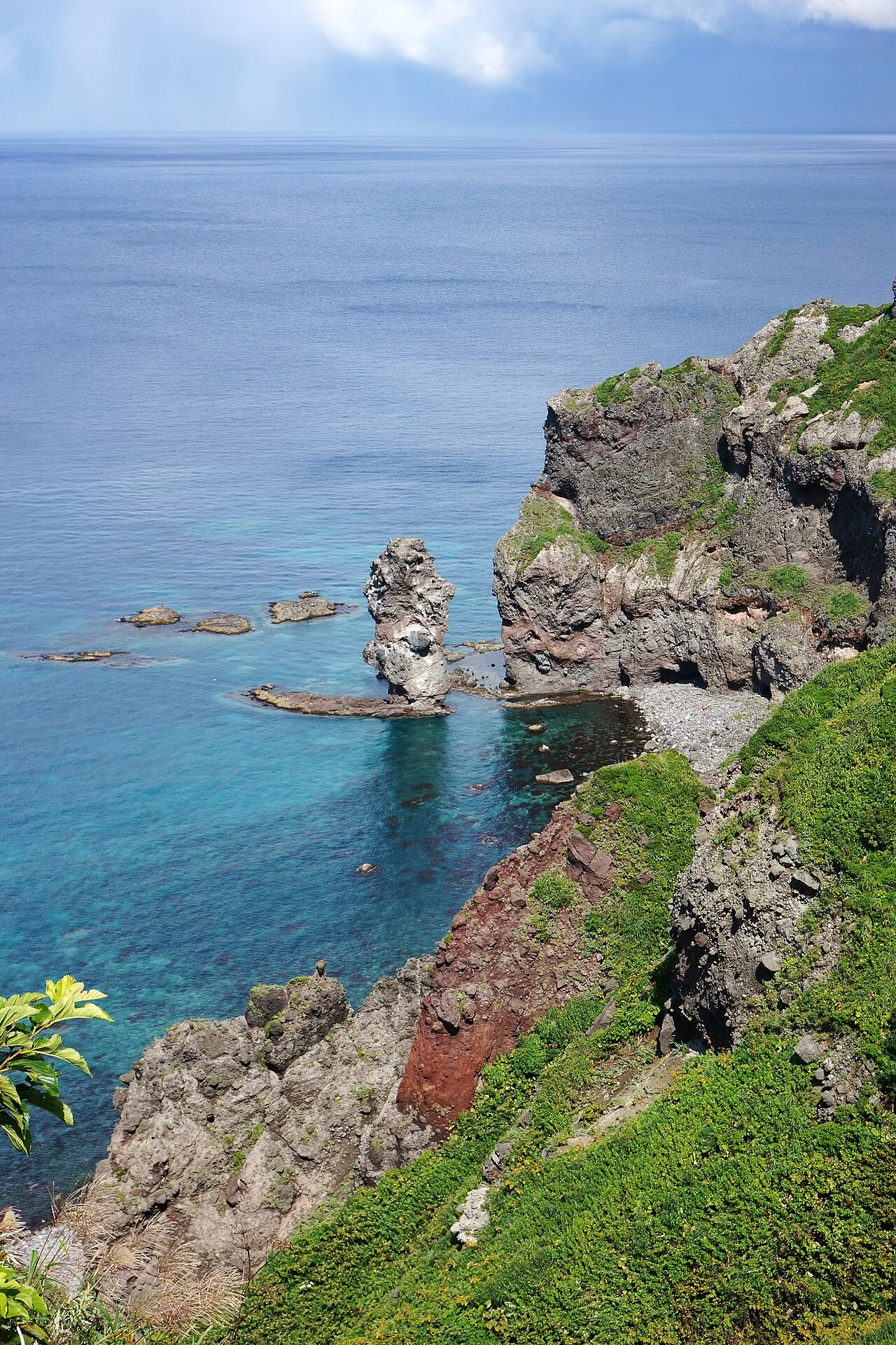
Cape Kamui (神威岬, Kamui misaki) is located on the western part of Shakotan, Hokkaido, Japan. Its lighthouse, the Cape Kamui Lighthouse, overlooks the Sea of Japan. An earthquake off the cape on 2 August 1940 resulted in a tsunami that killed ten people.
Source: Wikipedia · CC BY-SA 4.0
Photos of Kamui Misaki
-

663highland · CC BY 2.5 -

663highland · CC BY 2.5 -

663highland · CC BY 2.5


Climate of Kamui Misaki
Best months for sightseeingBest months for sightseeing: June–September.
This month · November
A wet month
Day 7° · Night 1° · Rain 128 mm
- Hottest month
- August (day 24°)
- Coldest month
- January (night -7°)
- Wettest month
- January (158 mm)
- Driest month
- April (60 mm)
Bars: average monthly low and high temperature. Below: precipitation. Monthly averages for 1970–2000 at about 18 km resolution, adjusted for elevation. Highlighted months are mild and relatively dry. Source: WorldClim 2.1 (CC BY 4.0).
Show values as a table
| Month | Jan | Feb | Mar | Apr | May | Jun | Jul | Aug | Sep | Oct | Nov | Dec |
|---|---|---|---|---|---|---|---|---|---|---|---|---|
| Average high (°C) | -1° | -1° | 3° | 9° | 15° | 18° | 22° | 24° | 21° | 15° | 7° | 1° |
| Average low (°C) | -7° | -6° | -4° | 2° | 6° | 11° | 16° | 17° | 13° | 7° | 1° | -4° |
| Precipitation (mm) | 158 | 110 | 73 | 60 | 60 | 70 | 98 | 126 | 135 | 109 | 128 | 132 |
Other places to visit in this season: June July August September
How to get to Kamui Misaki
The nearest airport is Sapporo Okadama Airport (OKD), 87 km to the east as the crow flies. For international flights: New Chitose Airport (CTS) (126 km). The nearest large city is Otaru, 56 km to the east.
Airports
- Sapporo Okadama Airport (OKD) Sapporo 87 kmeast
- New Chitose Airport (CTS) Sapporo 126 kmsoutheast
- Okushiri Airport (OIR) Okushiri Island 159 kmsouthwest
Nearby large cities
- Otaru Population: 115.3K 56 kmeast
- Sapporo Population: 2M 87 kmeast
- Ebetsu Population: 134K 101 kmeast
- Tomakomai Population: 174.8K 128 kmsoutheast
- Asahikawa Population: 333.5K 170 kmeast
Straight-line distances; road distances are longer. Airport data: OurAirports.
Day trips from Kamui Misaki
Within 100 km: 2 historic and cultural sites, 7 natural sites, 5 lakes, rivers and coasts.
0–25 km1 place
- Shakotan-hantō Natural site 15 kmSE
25–60 km3 places
- Raiden-yama Mountain 49 kmS
- Shiribetsu River River 51 kmS
- Ishikari Bay Natural site 55 kmE
60–100 km10 places
- Zenibako River River 70 kmE
- Mount Shiribetsu Mountain 78 kmSE
- Mount Eniwa Mountain 98 kmSE
- Mount Usu Mountain 72 kmSE
Straight-line distances.
Nearest towns and villages
-
Kamoenai Mura Municipality, Furuu-gun17 km SE
-
 Kamoenai Village, Kamoenai Mura23 km S
-
Furubira Village, Hokkaido25 km E
-
 Yoichi Town, Yoichi-chō37 km SE
-
 Tomari Village, Tomari Mura32 km SE
-
Yoichi-chō Municipality, Yoichi-gun37 km SE
Sources & licences
Data last updated: · 2 independent sources