Amagasaki
Local name: 尼崎市
Located in Amagasaki Shi, Hyōgo Coordinates: 34°43′00″ N 135°25′00″ E
- Population
- 459,593
- 459.6K
- Elevation
- 1 m
- above sea level
- Local time
- UTC+09:00
- Asia/Tokyo · UTC+09:00
- Airports
- ITM Osaka Itami International Airport7 km
- UKB Kobe Airport20 km
About Amagasaki
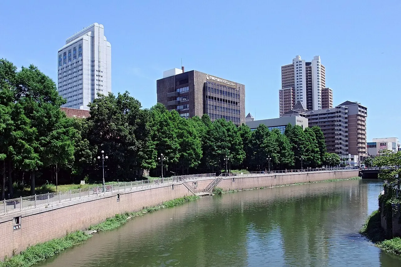
Amagasaki is a city. Location: Amagasaki Shi, Hyōgo. Population: 459,593. Elevation: 1 m.
Amagasaki (尼崎市, Amagasaki-shi; Japanese pronunciation: [ä̀.mä́.ɡä́.sä̀.k̟ʲì, -ŋä́.sä̀.k̟ʲì, -ɡä́.sä́.k̟ʲi̥.ɕì, -ŋä́.sä́.k̟ʲi̥.ɕì]) is an industrial city located in Hyōgo Prefecture, Japan. As of 30 November 2022, the city had an estimated population of 455,555 in 223,812 households, and a population density of 9000 persons per km². The total area of the city is 50.72 km2 (19.58 sq mi).
Source: Wikipedia · CC BY-SA 4.0
Photos of Amagasaki
-

m-louis .® from Osaka, Japan · CC BY-SA 4.0 -

漱石の猫 · CC0 -

ja:User:Nnn · CC BY-SA 3.0 -
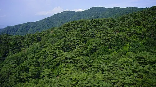
Mount Rokkō 663highland · CC BY 2.5 -
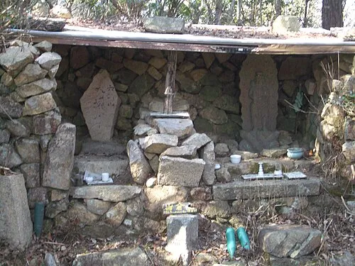
Mount Iwakura Mass Ave 975 at en.wikipedia · CC BY-SA 3.0


Travel notes for Amagasaki
From Wikivoyage
Amagasaki (尼崎) is an industrial city in Hyogo prefecture, Japan. It is located just west of Osaka.
Understand+
Tourist information site:
The local tourist association has a multilingual guide site.
Get in+
By plane:
Amagasaki has access to Kansai International Airport. From the airport a bus or a train can be taken to JR Osaka Station. From there, Amagasaki JR and Amagasaki Hanshin (阪神) are accessible.
By train:
Take the Shinkansen (新幹線) to Shin-Osaka, then transfer to a JR train to go to JR Amagasaki station.
Source: Wikivoyage · CC BY-SA 4.0 · abridged
Places bordering Amagasaki
- Itami
- Nishinomiya Shi
- Toyonaka
Twin towns and sister cities of Amagasaki
- Augsburg· Germany
Source: Wikidata. Only places with a page on this site are shown.
Population of Amagasaki over time
| 2010 | 453,748 | |
|---|---|---|
| 2015 | 452,563 | |
| 2021 | 458,835 | |
| 2022 | 455,555 |
Censuses and official estimates; source: Wikidata.
Climate of Amagasaki
Best months for sightseeingBest months for sightseeing: May, October.
This month · November
Outside the best season
Day 18° · Night 8° · Rain 70 mm
Better nearby cities in November
- Kochi · 217 km southwest18°
- Fujinomiya · 297 km east18°
- Fuji · 302 km east20°
- Hottest month
- August (day 33°)
- Coldest month
- January (night 1°)
- Wettest month
- June (212 mm)
- Driest month
- December (39 mm)
Bars: average monthly low and high temperature. Below: precipitation. Monthly averages for 1970–2000 at about 18 km resolution, adjusted for elevation. Highlighted months are mild and relatively dry. Source: WorldClim 2.1 (CC BY 4.0).
Show values as a table
| Month | Jan | Feb | Mar | Apr | May | Jun | Jul | Aug | Sep | Oct | Nov | Dec |
|---|---|---|---|---|---|---|---|---|---|---|---|---|
| Average high (°C) | 10° | 10° | 14° | 20° | 25° | 28° | 31° | 33° | 29° | 23° | 18° | 12° |
| Average low (°C) | 1° | 1° | 4° | 9° | 14° | 19° | 23° | 24° | 20° | 14° | 8° | 3° |
| Precipitation (mm) | 46 | 61 | 99 | 131 | 141 | 212 | 163 | 102 | 180 | 111 | 70 | 39 |
How to get to Amagasaki
The nearest airport is Osaka Itami International Airport (ITM), 7 km to the north as the crow flies. The nearest large city is Itami, 8 km to the north.
Airports
- Osaka Itami International Airport (ITM) Osaka 7 kmnorth
- Kobe Airport (UKB) Kobe 20 kmsouthwest
- Kansai International Airport (KIX) Osaka 36 kmsouthwest
Nearby large cities
- Itami Population: 198.1K 8 kmnorth
- Nishinomiya Population: 485.6K 8 kmwest
- Toyonaka Population: 401.6K 9 kmnortheast
- Suita Population: 385.6K 10 kmnortheast
- Takarazuka Population: 226.4K 11 kmnorthwest
Straight-line distances; road distances are longer. Airport data: OurAirports.
Day trips from Amagasaki
Within 100 km: 32 historic and cultural sites, 43 natural sites, 17 lakes, rivers and coasts.
0–25 km14 places
- Mount Rokkō Mountain 16 kmNW
- Yamato Gawa River 12 kmS
- Tenpō Zan Mountain 7 kmS
- Yodo River River 4 kmS
25–60 km49 places
- Mount Miwa Mountain 46 kmSE
- Mount Amanokagu Mountain 44 kmSE
- Mount Miminashi Mountain 42 kmSE
- Mount Unebi Mountain 42 kmSE
60–100 km29 places
- Awaji Island Island 65 kmSW
- Mount Ōdaigahara Mountain 84 kmSE
- Mount Kunimi Mountain 83 kmSE
- Mount Azami Mountain 71 kmSE
Straight-line distances.
Amagasaki and similar cities
Side by side with cities of similar size in the same country: population, elevation and climate.
| Measure | Amagasaki | Kanazawa | Katsushika-ku | Fukuyama |
|---|---|---|---|---|
| Population | 459.6K | 466K | 453.1K | 468.8K |
| Elevation | 1 m | -1 m | 1 m | 7 m |
| Summer day (hottest month) | 33° | 31° | 31° | 32° |
| Winter night (coldest month) | 1° | 0° | 0° | 1° |
| Annual rainfall | 1,355 mm | 2,071 mm | 1,367 mm | 1,337 mm |
| Best months | May, Oct | May–Jun, Sep–Oct | May–Jun, Oct | May, Oct |
| Distance | — | 236 km | 419 km | 190 km |
Climate values are 1970–2000 monthly averages; straight-line distance.
Nearby attractions & nature
Everything nearby-
Yodo River River, Japan3.7 km S
-
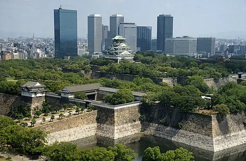 Osaka Castle Historic site, Chūō Ku11 km E
-
Tenpō Zan Mountain, Minato-ku6.7 km S
-
Mukogawa River River, Hyōgo5.7 km SW
-
Mount Iwakura Mountain, Takarazuka Shi13 km NW
-
Mount Kabuto Mountain, Nishinomiya Shi10 km NW
-
Mount Rokkō Mountain, Kita Ku16 km NW
-
Yamato Gawa River, Japan12 km S
Sources & licences
Data last updated: · 2 independent sources