- Population
- 46,922
- 46.9K
- Elevation
- 324 m
- above sea level
- Local time
- UTC+09:00
- Asia/Tokyo · UTC+09:00
- Places inside
- 2
- listed under Awaji Shi
- Airports
- KIX Kansai International Airport31 km
- UKB Kobe Airport32 km
About Awaji Shi
Awaji Shi is a district. Location: Hyōgo, Japan. Population: 46,922.
Awaji (淡路市, Awaji-shi; Japanese pronunciation: [ä́.β̞ä̀.(ɟ͡)ʑì, ä̀.β̞ä́.(ɟ͡)ʑí.ɕì]) is a city located on Awaji Island in Hyōgo Prefecture, Japan. As of 1 June 2022, the city had an estimated population of 42,597 and a population density of 230 persons per km2. The total area of the city is 184.32 square kilometres (71.17 sq mi).
Source: Wikipedia · CC BY-SA 4.0
Places bordering Awaji Shi
- Sumoto
Population of Awaji Shi over time
| 2010 | 46,459 | |
|---|---|---|
| 2015 | 43,977 | |
| 2021 | 41,127 |
Censuses and official estimates; source: Wikidata.
Climate of Awaji Shi
Best months for sightseeingBest months for sightseeing: May–June, September–October.
This month · November
Outside the best season
Day 15° · Night 7° · Rain 78 mm
Better nearby cities in November
- Kochi · 165 km southwest18°
- Ōita · 337 km southwest18°
- Beppu · 343 km west17°
- Hottest month
- August (day 29°)
- Coldest month
- February (night 0°)
- Wettest month
- June (222 mm)
- Driest month
- December (37 mm)
Bars: average monthly low and high temperature. Below: precipitation. Monthly averages for 1970–2000 at about 18 km resolution, adjusted for elevation. Highlighted months are mild and relatively dry. Source: WorldClim 2.1 (CC BY 4.0).
Show values as a table
| Month | Jan | Feb | Mar | Apr | May | Jun | Jul | Aug | Sep | Oct | Nov | Dec |
|---|---|---|---|---|---|---|---|---|---|---|---|---|
| Average high (°C) | 7° | 7° | 10° | 16° | 21° | 24° | 28° | 29° | 25° | 20° | 15° | 9° |
| Average low (°C) | 0° | 0° | 2° | 8° | 12° | 17° | 21° | 22° | 18° | 12° | 7° | 2° |
| Precipitation (mm) | 45 | 56 | 92 | 139 | 142 | 222 | 154 | 115 | 221 | 119 | 78 | 37 |
Other places to visit in this season: May June September October
How to get to Awaji Shi
The nearest airport is Kansai International Airport (KIX), 31 km to the east as the crow flies. The nearest large city is Akashi, 19 km to the northeast.
Airports
- Kansai International Airport (KIX) Osaka 31 kmeast
- Kobe Airport (UKB) Kobe 32 kmnortheast
- Tokushima Awaodori Airport / JMSDF Tokushima Air Base (TKS) Tokushima 49 kmsouthwest
Nearby large cities
- Akashi Population: 303.6K 19 kmnortheast
- Kakogawa Population: 271.6K 31 kmnorth
- Wakayama Population: 356.7K 37 kmsoutheast
- Izumisano Population: 100.1K 38 kmeast
- Minato Population: 375.3K 38 kmsoutheast
Straight-line distances; road distances are longer. Airport data: OurAirports.
Places in Awaji Shi
2 placesBar: population relative to the most populous place in this list.
Mountains & nature1
- Mount Maya · Mountain
Nearby attractions & nature
Everything nearby-
 Awaji Island Island, Hyōgo14 km SW
-
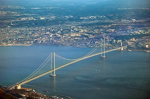 Akashi Kaikyō Bridge Landmark, Japan16 km NE
-
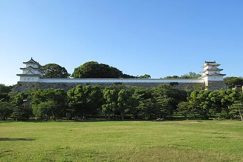 Akashi Castle Historic site, Akashi Shi19 km NE
-
Sen Zan Mountain, Sumoto Shi17 km SW
-
 Tomoga Shima Island, Wakayama25 km SE
-
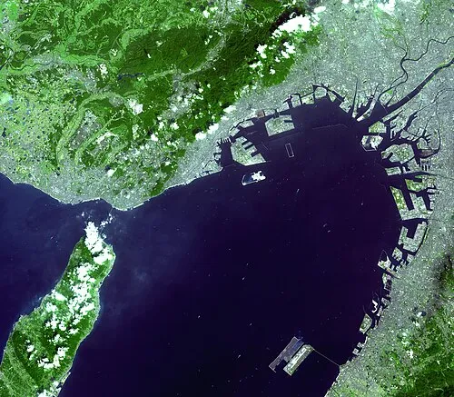 Osaka Bay Natural site, Japan21 km E
Sources & licences
Data last updated: · 2 independent sources