Shin’onsen Chō
Local name: 新温泉町
Located in Mikata-gun, Hyōgo Coordinates: 35°33′37″ N 134°29′03″ E
- Population
- 16,051
- 16.1K
- Elevation
- 58 m
- above sea level
- Local time
- UTC+09:00
- Asia/Tokyo · UTC+09:00
- Airports
- TJH Konotori Tajima Airport28 km
- TTJ Tottori Sand Dunes Conan Airport29 km
About Shin’onsen Chō
Shin’onsen Chō is a municipality. Location: Mikata-gun, Hyōgo. Population: 16,051. Elevation: 58 m.
Shin'onsen (新温泉町, Shin'onsen-chō) is a town located in Mikata District, Hyōgo Prefecture, Japan. As of 1 April 2022, the town had an estimated population of 12,814 in 4873 households and a population density of 53 persons per km2. The total area of the town is 241.01 square kilometres (93.05 sq mi).
Source: Wikipedia · CC BY-SA 4.0
Travel notes for Shin’onsen Chō
From Wikivoyage
Shin-onsen (新温泉町) is a small town in Hyogo, home of 17,000 people.
Understand+
The towns name, Shinonsen, literally translates to mean "New Onsen" or "New Hot Spring". It was formed from the merging of Hamasaka Town and Onsen Town (Hot Spring Town). While it may appear that "New Onsen" serves as a not-so-subtle way to advertise the town's major draw, the area of Yumura Onsen has been called "Onsen" (originally "Onsen Village", later becoming "Onsen Town") since the Nara Period, so while keeping "onsen" in the name was given the highest priority when the new name was chosen, it is not just a marketing strategy; it has history.
The merger has also given the town three distinct hot spring areas with three different types of waters: Hamasaka Onsen is a salt spring, Shichikama Onsen is a sulfate spring, and Yumura Onsen has a mix of carbonated, sulfate, and salt springs.
Tourist information site:
The town government's official site has a Japanese-only tourism section.
Get in+
By train:
Four stations along the San-in Main Line are located in Shinonsen; Kutani (久谷), Hamasaka (浜坂), Moroyose (諸寄), and Igumi (居組) Stations. Hamasaka Station is the main station in the city. From Osaka there is only one direct Hamakaze Train per day to Hamasaka Station, so most travelers will need to take a Limited Express Train to Tottori, Himeji, or Kinosaki Onsen and transfer to reach Hamasaka Station (or any station in Shinonsen). From Okayama, it is also necessary to travel to either Tottori or Himeji and transferring.
By bus:
If your destination is Yumura Onsen, there are direct buses from Tottori, Osaka (3 hours), and Kobe (3 hours) to the onsen. If you are around any of these cities, the buses will be both faster and cheaper than going by train. Yumura Onsen is not located near any train stations, so those who take the train will still have to transfer to a local bus after arriving at Hamasaka Station, adding 25 min+ to the travel time and costing significantly more. In addition, there are about 6 buses per day from Yoka Station in Yabu to Yumura Onsen.
Source: Wikivoyage · CC BY-SA 4.0 · abridged
Places bordering Shin’onsen Chō
- Kami-cho
- Tottori-shi
- Iwami Chō
- Wakasa
Population of Shin’onsen Chō over time
| 2010 | 16,004 | |
|---|---|---|
| 2015 | 14,819 | |
| 2021 | 13,213 |
Censuses and official estimates; source: Wikidata.
Climate of Shin’onsen Chō
Best months for sightseeingBest months for sightseeing: May–June, September–October.
This month · November
A wet month
Day 16° · Night 7° · Rain 145 mm
Better nearby cities in November
- Kochi · 240 km south18°
- Kofu · 369 km east17°
- Ōita · 370 km southwest18°
- Hottest month
- August (day 31°)
- Coldest month
- February (night 0°)
- Wettest month
- September (235 mm)
- Driest month
- April (119 mm)
Bars: average monthly low and high temperature. Below: precipitation. Monthly averages for 1970–2000 at about 18 km resolution, adjusted for elevation. Highlighted months are mild and relatively dry. Source: WorldClim 2.1 (CC BY 4.0).
Show values as a table
| Month | Jan | Feb | Mar | Apr | May | Jun | Jul | Aug | Sep | Oct | Nov | Dec |
|---|---|---|---|---|---|---|---|---|---|---|---|---|
| Average high (°C) | 7° | 7° | 11° | 18° | 22° | 25° | 29° | 31° | 26° | 21° | 16° | 10° |
| Average low (°C) | 0° | 0° | 2° | 7° | 12° | 17° | 22° | 22° | 18° | 12° | 7° | 2° |
| Precipitation (mm) | 177 | 154 | 128 | 119 | 128 | 173 | 196 | 128 | 235 | 141 | 145 | 156 |
Other places to visit in this season: May June September October
How to get to Shin’onsen Chō
The nearest airport is Konotori Tajima Airport (TJH), 28 km to the east as the crow flies. For international flights: Okayama Momotaro Airport (OKJ) (106 km). The nearest large city is Tottori-shi, 24 km to the west.
Airports
- Konotori Tajima Airport (TJH) Toyooka 28 kmeast
- Tottori Sand Dunes Conan Airport (TTJ) Tottori 29 kmwest
- Okayama Momotaro Airport (OKJ) Okayama 106 kmsouthwest
Nearby large cities
- Tottori-shi Population: 188.5K 24 kmwest
- Tsuyama Population: 102.3K 72 kmsouthwest
- Himeji Population: 530.5K 85 kmsouth
- Kakogawa Population: 271.6K 93 kmsouth
- Sandachō Population: 132.9K 101 kmsoutheast
Straight-line distances; road distances are longer. Airport data: OurAirports.
Day trips from Shin’onsen Chō
Within 100 km: 3 historic and cultural sites, 8 natural sites, 11 lakes, rivers and coasts.
0–25 km2 places
- Tottori Castle ruins Historic site 23 kmW
- Mount Hyōno Mountain 23 kmS
25–60 km8 places
- Sendai River River 26 kmW
- Maruyama River River 33 kmE
- Mount Ooe Mountain 58 kmE
- Lake Tōgō Lake 55 kmW
60–100 km12 places
- Kamuri Jima Island 86 kmE
- Yura River River 73 kmE
- Ko-shima Island 88 kmE
- Takano River River 77 kmE
Straight-line distances.
Nearby attractions & nature
Everything nearby-
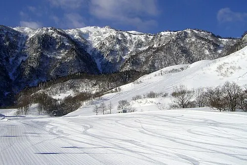 Mount Hyōno Mountain, Yabu-shi23 km S
-
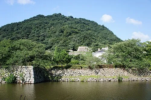 Tottori Castle ruins Historic site, Tottori Shi23 km W
Sources & licences
Data last updated: · 2 independent sources