Kotohira Chō
Local name: 琴平町
Located in Nakatado-gun, Kagawa Coordinates: 34°11′45″ N 133°49′06″ E
- Population
- 9,798
- 9.8K
- Elevation
- 68 m
- above sea level
- Local time
- UTC+09:00
- Asia/Tokyo · UTC+09:00
- Places inside
- 1
- listed under Kotohira Chō
- Airports
- TAK Takamatsu Airport18 km
- OKJ Okayama Momotaro Airport62 km
About Kotohira Chō
Kotohira Chō is a municipality. Location: Nakatado-gun, Kagawa. Population: 9,798. Elevation: 68 m.
Kotohira (琴平町, Kotohira-chō) is a town located in Nakatado District, Kagawa Prefecture, Japan. As of 1 October 2022, the town had an estimated population of 8,105 in 3618 households and a population density of 960 persons per km2. The total area of the town is 8.47 square kilometres (3.27 sq mi). The town is best known as the site of Shikoku's largest shrine complex, the Kotohira Shrine (popularly known as Konpira-san).
Source: Wikipedia · CC BY-SA 4.0
Travel notes for Kotohira Chō
From Wikivoyage
Kotohira (琴平) is a one-horse town known solely as the site of Kompira-san, a large shrine complex.
The local tourist association has a bilingual guide site.
Get in+
Kotohira is on the JR Dosan Line. From Takamatsu, rapid trains depart hourly between 10:00 and 20:00, reaching Kotohira in 49 minutes (¥830). Buses also run from Takamatsu Airport (50 minutes, ¥1500). The private Kotoden Kotohira Line (琴電琴平線) departs from Takamatsu-Chikko station on the hour and half-past (one hour, ¥610).
From Okayama, Kotohira can be reached in one hour by taking the hourly Nanpu limited express (¥3160), or occasional local trains (105 minutes). Another option is the Marine Liner rapid train, which leaves at approx. 44 minutes past the hour, to Sakaide and then a change for the local to Kotohira (80-90 minutes, ¥1300).
Source: Wikivoyage · CC BY-SA 4.0 · abridged
Places bordering Kotohira Chō
- Zentsūji Shi
- Mitoyo Shi
- Mannō Chō
Population of Kotohira Chō over time
| 2010 | 9,967 | |
|---|---|---|
| 2015 | 9,186 | |
| 2020 | 8,466 |
Censuses and official estimates; source: Wikidata.
Climate of Kotohira Chō
Best months for sightseeingBest months for sightseeing: May–June, October.
This month · November
Outside the best season
Day 16° · Night 8° · Rain 76 mm
Better nearby cities in November
- Kochi · 76 km south18°
- Ōita · 231 km southwest18°
- Beppu · 238 km southwest17°
- Hottest month
- August (day 31°)
- Coldest month
- January (night 1°)
- Wettest month
- June (243 mm)
- Driest month
- December (37 mm)
Bars: average monthly low and high temperature. Below: precipitation. Monthly averages for 1970–2000 at about 18 km resolution, adjusted for elevation. Highlighted months are mild and relatively dry. Source: WorldClim 2.1 (CC BY 4.0).
Show values as a table
| Month | Jan | Feb | Mar | Apr | May | Jun | Jul | Aug | Sep | Oct | Nov | Dec |
|---|---|---|---|---|---|---|---|---|---|---|---|---|
| Average high (°C) | 9° | 9° | 13° | 18° | 23° | 26° | 30° | 31° | 27° | 22° | 16° | 11° |
| Average low (°C) | 1° | 1° | 4° | 9° | 14° | 19° | 23° | 24° | 20° | 13° | 8° | 3° |
| Precipitation (mm) | 43 | 58 | 92 | 150 | 158 | 243 | 207 | 113 | 228 | 122 | 76 | 37 |
How to get to Kotohira Chō
The nearest airport is Takamatsu Airport (TAK), 18 km to the east as the crow flies. The nearest large city is Marugame, 10 km to the north.
Airports
- Takamatsu Airport (TAK) Takamatsu 18 kmeast
- Okayama Momotaro Airport (OKJ) Okayama 62 kmnorth
- Tokushima Awaodori Airport / JMSDF Tokushima Air Base (TKS) Tokushima 73 kmeast
Nearby large cities
- Marugame Population: 109.5K 10 kmnorth
- Takamatsu Population: 419K 26 kmnortheast
- Kurashiki Population: 483.6K 43 kmnorth
- Fukuyama Population: 468.8K 52 kmnorthwest
- Niihama Population: 123.1K 54 kmsouthwest
Straight-line distances; road distances are longer. Airport data: OurAirports.
Day trips from Kotohira Chō
Within 100 km: 10 historic and cultural sites, 7 natural sites, 33 lakes, rivers and coasts.
0–25 km4 places
- Shiwaku Islands Island 23 kmNW
- Great Seto Bridge Landmark 23 kmN
- Mukai Jima Island 23 kmN
- Doki River River 12 kmN
25–60 km22 places
- Shikoku Island 58 kmSW
- Nao Shima Island 33 kmNE
- Te Shima Island 39 kmNE
- Manabe Island Island 28 kmNW
60–100 km24 places
- Awaji Island Island 95 kmE
- Ikuchi Jima Island 66 kmW
- Ōmi Shima Island 74 kmW
- Ibo Gawa River 95 kmNE
Straight-line distances.
Places in Kotohira Chō
1 placeBar: population relative to the most populous place in this list.
Nearby attractions & nature
Everything nearby-
Doki River River, Kagawa12 km N
-
 Shiwaku Islands Island, Kagawa23 km NW
-
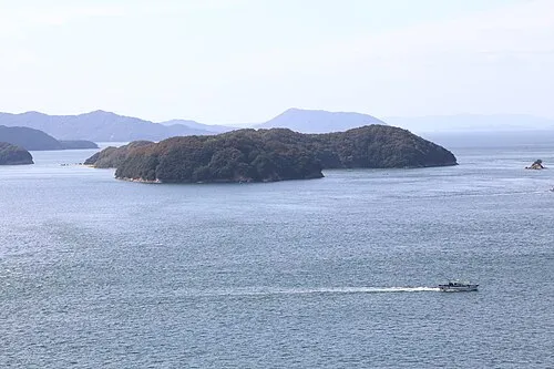 Mukai Jima Island, Kagawa23 km N
-
Great Seto Bridge Landmark, Japan23 km N
Sources & licences
Data last updated: · 2 independent sources