- Population
- 38,481
- 38.5K
- Elevation
- 145 m
- above sea level
- Local time
- UTC+09:00
- Asia/Tokyo · UTC+09:00
- Places inside
- 2
- listed under Minamikyushu Shi
- Airports
- KOJ Kagoshima Airport58 km
- TNE New Tanegashima Airport97 km
About Minamikyushu Shi
Minamikyushu Shi is a district. Location: Kagoshima, Japan. Population: 38,481.
Minamikyūshū (南九州市, Minamikyūshū-shi; lit. "South Kyushu City") is a city in Kagoshima Prefecture, Japan. As of 30 June 2024, the city had an estimated population of 31,666 in 16189 households, and a population density of 180 persons per km2. The total area of the city is 357.91 km2 (138.19 sq mi).
Source: Wikipedia · CC BY-SA 4.0
Places bordering Minamikyushu Shi
- Kagoshima
- Makurazaki
- Ibusuki
- Minamisatsuma Shi
Twin towns and sister cities of Minamikyushu Shi
- Hirakawa· Japan
Source: Wikidata. Only places with a page on this site are shown.
Population of Minamikyushu Shi over time
| 2010 | 39,065 | |
|---|---|---|
| 2015 | 36,352 | |
| 2021 | 33,115 |
Censuses and official estimates; source: Wikidata.
Climate of Minamikyushu Shi
Best months for sightseeingBest months for sightseeing: May–June, October.
This month · November
Outside the best season
Day 18° · Night 10° · Rain 99 mm
Better nearby cities in November
- Kagoshima · 27 km northeast19°
- Kanoya · 40 km east19°
- Kirishima · 54 km northeast19°
- Hottest month
- August (day 30°)
- Coldest month
- January (night 2°)
- Wettest month
- June (426 mm)
- Driest month
- December (90 mm)
Bars: average monthly low and high temperature. Below: precipitation. Monthly averages for 1970–2000 at about 18 km resolution, adjusted for elevation. Highlighted months are mild and relatively dry. Source: WorldClim 2.1 (CC BY 4.0).
Show values as a table
| Month | Jan | Feb | Mar | Apr | May | Jun | Jul | Aug | Sep | Oct | Nov | Dec |
|---|---|---|---|---|---|---|---|---|---|---|---|---|
| Average high (°C) | 11° | 12° | 15° | 20° | 23° | 26° | 29° | 30° | 28° | 23° | 18° | 13° |
| Average low (°C) | 2° | 3° | 7° | 11° | 15° | 19° | 23° | 23° | 20° | 15° | 10° | 4° |
| Precipitation (mm) | 97 | 118 | 166 | 223 | 261 | 426 | 317 | 222 | 218 | 118 | 99 | 90 |
How to get to Minamikyushu Shi
The nearest airport is Kagoshima Airport (KOJ), 58 km to the northeast as the crow flies. The nearest large city is Kagoshima, 27 km to the northeast.
Airports
- Kagoshima Airport (KOJ) Kagoshima 58 kmnortheast
- New Tanegashima Airport (TNE) Tanegashima 97 kmsoutheast
- Yakushima Airport (KUM) Yakushima 108 kmsouth
Nearby large cities
- Kagoshima Population: 595K 27 kmnortheast
- Kanoya Population: 101.1K 40 kmeast
- Kirishima Population: 123.2K 54 kmnortheast
- Miyakonojō Population: 161.1K 74 kmnortheast
- Miyazaki Population: 401.3K 113 kmnortheast
Straight-line distances; road distances are longer. Airport data: OurAirports.
Places in Minamikyushu Shi
2 placesBar: population relative to the most populous place in this list.
Cities & villages1
- Chiran · Village
Nearby attractions & nature
Everything nearby-
 Satsuma Peninsula Natural site, Kagoshima8.7 km N
-
 Kaimondake Volcano Mountain, Kagoshima20 km SE
-
Lake Ikeda Lake, Kagoshima17 km SE
-
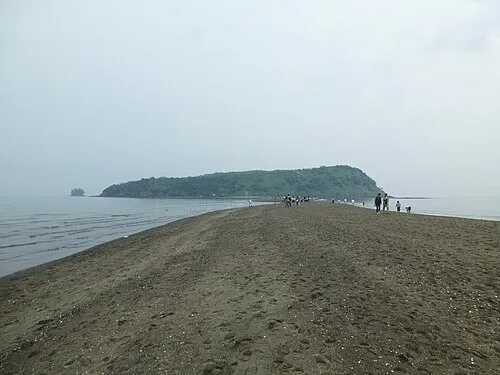 Chiringa Shima Island, Kagoshima24 km E
-
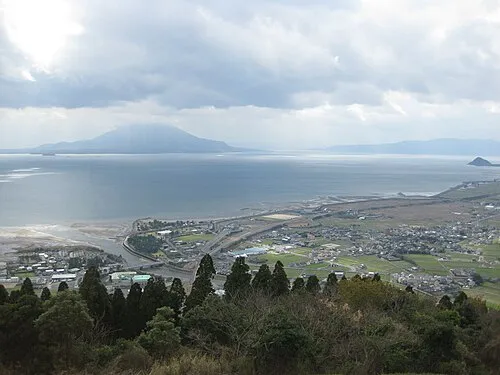 Kagoshima Wan Natural site, Kagoshima21 km NE
Sources & licences
Data last updated: · 2 independent sources