- Population
- 33,080
- 33.1K
- Elevation
- 160 m
- above sea level
- Local time
- UTC+09:00
- Asia/Tokyo · UTC+09:00
- Airports
- KOJ Kagoshima Airport56 km
- TNE New Tanegashima Airport97 km
About Minamikyushu
Minamikyushu is a city. Location: Minamikyushu Shi, Kagoshima. Population: 33,080. Elevation: 160 m. The best months to visit are May–June, October. The nearest airport is Kagoshima Airport (56 km). Nearby sights include Satsuma Peninsula and Kaimondake Volcano.
Photos of Minamikyushu
-

Kaimondake Volcano alpsdake · Public domain -

Satsuma Peninsula っ · Public domain -
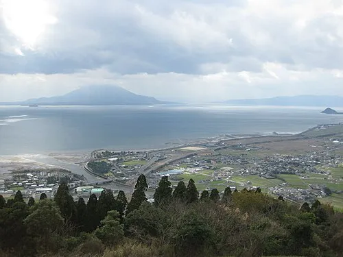
Kagoshima Wan Ray_go · CC BY-SA 3.0


Climate of Minamikyushu
Best months for sightseeingBest months for sightseeing: May–June, October.
This month · November
Outside the best season
Day 18° · Night 9° · Rain 99 mm
Better nearby cities in November
- Kagoshima · 26 km north19°
- Kanoya · 38 km east19°
- Kirishima · 53 km northeast19°
- Hottest month
- August (day 30°)
- Coldest month
- January (night 2°)
- Wettest month
- June (426 mm)
- Driest month
- December (90 mm)
Bars: average monthly low and high temperature. Below: precipitation. Monthly averages for 1970–2000 at about 18 km resolution, adjusted for elevation. Highlighted months are mild and relatively dry. Source: WorldClim 2.1 (CC BY 4.0).
Show values as a table
| Month | Jan | Feb | Mar | Apr | May | Jun | Jul | Aug | Sep | Oct | Nov | Dec |
|---|---|---|---|---|---|---|---|---|---|---|---|---|
| Average high (°C) | 11° | 12° | 15° | 20° | 23° | 26° | 29° | 30° | 27° | 23° | 18° | 13° |
| Average low (°C) | 2° | 3° | 6° | 11° | 15° | 19° | 23° | 23° | 20° | 15° | 9° | 4° |
| Precipitation (mm) | 97 | 118 | 166 | 223 | 261 | 426 | 317 | 222 | 218 | 118 | 99 | 90 |
How to get to Minamikyushu
The nearest airport is Kagoshima Airport (KOJ), 56 km to the northeast as the crow flies. The nearest large city is Kagoshima, 26 km to the north.
Airports
- Kagoshima Airport (KOJ) Kagoshima 56 kmnortheast
- New Tanegashima Airport (TNE) Tanegashima 97 kmsoutheast
- Yakushima Airport (KUM) Yakushima 108 kmsouth
Nearby large cities
- Kagoshima Population: 595K 26 kmnorth
- Kanoya Population: 101.1K 38 kmeast
- Kirishima Population: 123.2K 53 kmnortheast
- Miyakonojō Population: 161.1K 72 kmnortheast
- Miyazaki Population: 401.3K 111 kmnortheast
Straight-line distances; road distances are longer. Airport data: OurAirports.
Day trips from Minamikyushu
Within 100 km: 10 natural sites, 15 lakes, rivers and coasts.
0–25 km5 places
- Lake Ikeda Lake 16 kmSE
- Kaimondake Volcano Mountain 20 kmS
- Satsuma Peninsula Natural site 9 kmNW
- Chiringa Shima Island 22 kmE
25–60 km5 places
- Take-shima Island 60 kmS
- Cape Sata Natural site 44 kmSE
- Sakura Jima Island 33 kmNE
- Sakurajima Mountain 33 kmNE
60–100 km15 places
- Ōsumi-shotō Island 86 kmS
- Tanega Shima Island 98 kmSE
- Kamikoshiki Jima Island 78 kmNW
- Kuro Shima Island 76 kmSW
Straight-line distances.
Nearby attractions & nature
Everything nearby-
Satsuma Peninsula Natural site, Kagoshima8.6 km NW
-
Kaimondake Volcano Mountain, Kagoshima20 km S
-
Lake Ikeda Lake, Kagoshima16 km SE
-
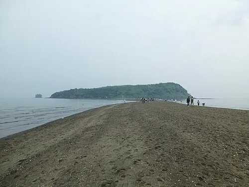 Chiringa Shima Island, Kagoshima22 km E
-
Kagoshima Wan Natural site, Kagoshima19 km NE
Sources & licences
Data last updated: