- Elevation
- 142 m
- above sea level
- Local time
- UTC+09:00
- Asia/Tokyo · UTC+09:00
- Population
- 27,000
- 27K
- Airports
- TKN Tokunoshima Airport10 km
- OKE Okinoerabu Airport45 km
About Tokunoshima Island
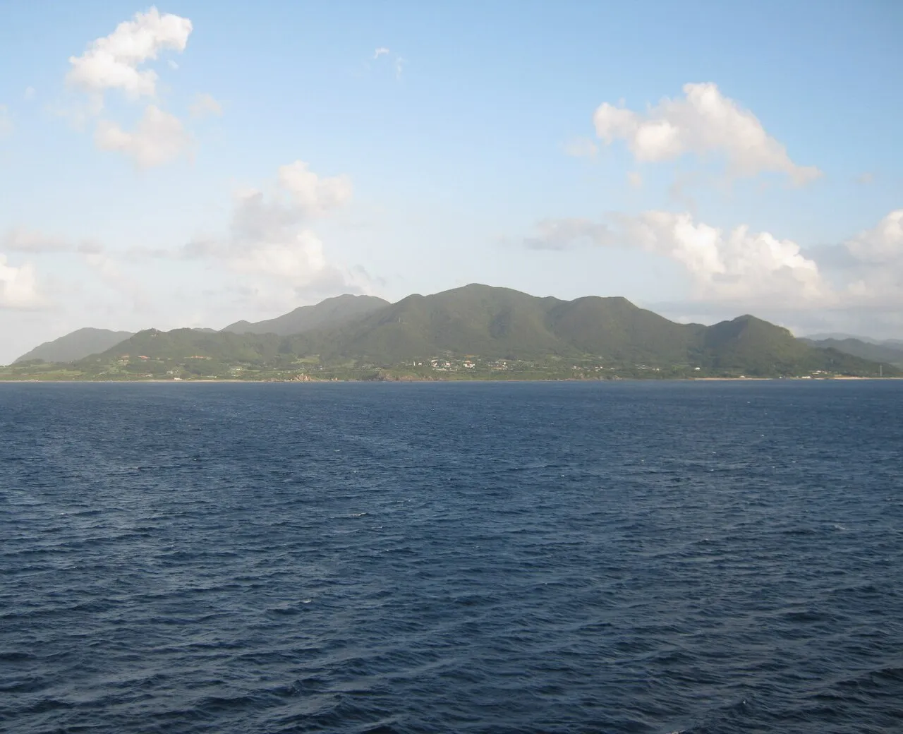
Tokunoshima Island is an island. Location: Kagoshima, Japan. Population: 27,000.
Tokunoshima (Japanese: 徳之島; Tokunoshima: Tukunushima), or Tokuno Island, is an island in the Amami archipelago of the southern Satsunan Islands of Kagoshima Prefecture, Japan. The island has a population of approximately 27,000 in an area od 247.85 km2 (95.70 sq mi). The island is divided into three administrative towns: Tokunoshima, Isen, and Amagi. The largest population centre on the island is the town of Kametsu, located along the eastern shore of the island within the administrative town of Tokunoshima.
Source: Wikipedia · CC BY-SA 4.0
At a glance
- Heritage designation
- part of UNESCO World Heritage Site
- Length
- 25 km
- Area
- 248 km²
Source: Wikidata
Climate of Tokunoshima Island
Best months for sightseeingBest months for sightseeing: March–May, October–December.
This month · November
A good month to visit
Day 23° · Night 18° · Rain 164 mm
- Hottest month
- July (day 31°)
- Coldest month
- January (night 12°)
- Wettest month
- June (315 mm)
- Driest month
- December (118 mm)
Bars: average monthly low and high temperature. Below: precipitation. Monthly averages for 1970–2000 at about 18 km resolution, adjusted for elevation. Highlighted months are mild and relatively dry. Source: WorldClim 2.1 (CC BY 4.0).
Show values as a table
| Month | Jan | Feb | Mar | Apr | May | Jun | Jul | Aug | Sep | Oct | Nov | Dec |
|---|---|---|---|---|---|---|---|---|---|---|---|---|
| Average high (°C) | 17° | 18° | 20° | 23° | 25° | 28° | 31° | 30° | 29° | 26° | 23° | 19° |
| Average low (°C) | 12° | 12° | 14° | 17° | 20° | 23° | 26° | 26° | 24° | 22° | 18° | 14° |
| Precipitation (mm) | 130 | 139 | 167 | 229 | 268 | 315 | 205 | 212 | 173 | 167 | 164 | 118 |
Other places to visit in this season: March April May October November December
How to get to Tokunoshima Island
The nearest airport is Tokunoshima Airport (TKN), 10 km to the northwest as the crow flies. The nearest large city is Uruma, 189 km to the southwest.
Airports
- Tokunoshima Airport (TKN) Amagi 10 kmnorthwest
- Okinoerabu Airport (OKE) Wadomari 45 kmsouthwest
- Yoron Airport (RNJ) Yoron 97 kmsouthwest
Nearby large cities
- Uruma Population: 125.3K 189 kmsouthwest
- Okinawa Population: 142.8K 196 kmsouthwest
- Ginowan Population: 100.1K 205 kmsouthwest
- Urasoe Population: 115.7K 207 kmsouthwest
- Naha Population: 317.6K 214 kmsouthwest
Straight-line distances; road distances are longer. Airport data: OurAirports.
Nearest towns and villages
-
Tokunoshima Chō Municipality, Ōshima-gun3.2 km NE
-
Amaki Municipality, Ōshima-gun4.4 km NW
-
Isen Chō Municipality, Ōshima-gun8.1 km S
-
Amagi Town, Amaki6.8 km NW
-
Isen Town, Isen Chō11 km S
-
Wadomari Town Municipality, Ōshima-gun51 km SW
More lakes, rivers and coasts in Japan
-
 Yoro Jima Island, Kagoshima36 km NE
-
 Uke Island Island, Kagoshima40 km NE
-
 Okinoerabujima Island Island, Ōshima-gun55 km SW
-
 Amami Ōshima Island, Kagoshima65 km NE
-
 Amami Islands Island, Kagoshima67 km NE
-
Sukomo Banare Island, Kagoshima44 km NE
Sources & licences
Data last updated: · 2 independent sources