- Population
- 7,061
- 7.1K
- Elevation
- 43 m
- above sea level
- Local time
- UTC+09:00
- Asia/Tokyo · UTC+09:00
- Airports
- OIM Oshima Airport46 km
- HND Tokyo Haneda International Airport74 km
About Manazuru
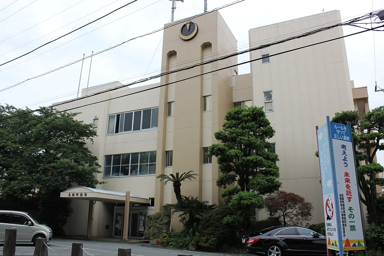
Manazuru is a town. Location: Manazuru Machi, Ashigarashimo-gun. Population: 7,061. Elevation: 43 m.
Manazuru (真鶴町, Manazuru-machi) is a town located in Kanagawa Prefecture, Japan. As of 1 June 2022, the town had an estimated population of 6,949 and a population density of 1000 persons per km2. The total area of the town is 7.02 square kilometres (2.71 sq mi).
Source: Wikipedia · CC BY-SA 4.0
Photos of Manazuru
-

m-louis .® from Osaka, Japan · CC BY-SA 2.0 -

m-louis .® from Osaka, Japan · CC BY-SA 2.0 -

m-louis .® from Osaka, Japan · CC BY-SA 2.0


Travel notes for Manazuru
From Wikivoyage
Manazuru (真鶴) is a coastal resort in Kanagawa prefecture, on the east coast of the Izu Peninsula southwest of Tokyo, Japan, near Hakone, Odawara, Atami and Yugawara.
Understand+
Manazuru is a production center of high-quality stone which is long ago Komatsu Ishi. The name of the town was named because the shape on the map is similar to crane.
Quarries are abundant in the mountain north of the city area. Hills along the northern coast are cultivated Mikan.
The northwestern part of the town is a part of the mountainous region that continues to the outer ring of Hakone volcano.
The majority of the town area is a mountainous area and the flat area is poor, but the mountain foot of Hakone volcano is used as a mikan garden. It is said that the view from the slope where Hakone is to the north and Sagami Bay to the south is closely resembles the Mediterranean coast of France, Italy, and it is called Japanese Riviera.
The Kataura area of the adjacent Odawara is also called "Oriental Riviera".
1 Manazurucho Sight Seeing Information Center, Manatsuru 894-1, ☏ +81 465-68-2543. Tourist information available. (updated Sep 2023)
Tourist information site:
The local tourist association has a Japanese-only guide site.
Get in+
By plane:
You can reach Manazuru Station from one of Tokyo's two airports. From Narita Airport, take the Narita Express train to Shinagawa, then transfer to either a Shinkansen Kodama train or a Tokaido Line local train. It is 2 hours via shinkansen connection and 3 hours via local connection.
From Haneda Airport, take a Keihin Kyuko line train to Shinagawa for connection to the Shinkansen and change at Yokohama for the local JR Tokaido line.
Alternatively you can take the Keikyu Line from Haneda to Yokohama via Keikyu-Kamata station and change at Yokohama for the local JR Tokaido line.
By train:
The fastest and most expensive method of reaching Manazuru from Tokyo is to take a Tokaido Shinkansen Kodama (こだま) train from Tokyo to Odawara, then transfer to the local JR Tokaido line for the run to Atami, Numazu. The one-way fare starts from ¥3390 for unreserved seating, but with a Japan Rail Pass you need only to pay ¥240 for the local JR Tokaido line - easily done with a Suica or PASMO card. With a good connection, the trip takes one hour.
Be aware that the JR East Rail Pass does not provide access to the Tokaido Shinkansen and to make use of this pass you will need to ride the regular Tokaido Main Line to Manazuru. From Tokyo, a convenient choice that is valid with the JR East Pass is the Odoriko limited express train service. These trains have bigger windows and better seating than the regular commuter trains, and seat reservations can be made. There are at least 3-4 runs during the day in either direction.
Source: Wikivoyage · CC BY-SA 4.0 · abridged
Places bordering Manazuru
- Odawara
- Yugawara
Twin towns and sister cities of Manazuru
- Azumino· Japan
Source: Wikidata. Only places with a page on this site are shown.
Population of Manazuru over time
| 2010 | 8,212 | |
|---|---|---|
| 2015 | 7,333 | |
| 2020 | 6,724 |
Censuses and official estimates; source: Wikidata.
Climate of Manazuru
Best months for sightseeingBest months for sightseeing: May–June, October.
This month · November
A wet month
Day 18° · Night 10° · Rain 108 mm
Better nearby cities in November
- Odawara · 12 km north19°
- Mishima · 21 km west18°
- Numazu · 25 km west18°
- Hottest month
- August (day 30°)
- Coldest month
- February (night 2°)
- Wettest month
- June (235 mm)
- Driest month
- December (58 mm)
Bars: average monthly low and high temperature. Below: precipitation. Monthly averages for 1970–2000 at about 18 km resolution, adjusted for elevation. Highlighted months are mild and relatively dry. Source: WorldClim 2.1 (CC BY 4.0).
Show values as a table
| Month | Jan | Feb | Mar | Apr | May | Jun | Jul | Aug | Sep | Oct | Nov | Dec |
|---|---|---|---|---|---|---|---|---|---|---|---|---|
| Average high (°C) | 11° | 11° | 14° | 19° | 23° | 25° | 29° | 30° | 27° | 22° | 18° | 14° |
| Average low (°C) | 3° | 2° | 5° | 10° | 15° | 18° | 22° | 23° | 20° | 15° | 10° | 5° |
| Precipitation (mm) | 65 | 80 | 137 | 155 | 165 | 235 | 184 | 227 | 233 | 179 | 108 | 58 |
How to get to Manazuru
The nearest airport is Oshima Airport (OIM), 46 km to the southeast as the crow flies. For international flights: Tokyo Haneda International Airport (HND) (74 km). The nearest large city is Odawara, 12 km to the north.
Airports
- Oshima Airport (OIM) Izu Oshima 46 kmsoutheast
- Tokyo Haneda International Airport (HND) Tokyo 74 kmnortheast
- Mount Fuji Shizuoka Airport (FSZ) Makinohara / Shimada 95 kmsouthwest
Nearby large cities
- Odawara Population: 188.9K 12 kmnorth
- Mishima Population: 107.9K 21 kmwest
- Hadano Population: 163.8K 25 kmnorth
- Numazu Population: 189.5K 26 kmwest
- Hiratsuka Population: 258.4K 26 kmnortheast
Straight-line distances; road distances are longer. Airport data: OurAirports.
Day trips from Manazuru
Within 100 km: 51 historic and cultural sites, 49 natural sites, 47 lakes, rivers and coasts.
0–25 km6 places
- Hatsu-shima Island 13 kmS
- Sakawa River River 12 kmN
- Tama Gawa River 8 kmN
- Hakone Yama Mountain 13 kmNW
25–60 km51 places
- Ō Shima Island 52 kmSE
- Jōga Shima Island 44 kmE
- Enoshima Island 35 kmNE
- Mount Echizen-dake Mountain 33 kmW
60–100 km90 places
- Nii-jima Island 87 kmS
- Shikine-jima Island 92 kmS
- To Shima Island 71 kmS
- Lake Shoji Lake 61 kmNW
Straight-line distances.
Nearby attractions & nature
Everything nearby-
Nangō San Mountain, Yugawara Machi4.1 km NW
-
Tama Gawa River, Kanagawa8.1 km N
-
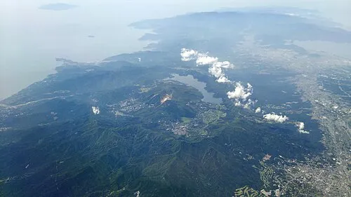 Hakone Yama Mountain, Japan13 km NW
-
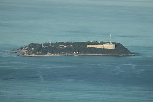 Hatsu-shima Island, Shizuoka13 km S
-
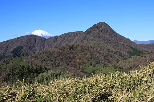 Kintoki Zan Mountain, Hakone-machi19 km NW
-
Sakawa River River, Kanagawa12 km N
Sources & licences
Data last updated: · 2 independent sources