
- Elevation
- 270 m
- above sea level
- Local time
- UTC+09:00
- Asia/Tokyo · UTC+09:00
- Airports
- ITM Osaka Itami International Airport25 km
- UKB Kobe Airport51 km
About Mount Tennōzan
Mount Tennōzan is a mountain. Location: Ōyamazaki Chō, Otokuni-gun. Elevation: 270 m.
Mount Tennō (天王山, Tennōzan), or Mount Tennōzan, is a mountain in Ōyamazaki, Kyoto, Japan. The name originates from a shrine on the mountain dedicated to Gozu Tennō, the ox-headed deity of disease and health.
Source: Wikipedia · CC BY-SA 4.0
Photos of Mount Tennōzan
-

mariemon · CC BY 3.0 -

mariemon · CC BY 3.0 -

投稿者が撮影 · CC BY 3.0 -

投稿者が撮影 · Public domain -
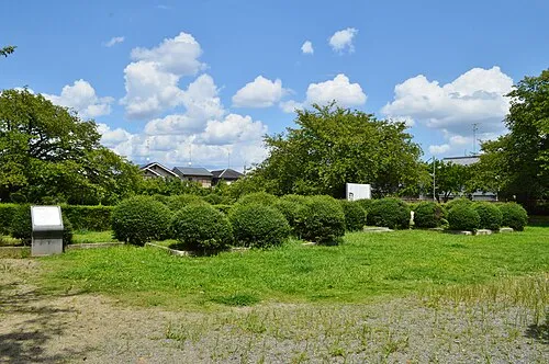
Nagaoka Saigen Jiro · CC0


Climate of Mount Tennōzan
Best months for sightseeingBest months for sightseeing: May–June, September–October.
This month · November
Outside the best season
Day 15° · Night 6° · Rain 73 mm
Better nearby cities in November
- Kochi · 248 km southwest18°
- Fujinomiya · 270 km east18°
- Fuji · 275 km east20°
- Hottest month
- August (day 31°)
- Coldest month
- January (night -1°)
- Wettest month
- June (229 mm)
- Driest month
- December (45 mm)
Bars: average monthly low and high temperature. Below: precipitation. Monthly averages for 1970–2000 at about 18 km resolution, adjusted for elevation. Highlighted months are mild and relatively dry. Source: WorldClim 2.1 (CC BY 4.0).
Show values as a table
| Month | Jan | Feb | Mar | Apr | May | Jun | Jul | Aug | Sep | Oct | Nov | Dec |
|---|---|---|---|---|---|---|---|---|---|---|---|---|
| Average high (°C) | 7° | 8° | 11° | 18° | 22° | 25° | 29° | 31° | 26° | 21° | 15° | 10° |
| Average low (°C) | -1° | -1° | 2° | 7° | 12° | 17° | 21° | 22° | 18° | 11° | 6° | 1° |
| Precipitation (mm) | 56 | 69 | 107 | 142 | 149 | 229 | 211 | 142 | 193 | 117 | 73 | 45 |
Other places to visit in this season: May June September October
How to get to Mount Tennōzan
The nearest airport is Osaka Itami International Airport (ITM), 25 km to the southwest as the crow flies. The nearest large city is Takatsuki, 8 km to the southwest.
Airports
- Osaka Itami International Airport (ITM) Osaka 25 kmsouthwest
- Kobe Airport (UKB) Kobe 51 kmsouthwest
- Kansai International Airport (KIX) Osaka 66 kmsouthwest
Nearby large cities
- Takatsuki Population: 354.5K 8 kmsouthwest
- Hirakata Population: 406.3K 10 kmsouth
- Uji Population: 192.9K 12 kmeast
- Ibaraki Population: 287.7K 14 kmsouthwest
- Neyagawa Population: 238.5K 16 kmsouth
Straight-line distances; road distances are longer. Airport data: OurAirports.
Day trips from Mount Tennōzan
Within 100 km: 30 historic and cultural sites, 45 natural sites, 26 lakes, rivers and coasts.
0–25 km28 places
- Nanzen-ji Attraction 16 kmNE
- Eikan-dō Attraction 17 kmNE
- National Museum of Modern Art, Kyoto Museum 16 kmNE
- Mount Hiei Mountain 23 kmNE
25–60 km32 places
- Mount Rokkō Mountain 40 kmW
- Mount Miwa Mountain 44 kmSE
- Mount Amanokagu Mountain 47 kmS
- Mount Miminashi Mountain 45 kmS
60–100 km41 places
- Awaji Island Island 96 kmSW
- Kumozu River River 85 kmE
- Mount Ōdaigahara Mountain 87 kmSE
- Mount Kunimi Mountain 81 kmSE
Straight-line distances.
Nearest towns and villages

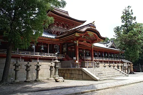

Nearby attractions & nature
Everything nearby-
Katsura River River, Japan2.6 km E
-
Yodo-gawa River, Japan3.6 km S
-
Nagaoka Historic site, Nagaokakyō Shi3.3 km NE
-
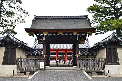 Kyoto Imperial Palace Natural site, Kamigyō Ku16 km NE
-
 Kamo River River, Japan10 km NE
-
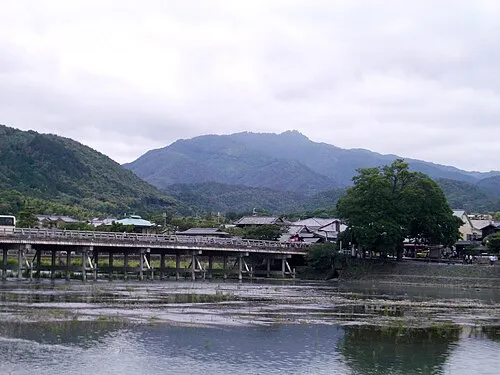 Mount Atago Mountain, Ukyō District19 km N
-
 Mount Hiei Mountain, Sakyō Ku23 km NE
-
 Saiho-ji Attraction, Nishi-kyō Ku10 km N
Sources & licences
Data last updated: · 2 independent sources