- Population
- 15,597
- 15.6K
- Elevation
- 33 m
- above sea level
- Local time
- UTC+09:00
- Asia/Tokyo · UTC+09:00
- Places inside
- 1
- listed under Tamaki
- Airports
- NGO Chubu Centrair International Airport45 km
- NKM Nagoya Airport / JASDF Komaki Air Base90 km
About Tamaki
Tamaki is a municipality. Location: Watarai, Mie. Population: 15,597. Elevation: 33 m. The best months to visit are May–June, September–October. The nearest airport is Chubu Centrair International Airport (45 km). Nearby sights include Miya River and Isuzu River.
Climate of Tamaki
Best months for sightseeingBest months for sightseeing: May–June, September–October.
Bars: average monthly low and high temperature. Below: precipitation. Monthly averages for 1970–2000 at about 18 km resolution, adjusted for elevation. Highlighted months are mild and relatively dry. Source: WorldClim 2.1 (CC BY 4.0).
Show values as a table
| Month | Jan | Feb | Mar | Apr | May | Jun | Jul | Aug | Sep | Oct | Nov | Dec |
|---|---|---|---|---|---|---|---|---|---|---|---|---|
| Average high (°C) | 10° | 10° | 13° | 18° | 22° | 25° | 29° | 30° | 27° | 22° | 17° | 12° |
| Average low (°C) | 1° | 1° | 4° | 9° | 14° | 18° | 23° | 23° | 20° | 14° | 8° | 3° |
| Precipitation (mm) | 58 | 81 | 134 | 184 | 181 | 277 | 231 | 228 | 299 | 207 | 116 | 59 |
Other places to visit in this season: May June September October
Airports nearest to Tamaki
- Chubu Centrair International Airport (NGO) Tokoname 45 km
- Nagoya Airport / JASDF Komaki Air Base (NKM) Nagoya 90 km
- Osaka Itami International Airport (ITM) Osaka 113 km
Straight-line distance; airports with scheduled flights only. Source: OurAirports (public domain).
Places in Tamaki
1 placeBar: population relative to the most populous place in this list.
Nearby attractions & nature
Everything nearby-
Miya River River, Japan12 km NE
-
Isuzu River River, Japan12 km E
-
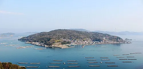 Sakate-jima Island, Japan22 km E
-
 Tōshi-jima Island, Japan25 km E
-
Kushida River River, Japan14 km N
-
Kumozu River River, Japan19 km N
Sources & licences
Data last updated: