- Elevation
- 1,405 m
- above sea level
- Local time
- UTC+09:00
- Asia/Tokyo · UTC+09:00
- Airports
- KMI Miyazaki Airport47 km
- KMJ Kumamoto Airport80 km
About Mount Osuzu
Mount Osuzu is a mountain. Location: Tsuno Chō, Kōyu-gun. Elevation: 1,405 m. The best months to visit are July–September. The nearest airport is Miyazaki Airport (47 km).
Climate of Mount Osuzu
Best months for sightseeingBest months for sightseeing: July–September.
This month · November
A cold month
Day 9° · Night 1° · Rain 92 mm
Better nearby cities in November
- Nobeoka · 39 km northeast18°
- Miyazaki · 43 km south19°
- Miyakonojō · 71 km southwest18°
- Hottest month
- August (day 21°)
- Coldest month
- January (night -7°)
- Wettest month
- June (457 mm)
- Driest month
- December (56 mm)
Bars: average monthly low and high temperature. Below: precipitation. Monthly averages for 1970–2000 at about 18 km resolution, adjusted for elevation. Highlighted months are mild and relatively dry. Source: WorldClim 2.1 (CC BY 4.0).
Show values as a table
| Month | Jan | Feb | Mar | Apr | May | Jun | Jul | Aug | Sep | Oct | Nov | Dec |
|---|---|---|---|---|---|---|---|---|---|---|---|---|
| Average high (°C) | 2° | 3° | 6° | 11° | 14° | 17° | 21° | 21° | 18° | 14° | 9° | 4° |
| Average low (°C) | -7° | -6° | -3° | 3° | 7° | 11° | 15° | 15° | 12° | 7° | 1° | -5° |
| Precipitation (mm) | 67 | 103 | 172 | 236 | 285 | 457 | 408 | 327 | 297 | 165 | 92 | 56 |
How to get to Mount Osuzu
The nearest airport is Miyazaki Airport (KMI), 47 km to the south as the crow flies. The nearest large city is Nobeoka, 39 km to the northeast.
Airports
- Miyazaki Airport (KMI) Miyazaki 47 kmsouth
- Kumamoto Airport (KMJ) Kumamoto 80 kmnorthwest
- Kagoshima Airport (KOJ) Kagoshima 86 kmsouthwest
Nearby large cities
- Nobeoka Population: 119.5K 39 kmnortheast
- Miyazaki Population: 401.3K 42 kmsouth
- Miyakonojō Population: 161.1K 71 kmsouthwest
- Honmachi Population: 123.1K 81 kmwest
- Kirishima Population: 123.2K 88 kmsouthwest
Straight-line distances; road distances are longer. Airport data: OurAirports.
Day trips from Mount Osuzu
Within 100 km: 2 historic and cultural sites, 9 natural sites, 8 lakes, rivers and coasts.
0–25 km1 place
- Mimigawa River River 19 kmE
25–60 km6 places
- Kyūshū Island 43 kmW
- Ao Shima Island 55 kmS
- Ooyodo River River 45 kmS
- Mount Ōkueyama Mountain 49 kmN
60–100 km12 places
- Kō Shima Island 94 kmS
- Hi Kawa River 82 kmNW
- Ōyano Jima Island 99 kmW
- Kuma River River 83 kmW
Straight-line distances.
Nearest towns and villages
-
Kijō Chō Municipality, Kōyu-gun6.6 km SW
-
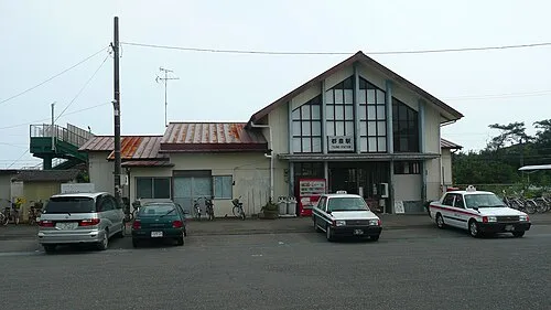 Tsunō Town, Tsuno Chō14 km E
-
Kawaminami Chō Municipality, Kōyu-gun12 km SE
-
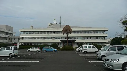 Kawaminami Town, Kawaminami Chō15 km SE
-
Misato Chō Municipality, Higashiusuki-gun16 km N
-
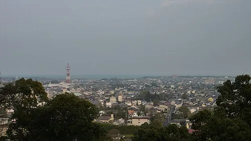 Takanabe Town, Takanabe Chō20 km S
Sources & licences
Data last updated: · 2 independent sources