Itoigawa
Local name: 糸魚川市
Located in Itoigawa Shi, Niigata Coordinates: 37°02′00″ N 137°51′00″ E
- Population
- 40,765
- 40.8K
- Elevation
- 15 m
- above sea level
- Local time
- UTC+09:00
- Asia/Tokyo · UTC+09:00
- Airports
- TOY Toyama Kitokito Airport73 km
- NTQ Noto Satoyama Airport84 km
About Itoigawa
Itoigawa is a city. Location: Itoigawa Shi, Niigata. Population: 40,765. Elevation: 15 m.
Itoigawa (糸魚川市, Itoigawa-shi; Japanese pronunciation: [ì.tó̞.í.ɡä̀.β̞ä̀, -tó̞ì.ɡä̀.β̞ä̀, -ŋä̀.β̞ä̀, -tó̞í.ɡä́.β̞ä́.ɕì, -ŋä́.β̞ä́-]) is a city located in Niigata Prefecture, Japan. As of 1 September 2024, the city had an estimated population of 38,224 living in 17,028 households, and a population density of 51 persons per km2. The total area of the city is 746.24 square kilometres (288.12 sq mi).
Source: Wikipedia · CC BY-SA 4.0
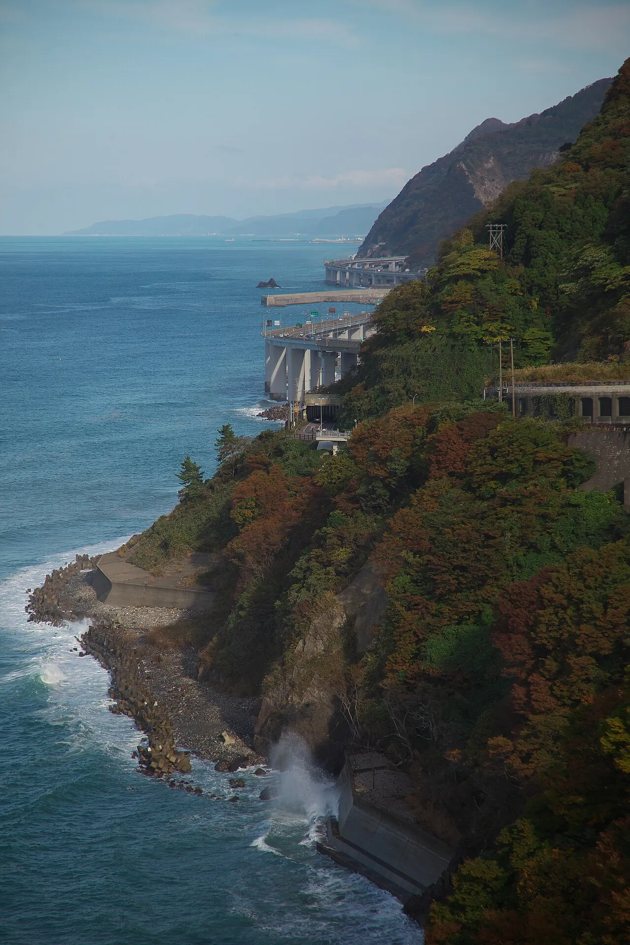
Photos of Itoigawa
-

くろふね · CC BY-SA 4.0 -

のりまき · CC BY 3.0 -

のりまき · CC BY 3.0 -

のりまき · CC BY 3.0 -

のりまき · CC BY 3.0


Travel notes for Itoigawa
From Wikivoyage
Itoigawa (糸魚川) is a city at the far southwestern corner of Niigata Prefecture, Japan.
Understand+
Itoigawa (or more specifically Oyashirazu, in the west of the city) is situated at the northern terminus of the Itoigawa-Shizuoka Tectonic Line, a fault line geologically separating North-Eastern and South-Western Japan.
Itoigawa is home to the Itoigawa Geopark.
Tourist Information Site:
The local tourist association maintains an English guide site, Discover ITOIGAWA.
Get in+
By plane:
The nearest airport is Toyama, which is a little over an hour away by car. By public transport, take the bus to Toyama Station and change there to the train (see below).
By train:
The main way into Itoigawa is the Hakutaka service on the Hokuriku Shinkansen. Times and prices are as follows:
Tokyo: 2 hr 10 min, ¥10,800
Takasaki: 1 hr 20 min, ¥8110
Karuizawa: 1 hr 5 min, ¥6580
Nagano: 40 min, ¥4470
Toyama: 26 min, ¥3480
Kanazawa: 50 min, ¥5180
Trains connect at Kanazawa to Limited Express trains (Thunderbird towards Osaka, Shirasagi towards Maibara and Nagoya):
Komatsu: 1 hr 15 min, ¥6030
Fukui: 1 hr 45 min, ¥7330
Tsuruga: 2 hr 20 min, ¥8730
Maibara (Shirasagi): 2 hr 50 min, ¥9550
Gifu (Shirasagi): 3 hr 40 min, ¥10,200
Nagoya (Shirasagi): 4 hr, ¥10,740
Kyoto (Thunderbird): 3 hr 40 min, ¥10,200
Osaka (Thunderbird): 4 hr, ¥10,740
From Nagoya, a better route is to take the Shinano Limited Express to Nagano and change there; this takes about 4 hours and costs ¥10,100.
When the Shinkansen opened in 2015, the Hokuriku Main Line through Itoigawa was transferred to the new non-JR Echigo Tokimeki Railway and became its Nihonkai-Hisui Line. While it offers a few direct trains to Toyama and Kanazawa, most services require a change at Tomari. Taking this line, Toyama is 2 hours and ¥1520 away, and Kanazawa is 3 hr 20 min and ¥2830 away.
From Niigata, the best way to Itoigawa is to take one of the five Shirayuki Limited Express trains a day to Jōetsu-Myōkō, where you can change to the Shinkansen; this takes about 2 hr 30 min and ¥6700. Japan Rail Pass users will have to pay ¥450 to travel on the non-JR section between Naoetsu and Jōetsu-Myōkō. Those who do not have a rail pass may wish to change at Naoetsu to the Nihonkai-Hisui Line; this takes 2 hr 40 min and ¥5090.
Source: Wikivoyage · CC BY-SA 4.0 · abridged
Places bordering Itoigawa
- Jōetsu
- Myoko-shi
- Hakuba
- Otari Mura
- Asahi Machi
Twin towns and sister cities of Itoigawa
- Shiojiri-shi· Japan
Source: Wikidata. Only places with a page on this site are shown.
Population of Itoigawa over time
| 2010 | 47,702 | |
|---|---|---|
| 2015 | 44,162 | |
| 2021 | 40,200 |
Censuses and official estimates; source: Wikidata.
Climate of Itoigawa
Best months for sightseeingBest months for sightseeing: May–June, September–October.
This month · November
A wet month
Day 14° · Night 6° · Rain 191 mm
Better nearby cities in November
- Kofu · 165 km southeast17°
- Fujinomiya · 213 km south18°
- Fuji · 221 km south20°
- Hottest month
- August (day 30°)
- Coldest month
- February (night -2°)
- Wettest month
- January (234 mm)
- Driest month
- April (94 mm)
Bars: average monthly low and high temperature. Below: precipitation. Monthly averages for 1970–2000 at about 18 km resolution, adjusted for elevation. Highlighted months are mild and relatively dry. Source: WorldClim 2.1 (CC BY 4.0).
Show values as a table
| Month | Jan | Feb | Mar | Apr | May | Jun | Jul | Aug | Sep | Oct | Nov | Dec |
|---|---|---|---|---|---|---|---|---|---|---|---|---|
| Average high (°C) | 5° | 5° | 9° | 16° | 21° | 25° | 29° | 30° | 26° | 20° | 14° | 9° |
| Average low (°C) | -1° | -2° | 1° | 6° | 11° | 16° | 21° | 22° | 18° | 11° | 6° | 1° |
| Precipitation (mm) | 234 | 156 | 128 | 94 | 100 | 149 | 186 | 139 | 200 | 157 | 191 | 231 |
Other places to visit in this season: May June September October
How to get to Itoigawa
The nearest airport is Toyama Kitokito Airport (TOY), 73 km to the southwest as the crow flies. The nearest large city is Jōetsu, 37 km to the east.
Airports
- Toyama Kitokito Airport (TOY) Toyama 73 kmsouthwest
- Noto Satoyama Airport (NTQ) Wajima 84 kmwest
- Shinshu-Matsumoto Airport (MMJ) Matsumoto 96 kmsouth
Nearby large cities
- Jōetsu Population: 189.4K 37 kmeast
- Nagano Population: 372.8K 52 kmsoutheast
- Toyama Population: 415.8K 68 kmsouthwest
- Ueda Population: 157.5K 80 kmsoutheast
- Takaoka Population: 170.1K 81 kmsouthwest
Straight-line distances; road distances are longer. Airport data: OurAirports.
Day trips from Itoigawa
Within 100 km: 2 historic and cultural sites, 36 natural sites, 13 lakes, rivers and coasts.
0–25 km2 places
- Mount Amakazari Mountain 18 kmSE
- Mount Hiuchi Mountain 23 kmSE
25–60 km15 places
- Kurobe River River 40 kmW
- Arakawa River River 39 kmNE
- Takada castle Historic site 37 kmE
- Lake Kizaki Lake 52 kmS
60–100 km34 places
- Noto Jima Island 77 kmW
- Mount Sekidō Mountain 79 kmW
- Toyama-wan Natural site 65 kmW
- Sho River River 74 kmW
Straight-line distances.
Nearby attractions & nature
Everything nearby-
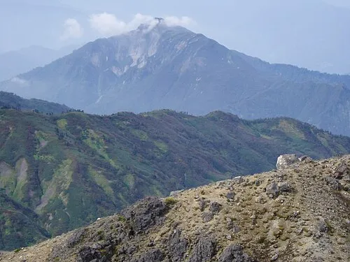 Mount Amakazari Mountain, Itoigawa Shi18 km SE
-
 Mount Hiuchi Mountain, Myoko-shi23 km SE
Sources & licences
Data last updated: · 2 independent sources