Awashima Island
Local name: 粟島
Located in Awashimaura Mura, Iwafune-gun Coordinates: 38°27′50″ N 139°14′31″ E
- Elevation
- 146 m
- above sea level
- Local time
- UTC+09:00
- Asia/Tokyo · UTC+09:00
- Population
- 265
- 265
- Airports
- KIJ Niigata Airport58 km
- SYO Shonai Airport61 km
About Awashima Island
Awashima Island is an island. Location: Awashimaura Mura, Iwafune-gun. Population: 265.
Awashima (粟島) is an island in the Sea of Japan. The island is located approximately 30 kilometres (19 mi) west of the city of Murakami in northern Niigata Prefecture. Awashima is administratively the village of Awashimaura under Iwafune District of Niigata Prefecture. As of 2020, the island's population is 353.
Source: Wikipedia · CC BY-SA 4.0
At a glance
- Area
- 9.7 km²
Source: Wikidata
Travel notes for Awashima Island
From Wikivoyage
Awashima (粟島) is an island in northern Niigata with 365 inhabitants, the island has two main settlements: Uchiura (内浦) on the east coast and Kamaya (釜谷) on the west coast. The island lies far off the beaten path for both international and domestic tourists but has many nice beaches and can provide an escape from the urban centres of Tokyo and Osaka. The island is administered as a municipality, Awashimaura Village (粟島浦村).
Understand+
First settled in the Jomon Period, Awashima was long the last frontier for many of Japan's northern clans and inhabited by the Emishi, an ethnic group comprised of non-Yamato and Ainu people. The Emishi were slowly pushed out by pirates and traders, causing Awashima to become a hub for trade heading to Tohoku. Awashima was also greatly impacted by the 1964 Niigata earthquake, as many structures were destroyed due to the subsequent flooding. Now Awashima is an Important Birding Area and its economy is centred around seasonal tourism and fishing, leading to its reputation for fresh fish. Like most rural areas in Japan, its population is declining.
Tourist information:
1 Awashima Information Centre (粟島観光案内所) (Turn left at the first intersection from the port, 100-meter walk), ☏ +81 254552146. Tourist information centre on island's east side, bike rentals (updated Aug 2021)
The local tourist association has a Japanese-only guide site.
Get in+
The only way to access Awashima is by ferry or catamaran from Iwafune in Murakami. They depart regularly and are operated by Awashimakisan ☏ +81 254-55-2131. The journey by high-speed catamaran takes 60 minutes and costs ¥3860 for adults and ¥1940 for children, the slower ferry costs ¥1910 for adults and ¥960 for children, the journey takes 85 minutes. 1 Awashima's port is in the centre of Uchiura and the rest of the island is accessible from there.
Source: Wikivoyage · CC BY-SA 4.0 · abridged
Climate of Awashima Island
Best months for sightseeingBest months for sightseeing: June–July, September.
This month · November
A wet month
Day 13° · Night 7° · Rain 235 mm
Better nearby cities in November
- Kofu · 317 km south17°
- Isehara · 341 km south18°
- Odawara · 357 km south19°
- Hottest month
- August (day 28°)
- Coldest month
- February (night 1°)
- Wettest month
- December (268 mm)
- Driest month
- May (109 mm)
Bars: average monthly low and high temperature. Below: precipitation. Monthly averages for 1970–2000 at about 18 km resolution, adjusted for elevation. Highlighted months are mild and relatively dry. Source: WorldClim 2.1 (CC BY 4.0).
Show values as a table
| Month | Jan | Feb | Mar | Apr | May | Jun | Jul | Aug | Sep | Oct | Nov | Dec |
|---|---|---|---|---|---|---|---|---|---|---|---|---|
| Average high (°C) | 6° | 5° | 7° | 13° | 17° | 21° | 26° | 28° | 24° | 18° | 13° | 8° |
| Average low (°C) | 1° | 1° | 1° | 6° | 11° | 16° | 20° | 21° | 18° | 13° | 7° | 4° |
| Precipitation (mm) | 213 | 154 | 130 | 113 | 109 | 132 | 196 | 155 | 191 | 184 | 235 | 268 |
How to get to Awashima Island
The nearest airport is Niigata Airport (KIJ), 58 km to the south as the crow flies. The nearest large city is Tsuruoka, 58 km to the northeast.
Airports
- Niigata Airport (KIJ) Niigata 58 kmsouth
- Shonai Airport (SYO) Shonai 61 kmnortheast
- Sado Airport (SDS) Sado 85 kmsouthwest
Nearby large cities
- Tsuruoka Population: 125.4K 58 kmnortheast
- Sakata Population: 100.3K 73 kmnortheast
- Yamagata Population: 248.8K 102 kmeast
- Nagaoka Population: 266.9K 118 kmsouth
- Aizu-Wakamatsu Population: 118.2K 124 kmsoutheast
Straight-line distances; road distances are longer. Airport data: OurAirports.
Day trips from Awashima Island
Within 100 km: 11 natural sites, 7 lakes, rivers and coasts.
25–60 km2 places
- Shinano River River 59 kmS
- Agano River River 57 kmS
60–100 km16 places
- Sado Island Island 89 kmSW
- Tobi Shima Island 86 kmN
- Mount Gassan Mountain 69 kmE
- Mount Kongō Mountain 79 kmSW
Straight-line distances.
Nearest towns and villages
-
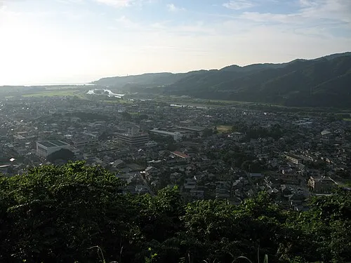 Murakami City, Murakami Shi33 km SE
-
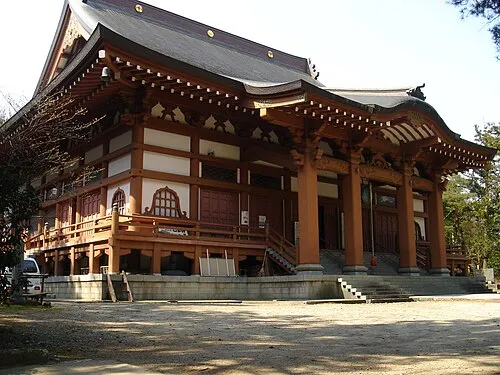 Tainai City, Tainai Shi47 km S
-
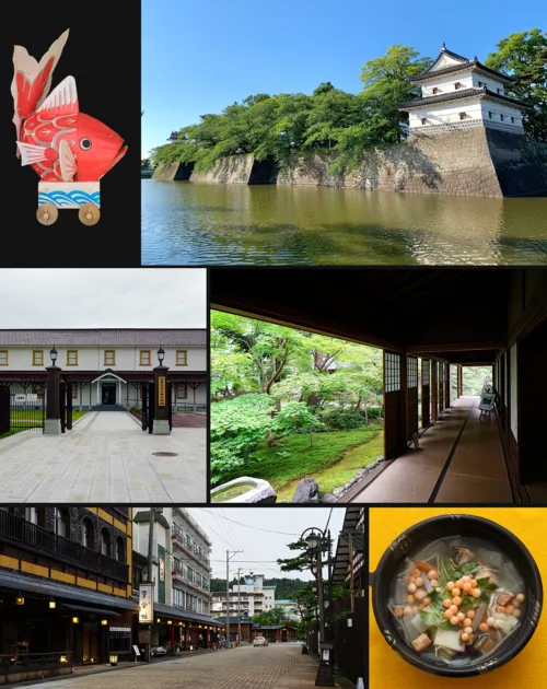 Shibata City, Shibata Shi58 km S
-
 Seirō Machi Municipality, Kitakambara-gun53 km S
-
 Sekikawa Mura Municipality, Iwafune-gun54 km SE
-
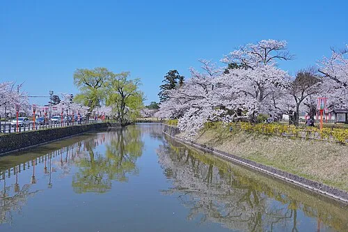 Tsuruoka City, Tsuruoka Shi58 km NE
Sources & licences
Data last updated: · 2 independent sources