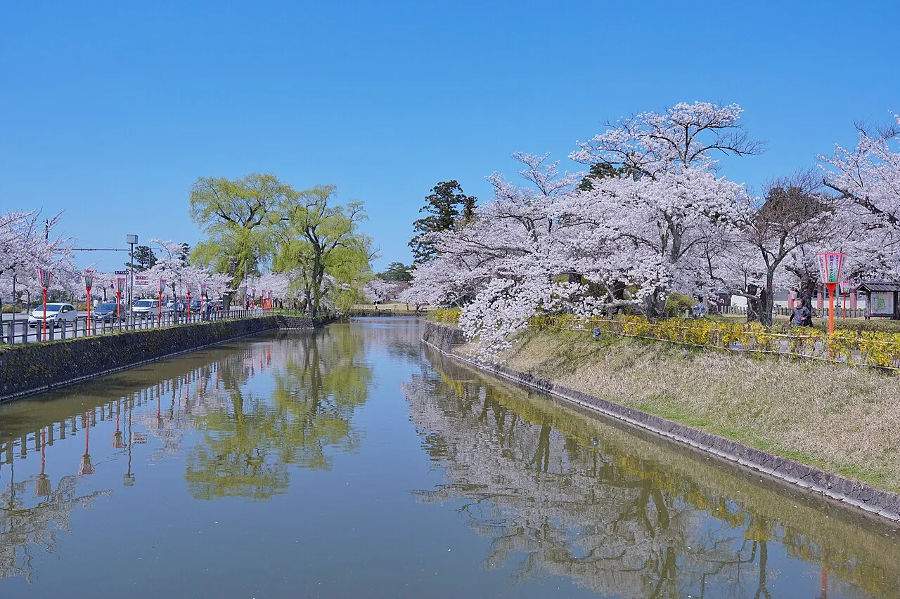
- Population
- 125,389
- 125.4K
- Elevation
- 13 m
- above sea level
- Local time
- UTC+09:00
- Asia/Tokyo · UTC+09:00
- Airports
- SYO Shonai Airport10 km
- GAJ Yamagata Airport59 km
About Tsuruoka
Tsuruoka is a city. Location: Tsuruoka Shi, Yamagata. Population: 125,389. Elevation: 13 m. The best months to visit are May–June, September. The nearest airport is Shonai Airport (10 km). Nearby sights include Haguro Yama and Aka River.
Photos of Tsuruoka
-

Ebiebi2 · CC BY-SA 4.0 -

Ebiebi2 · CC BY-SA 4.0 -

東京特許許可? · CC BY-SA 3.0 -

Olegushka · CC0 -

Kikuko Nakayama · CC BY-SA 2.0


Travel notes for Tsuruoka
From Wikivoyage
Tsuruoka (鶴岡) is a city in Yamagata.
Understand+
Tourist information site:
The local tourist association has a bilingual guide site.
Get in+
By plane:
1 Shonai Airport (SYO IATA, 庄内空港, shonai kūkō) (shuttle buses run to Tsuruoka (30 minutes, ¥740)). The nearest airport. Only flights to Tokyo Haneda Airport with ANA. (updated Aug 2016)
By train:
2 Tsuruoka Station (鶴岡駅, tsuruoka-eki). Tsuruoka is on the JR Uetsu Line which runs along the Sea of Japan. The Nihonkai night train passes through Tsuruoka -- its southern terminus is Osaka, and its northern terminus is Aomori. (updated Aug 2016)
From Tokyo, Tsuruoka is reachable in as little as four hours by taking a Joetsu Shinkansen Toki or Max Toki service, changing in Niigata to one of several daily Inaho limited express trains (¥12,760). Taking local trains from Tokyo is silly, because the overnight bus is comparable in price and faster (though if you're doing the Seishun 18 ticket, this train option, though slower, will still be several times cheaper than the cheapest bus.)
By bus:
Shonai Kotsu Yuhi Express (庄内交通, 夕陽号). about 8 hours from Shibuya to Tsuruoka. Shonai Kotsu runs an overnight bus, the "Yuhi Express", from Shibuya and Ikebukuro in Tokyo to Tsuruoka. ¥7540 one way, ¥13,570 round trip. (updated Aug 2016)
Source: Wikivoyage · CC BY-SA 4.0 · abridged
Climate of Tsuruoka
Best months for sightseeingBest months for sightseeing: May–June, September.
This month · November
A wet month
Day 13° · Night 5° · Rain 213 mm
Better nearby cities in November
- Kofu · 357 km south17°
- Isehara · 372 km south18°
- Odawara · 390 km south19°
- Hottest month
- August (day 29°)
- Coldest month
- February (night -2°)
- Wettest month
- December (214 mm)
- Driest month
- May (101 mm)
Bars: average monthly low and high temperature. Below: precipitation. Monthly averages for 1970–2000 at about 18 km resolution, adjusted for elevation. Highlighted months are mild and relatively dry. Source: WorldClim 2.1 (CC BY 4.0).
Show values as a table
| Month | Jan | Feb | Mar | Apr | May | Jun | Jul | Aug | Sep | Oct | Nov | Dec |
|---|---|---|---|---|---|---|---|---|---|---|---|---|
| Average high (°C) | 4° | 4° | 8° | 15° | 20° | 24° | 27° | 29° | 25° | 19° | 13° | 7° |
| Average low (°C) | -2° | -2° | 1° | 6° | 11° | 16° | 20° | 21° | 17° | 11° | 5° | 1° |
| Precipitation (mm) | 169 | 125 | 111 | 107 | 101 | 124 | 179 | 170 | 177 | 165 | 213 | 214 |
How to get to Tsuruoka
The nearest airport is Shonai Airport (SYO), 10 km to the north as the crow flies. The nearest large city is Sakata, 22 km to the north.
Airports
- Shonai Airport (SYO) Shonai 10 kmnorth
- Yamagata Airport (GAJ) Higashine 59 kmsoutheast
- Akita Airport (AXT) Akita 105 kmnorth
Nearby large cities
- Sakata Population: 100.3K 22 kmnorth
- Yamagata Population: 248.8K 72 kmsoutheast
- Ōsaki Population: 128.8K 101 kmeast
- Sendai Population: 1.1M 104 kmsoutheast
- Akita Population: 307.7K 113 kmnorth
Straight-line distances; road distances are longer. Airport data: OurAirports.
Day trips from Tsuruoka
Within 100 km: 13 natural sites, 5 lakes, rivers and coasts.
0–25 km4 places
- Dewa Sanzan Mountain 17 kmSE
- Aka River River 14 kmN
- Haguro Yama Mountain 14 kmE
- Mogami River River 22 kmN
25–60 km7 places
- Awashima Island Island 58 kmSW
- Tobi Shima Island 58 kmNW
- Mount Gassan Mountain 26 kmSE
- Asahi Dake Mountain 51 kmS
60–100 km7 places
- Koyoshi River River 76 kmN
- Mount Funagata Mountain 76 kmSE
- Mount Yakeishi Mountain 100 kmNE
- Mount Zaō Mountain 84 kmSE
Straight-line distances.
Tsuruoka and similar cities
Side by side with cities of similar size in the same country: population, elevation and climate.
| Measure | Tsuruoka | Uruma | Koganei | Kashihara-shi |
|---|---|---|---|---|
| Population | 125.4K | 125.3K | 126.1K | 124.5K |
| Elevation | 13 m | 22 m | 80 m | 65 m |
| Summer day (hottest month) | 29° | 31° | 30° | 32° |
| Winter night (coldest month) | -2° | 14° | -1° | 1° |
| Annual rainfall | 1,855 mm | 2,081 mm | 1,461 mm | 1,487 mm |
| Best months | May–Jun, Sep | Nov–May | May–Jun, Oct | May, Oct |
| Distance | — | 1,768 km | 336 km | 590 km |
Climate values are 1970–2000 monthly averages; straight-line distance.
Nearby attractions & nature
Everything nearby-
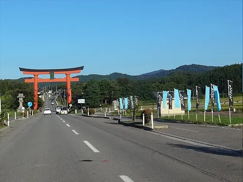 Haguro Yama Mountain, Tsuruoka Shi14 km E
-
Aka River River, Yamagata14 km N
-
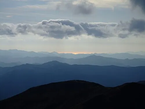 Dewa Sanzan Mountain, Yamagata17 km SE
-
Mogami River River, Yamagata22 km N
Sources & licences
Data last updated: