- Population
- 1,535
- 1.5K
- Elevation
- 497 m
- above sea level
- Local time
- UTC+09:00
- Asia/Tokyo · UTC+09:00
- Places inside
- 1
- listed under Nishi-awakura Son
- Airports
- TTJ Tottori Sand Dunes Conan Airport41 km
- TJH Konotori Tajima Airport54 km
About Nishi-awakura Son
Nishi-awakura Son is a municipality. Location: Aida-gun, Okayama. Population: 1,535. Elevation: 497 m.
Nishiawakura (西粟倉村, Nishiawakura-son) is a village located in Aida District, Okayama Prefecture, Japan.As of 1 February 2023, the village had an estimated population of 1,361 in 593 households and a population density of 29 persons per km². The total area of the village is 57.97 square kilometres (22.38 sq mi).
Source: Wikipedia · CC BY-SA 4.0
Travel notes for Nishi-awakura Son
From Wikivoyage
Nishiawakura (西粟倉村 Nishiawakura-son) is the northeasternmost village in Okayama Prefecture.
Understand+
Nishiawakura was established as a shoen, a privately-owned and governed estate, called the Awakura-so (粟倉荘). Nishiawakura was the western estate (nishi means "west"), and at the time there was a Higashiawakura (higashi meaning "east"), as well. Nishiawakura chose to remain its own village while Higashiawakura was incorporated into modern Mimasaka. There are no records of there ever being a united "Awakura".
With 95% of the village being forested, it's unsurprising that Nishiawakura is known for its scenic mountains and forests. Much of the forests (84%) were planted as artificial forests after World War II in order to help rebuild the war-torn country. Cedar and cypress are fast-growing trees that produce good wood for building. Over time, demand decreased as domestic woods became less preferable to imports which devastated the local economy. In 2008, Mori no Gakko (森の学校) was established to revitalize the lumber industry (and by extension the town itself) by selling affordable wooden tiles, called Yukahari Tiles, that is used in flooring. Their wood can also be used to make furniture and other products. Awakura Onsen's Motoyu uses local wood to heat the onsen, as well as using cypress wood to scent the hot spring water. The town is also at the forefront of Sustainable Development in Japan as they work to thin out forests to keep them healthy when they harvest lumber so that the forest can replenish itself. The Mori wo Taberu Project (森を食べるプロジェクト), which translates to the "Forest-eating Project", is another local group with the goal of incorporating local wood into edible products. They introduced Hinoki Beer in September of 2020 as a unique beer that was fermented with bits of cypress, which is said to add a fruity flavor. They also make smoked ham and breads using cypress yeast. Their products can be found at Awakurando and Awakura Onsen's Motoyu.
Tourist information site:
The village has a Japanese-only tourism section.
Get in+
Nishiawakura is served by the Chizu Express Line via two stations, Nishiawakura Station and Awakura-Onsen Station. Although it is a private railway, they have a deal with JR West, so there are express trains from Okayama and Kamigori that will take you as far as Ohara Station where you can transfer (or take a taxi) to reach Nishiawakura. From Tottori, travel to Chizu where you can transfer. At certain times of the day, it may be faster to go past Nishiawakura to transfer and backtrack (ex: From Tottori/Chizu, taking an Express Train to Ohara Station to transfer rather than waiting for a direct train from Chizu Station).
Source: Wikivoyage · CC BY-SA 4.0 · abridged
Places bordering Nishi-awakura Son
- Mimasaka-shi
- Chizu Chō
- Wakasa
Population of Nishi-awakura Son over time
| 2010 | 1,520 | |
|---|---|---|
| 2015 | 1,472 | |
| 2021 | 1,377 |
Censuses and official estimates; source: Wikidata.
Climate of Nishi-awakura Son
Best months for sightseeingBest months for sightseeing: May–June, September.
This month · November
A wet month
Day 13° · Night 5° · Rain 104 mm
Better nearby cities in November
- Kochi · 197 km south18°
- Ōita · 333 km southwest18°
- Beppu · 337 km southwest17°
- Hottest month
- August (day 29°)
- Coldest month
- January (night -3°)
- Wettest month
- July (253 mm)
- Driest month
- December (88 mm)
Bars: average monthly low and high temperature. Below: precipitation. Monthly averages for 1970–2000 at about 18 km resolution, adjusted for elevation. Highlighted months are mild and relatively dry. Source: WorldClim 2.1 (CC BY 4.0).
Show values as a table
| Month | Jan | Feb | Mar | Apr | May | Jun | Jul | Aug | Sep | Oct | Nov | Dec |
|---|---|---|---|---|---|---|---|---|---|---|---|---|
| Average high (°C) | 4° | 5° | 9° | 16° | 20° | 23° | 27° | 29° | 24° | 18° | 13° | 8° |
| Average low (°C) | -3° | -3° | 0° | 5° | 10° | 15° | 20° | 21° | 16° | 10° | 5° | 0° |
| Precipitation (mm) | 104 | 104 | 123 | 148 | 160 | 234 | 253 | 172 | 242 | 131 | 104 | 88 |
How to get to Nishi-awakura Son
The nearest airport is Tottori Sand Dunes Conan Airport (TTJ), 41 km to the northwest as the crow flies. For international flights: Okayama Momotaro Airport (OKJ) (66 km). The nearest large city is Tsuyama, 35 km to the southwest.
Airports
- Tottori Sand Dunes Conan Airport (TTJ) Tottori 41 kmnorthwest
- Konotori Tajima Airport (TJH) Toyooka 54 kmnortheast
- Okayama Momotaro Airport (OKJ) Okayama 66 kmsouthwest
Nearby large cities
- Tsuyama Population: 102.3K 35 kmsouthwest
- Tottori-shi Population: 188.5K 35 kmnorth
- Himeji Population: 530.5K 53 kmsoutheast
- Kakogawa Population: 271.6K 65 kmsoutheast
- Akashi Population: 303.6K 85 kmsoutheast
Straight-line distances; road distances are longer. Airport data: OurAirports.
Day trips from Nishi-awakura Son
Within 100 km: 10 historic and cultural sites, 17 natural sites, 20 lakes, rivers and coasts.
0–25 km3 places
- Mount Hyōno Mountain 24 kmNE
- Mount Nagi Mountain 15 kmW
- Hyōnosen-Ushiroyama-Nagisan-kokutei-kōen Natural site 21 kmNE
25–60 km9 places
- Sendai River River 41 kmN
- Tottori Castle ruins Historic site 36 kmN
- Ibo Gawa River 52 kmSE
- Himeji castle Historic site 51 kmSE
60–100 km35 places
- Awaji Island Island 100 kmSE
- Nao Shima Island 88 kmS
- Te Shima Island 83 kmS
- Mount Rokkō Mountain 96 kmSE
Straight-line distances.
Places in Nishi-awakura Son
1 placeBar: population relative to the most populous place in this list.
Nearby attractions & nature
Everything nearby-
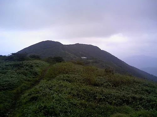 Mount Nagi Mountain, Nagi Chō15 km W
-
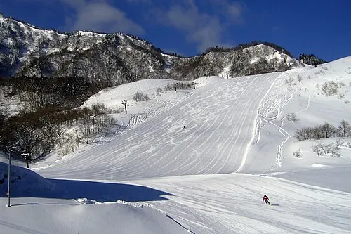 Hyōnosen-Ushiroyama-Nagisan-kokutei-kōen Natural site, Hyōgo21 km NE
-
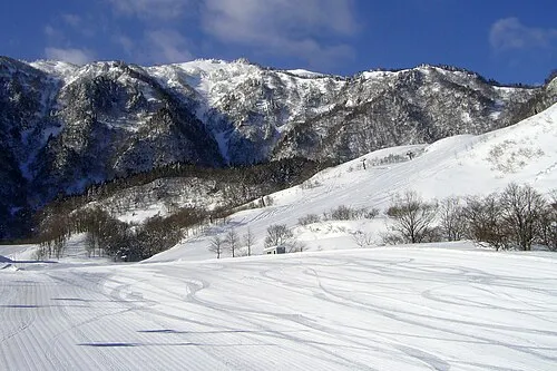 Mount Hyōno Mountain, Yabu-shi24 km NE
Sources & licences
Data last updated: · 2 independent sources