- Elevation
- 1,255 m
- above sea level
- Local time
- UTC+09:00
- Asia/Tokyo · UTC+09:00
- Airports
- TTJ Tottori Sand Dunes Conan Airport40 km
- OKJ Okayama Momotaro Airport55 km
About Mount Nagi
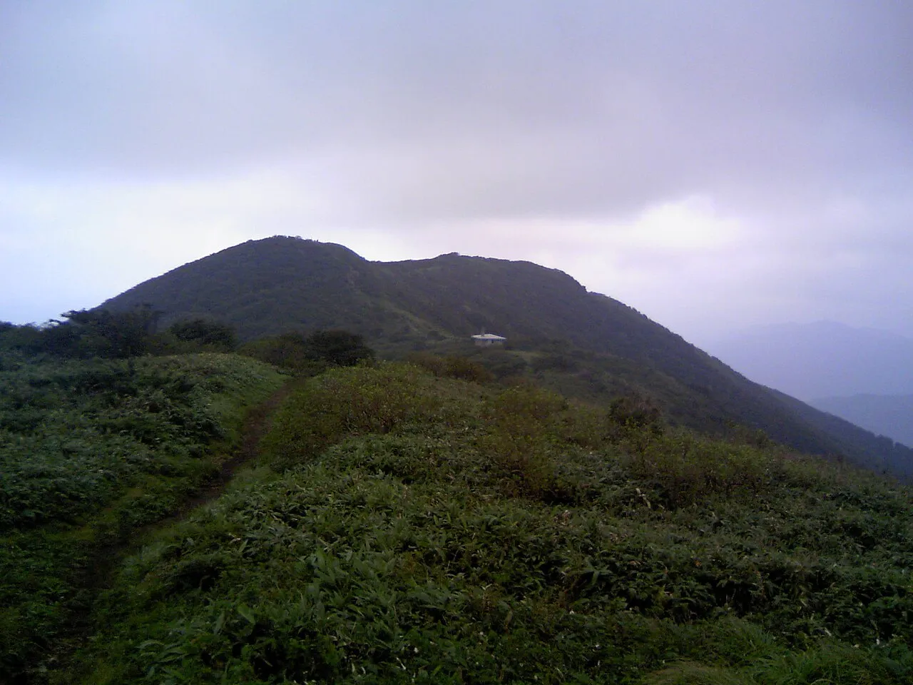
Mount Nagi is a mountain. Location: Nagi Chō, Katsuta-gun. Elevation: 1,255 m.
Mount Nagi (那岐山, Nagi-san), is a mountain located on the border of Chizu, Tottori Prefecture, and Nagi, Okayama Prefecture, Japan. The other reading of this mountain's kanji is Nagisen. This mountain is an important part of Hyōnosen-Ushiroyama-Nagisan Quasi-National Park, with Mount Hyōno and Mount Ushiro.
Source: Wikipedia · CC BY-SA 4.0
Photos of Mount Nagi
-

Koda6029 · CC BY-SA 4.0 -

Koda6029 · CC BY-SA 4.0 -

Mass Ave 975 · CC BY-SA 3.0 -

Mass Ave 975 · CC BY-SA 3.0


Climate of Mount Nagi
Best months for sightseeingBest months for sightseeing: July–August.
This month · November
A wet month
Day 8° · Night -1° · Rain 100 mm
Better nearby cities in November
- Kochi · 190 km south18°
- Ōita · 321 km southwest18°
- Beppu · 324 km southwest17°
- Hottest month
- August (day 23°)
- Coldest month
- January (night -8°)
- Wettest month
- July (238 mm)
- Driest month
- December (84 mm)
Bars: average monthly low and high temperature. Below: precipitation. Monthly averages for 1970–2000 at about 18 km resolution, adjusted for elevation. Highlighted months are mild and relatively dry. Source: WorldClim 2.1 (CC BY 4.0).
Show values as a table
| Month | Jan | Feb | Mar | Apr | May | Jun | Jul | Aug | Sep | Oct | Nov | Dec |
|---|---|---|---|---|---|---|---|---|---|---|---|---|
| Average high (°C) | -1° | 0° | 4° | 10° | 15° | 18° | 22° | 23° | 19° | 13° | 8° | 3° |
| Average low (°C) | -8° | -8° | -6° | 0° | 5° | 10° | 15° | 15° | 11° | 4° | -1° | -6° |
| Precipitation (mm) | 99 | 101 | 116 | 140 | 150 | 218 | 238 | 148 | 234 | 124 | 100 | 84 |
How to get to Mount Nagi
The nearest airport is Tottori Sand Dunes Conan Airport (TTJ), 40 km to the north as the crow flies. For international flights: Okayama Momotaro Airport (OKJ) (55 km). The nearest large city is Tsuyama, 21 km to the southwest.
Airports
- Tottori Sand Dunes Conan Airport (TTJ) Tottori 40 kmnorth
- Okayama Momotaro Airport (OKJ) Okayama 55 kmsouthwest
- Konotori Tajima Airport (TJH) Toyooka 67 kmnortheast
Nearby large cities
- Tsuyama Population: 102.3K 21 kmsouthwest
- Tottori-shi Population: 188.5K 37 kmnorth
- Himeji Population: 530.5K 62 kmsoutheast
- Kakogawa Population: 271.6K 74 kmsoutheast
- Kurashiki Population: 483.6K 75 kmsouthwest
Straight-line distances; road distances are longer. Airport data: OurAirports.
Day trips from Mount Nagi
Within 100 km: 10 historic and cultural sites, 13 natural sites, 21 lakes, rivers and coasts.
0–25 km1 place
- Chūgoku-sammyaku Mountain 19 kmNW
25–60 km10 places
- Sendai River River 41 kmN
- Tottori Castle ruins Historic site 38 kmN
- Lake Tōgō Lake 43 kmNW
- Tenjin River River 47 kmNW
60–100 km33 places
- Nao Shima Island 81 kmS
- Shiwaku Islands Island 97 kmSW
- Te Shima Island 77 kmS
- Ogi Shima Island 83 kmS
Straight-line distances.
Nearest towns and villages
-
Chizu Chō Municipality, Yazu-gun12 km NE
-
Shōō Chō Municipality, Katsuta-gun13 km S
-
Chizu Town, Chizu Chō12 km NE
-
Nishi-awakura Son Municipality, Aida-gun15 km E
-
Tsuyama City, Tsuyama Shi21 km SW
-
Nishiawakura Village, Nishi-awakura Son16 km E
Sources & licences
Data last updated: · 2 independent sources