Kurashiki
Local name: 倉敷市
Located in Kurashiki Shi, Okayama Coordinates: 34°35′00″ N 133°46′00″ E
- Population
- 483,576
- 483.6K
- Elevation
- 4 m
- above sea level
- Local time
- UTC+09:00
- Asia/Tokyo · UTC+09:00
- Airports
- OKJ Okayama Momotaro Airport21 km
- TAK Takamatsu Airport47 km
About Kurashiki
Kurashiki is a city. Location: Kurashiki Shi, Okayama. Population: 483,576. Elevation: 4 m.
Kurashiki (倉敷市, Kurashiki-shi) is a city located in Okayama Prefecture, Japan. As of 31 March 2023, the city had an estimated population of 478,651 and a population density of 1300 persons per km2. The total area of the city is 355.63 square kilometres (137.31 sq mi).
Source: Wikipedia · CC BY-SA 4.0
Photos of Kurashiki
-

inunami · CC BY 2.0 -

Mikkie27 · CC BY-SA 4.0


Travel notes for Kurashiki
From Wikivoyage
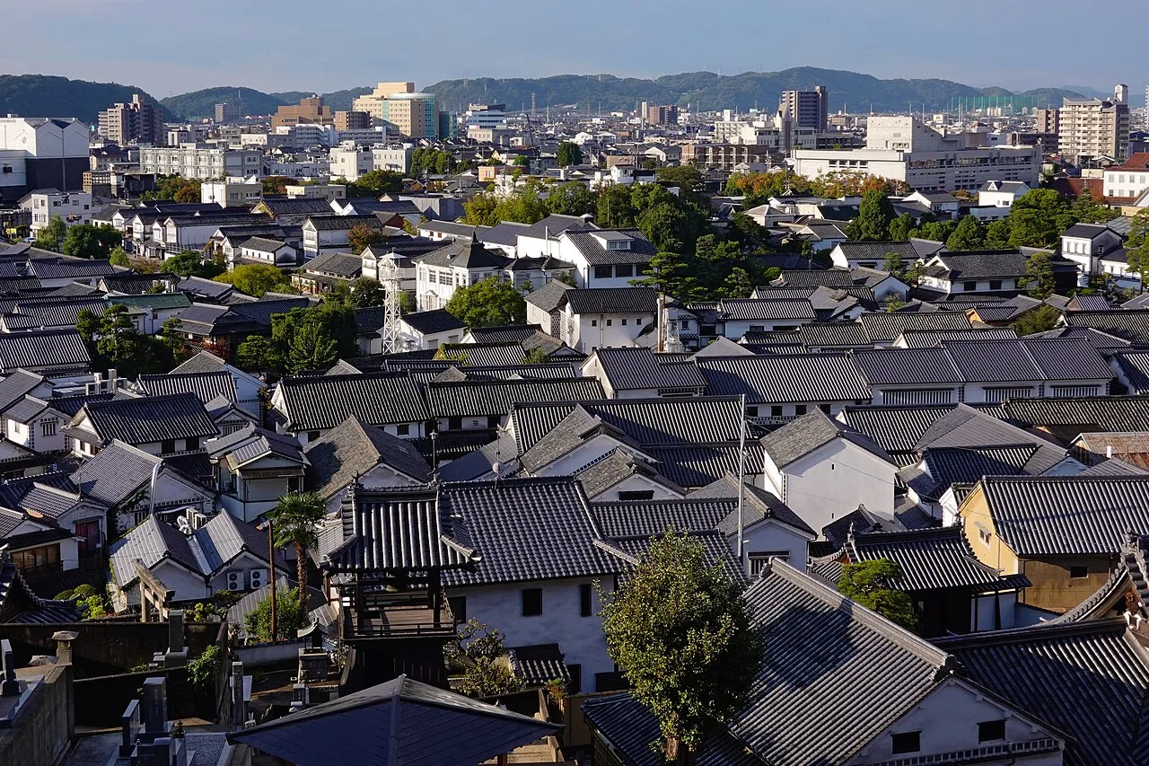
Kurashiki (倉敷市 Kurashiki-shi) is one of Japan's great old merchant towns, with around half a million citizens today. Sitting along a scenic canal at the foot of Mt. Tsurugata, Kurashiki's white-walled storehouses are beautifully preserved and open for exploration.
Understand+
During the Edo period, Kurashiki did heavy trade with the capital in rice, sugar, and other goods. Later, during the Meiji Restoration (i.e. after 1868), the city became known for textiles. Kurashiki escaped World War II largely unscathed, and as a result, many of the original storehouses, mills, and shops remain in beautiful condition, open to visitors in the Bikan Historic Area.
The effect is delightful — storehouses (倉 kura) with lattice windows share space with weeping willows along the banks of the old canal, which is illuminated at night. The canal has led some overly optimistic tourist associations to call Kurashiki "the Venice of Japan". If not that — the city surrounding the Bikan area is as much a concrete jumble as any other in the country — Kurashiki is still a rare piece of old Japan, one that gives a sense of where people lived and worked, not merely the temples at which they worshipped.
Tourist information:
Tourist information can be found at the two main train stations.
1 Bikan Historic Area (倉敷美観地区), 1-4-8 Chuo-dori, ☏ +81 86-422-0542. 09:00-17:00.
The local tourist association has a Japanese-only guide site with integrated machine translation.
Get in+
By plane:
Okayama Momotarō Airport (岡山空港 OKJ IATA), Okayama. A shuttle bus connects Kurashiki Station with the airport (45 min, ¥1,130). Tickets can be purchased from a vending machine outside of the airport. Large luggage is okay; the driver will stow it underneath the seats. Staff at the information booth just beyond baggage claim are very helpful, and will go outside with you to purchase the ticket and get you on the appropriate bus. Catch a flight there, or take a second shuttle bus to Hiroshima Airport (2 hrs, ¥2,100). (updated Jul 2020)
By train:
Kurashiki is on the San'yo Main Line between Okayama and Fukuyama. The best way to reach Kurashiki from the San'yo Shinkansen is to transfer to a local train at Okayama; the ride takes about 15 minutes (¥320). The few express trains between Okayama and Kurashiki are more than twice as expensive, and will only save you a couple of minutes. However, if you have a Japan Rail Pass, you can take either a local or a limited express; on the latter, hop onto any non-reserved car and flash your rail pass to the conductor, declaring Kurashiki as your destination.
2 JR Kurashiki Station (倉敷駅), Achi 1-1-1, ☏ +81 86-424-1220. 09:00-17:00. Exit the train station to the south (left from JR ticket collection), overlooking the bus depot. Stay on the upper level, and you'll find the office among the shops to the right (west).
3 JR Shin-Kurashiki Station (新倉敷駅), 390-4 Tamashima Tsumasaki, ☏ +81 86-526-8446. 09:00-17:00. The Kodama Shinkansen stops here. However, the station is about 8 km west of downtown Kurashiki, two stops away on the JR San'yo Main Line. If you're coming from points east, you'll probably want to take a faster train to Okayama and transfer to a local service instead.
By bus:
Source: Wikivoyage · CC BY-SA 4.0 · abridged
Places bordering Kurashiki
- Okayama Shi
- Sōja
- Asakuchi Shi
- Yakage
- Hayashima Chō
- Sakaidechō
- Marugame
Twin towns and sister cities of Kurashiki
- Sankt Pölten· Austria
- Kansas City· United States
Source: Wikidata. Only places with a page on this site are shown.
Population of Kurashiki over time
| 2010 | 475,513 | |
|---|---|---|
| 2015 | 477,118 | |
| 2021 | 474,862 |
Censuses and official estimates; source: Wikidata.
Climate of Kurashiki
Best months for sightseeingBest months for sightseeing: May, October.
This month · November
Outside the best season
Day 17° · Night 7° · Rain 66 mm
Better nearby cities in November
- Kochi · 117 km south18°
- Ōita · 250 km southwest18°
- Beppu · 255 km southwest17°
- Hottest month
- August (day 32°)
- Coldest month
- January (night 0°)
- Wettest month
- June (225 mm)
- Driest month
- December (32 mm)
Bars: average monthly low and high temperature. Below: precipitation. Monthly averages for 1970–2000 at about 18 km resolution, adjusted for elevation. Highlighted months are mild and relatively dry. Source: WorldClim 2.1 (CC BY 4.0).
Show values as a table
| Month | Jan | Feb | Mar | Apr | May | Jun | Jul | Aug | Sep | Oct | Nov | Dec |
|---|---|---|---|---|---|---|---|---|---|---|---|---|
| Average high (°C) | 9° | 9° | 13° | 19° | 23° | 27° | 31° | 32° | 28° | 22° | 17° | 11° |
| Average low (°C) | 0° | 1° | 3° | 9° | 13° | 19° | 23° | 24° | 20° | 13° | 7° | 2° |
| Precipitation (mm) | 40 | 55 | 86 | 134 | 142 | 225 | 204 | 115 | 209 | 107 | 66 | 32 |
How to get to Kurashiki
The nearest airport is Okayama Momotaro Airport (OKJ), 21 km to the northeast as the crow flies. The nearest large city is Marugame, 33 km to the south.
Airports
- Okayama Momotaro Airport (OKJ) Okayama 21 kmnortheast
- Takamatsu Airport (TAK) Takamatsu 47 kmsoutheast
- Hiroshima Airport (HIJ) Hiroshima 80 kmwest
Nearby large cities
- Marugame Population: 109.5K 33 kmsouth
- Takamatsu Population: 419K 38 kmsoutheast
- Fukuyama Population: 468.8K 38 kmwest
- Onomichi Population: 131.2K 55 kmwest
- Tsuyama Population: 102.3K 56 kmnorth
Straight-line distances; road distances are longer. Airport data: OurAirports.
Day trips from Kurashiki
Within 100 km: 10 historic and cultural sites, 12 natural sites, 30 lakes, rivers and coasts.
0–25 km10 places
- Nao Shima Island 24 kmSE
- Shiwaku Islands Island 23 kmS
- Great Seto Bridge Landmark 21 kmS
- Mukai Jima Island 20 kmS
25–60 km14 places
- Te Shima Island 30 kmE
- Manabe Island Island 30 kmSW
- Ogi Shima Island 32 kmSE
- Megi Shima Island 33 kmSE
60–100 km28 places
- Shikoku Island 96 kmS
- Awaji Island Island 100 kmE
- Ikuchi Jima Island 69 kmSW
- Ōmi Shima Island 78 kmSW
Straight-line distances.
Kurashiki and similar cities
Side by side with cities of similar size in the same country: population, elevation and climate.
| Measure | Kurashiki | Nishinomiya | Ōita | Higashiosaka |
|---|---|---|---|---|
| Population | 483.6K | 485.6K | 477.7K | 493.9K |
| Elevation | 4 m | 5 m | 9 m | 6 m |
| Summer day (hottest month) | 32° | 32° | 31° | 33° |
| Winter night (coldest month) | 0° | 1° | 2° | 1° |
| Annual rainfall | 1,415 mm | 1,449 mm | 1,798 mm | 1,381 mm |
| Best months | May, Oct | May, Oct | May–Jun, Oct–Nov | May, Oct |
| Distance | — | 144 km | 250 km | 167 km |
Climate values are 1970–2000 monthly averages; straight-line distance.
Nearby attractions & nature
Everything nearby-
Takahashi River River, Okayama8.8 km SW
-
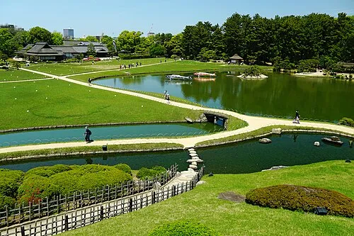 Kōrakuen Natural site, Kita-ku18 km NE
-
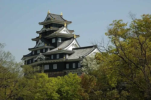 Crow Castle Historic site, Kita-ku18 km NE
-
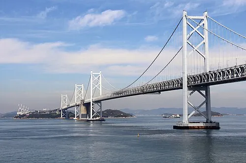 Shimotsui-Seto Bridge Landmark, Japan17 km S
-
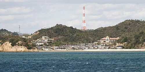 Nao Shima Island, Kagawa24 km SE
-
 Shiwaku Islands Island, Kagawa23 km S
-
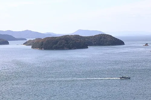 Mukai Jima Island, Kagawa20 km S
-
Great Seto Bridge Landmark, Japan21 km S
Sources & licences
Data last updated: · 2 independent sources